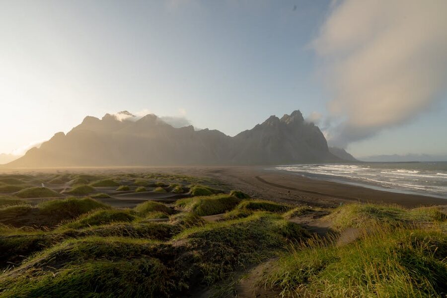
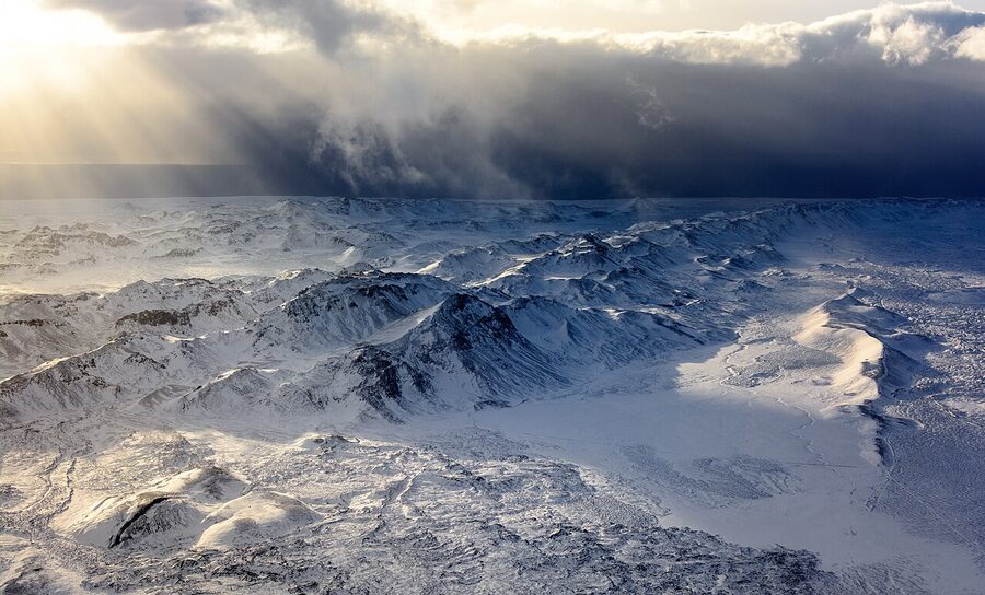
The morning I drove out to Fagradalsfjall the first time, I got halfway down Route 41 and had to pull over. Not because of traffic, you rarely see traffic on Reykjanes. I pulled over because a plume of grey ash was climbing straight up off the horizon in front of me, and fifteen kilometres to the east, poking above a thin band of cloud, Snæfellsjökull glacier was doing its mirror-image thing on the other side of the bay. Fire to the front, ice to the left. The whole cliché of “land of fire and ice” lands in one windshield view, which is exactly the point.
The phrase itself is everywhere, on T-shirts, on tour brochures, on the cover of half the guidebooks. It’s a little worn out, and most visitors ask me what it actually means once they’re on the ground here. So here’s the long answer, because it’s more interesting than the short one. This is the tour guide I’d hand to a friend who wanted to see both halves, the volcano half and the glacier half, without wasting three days on bad operators or bad weather.
In This Article
- What “fire and ice” actually means
- The fire side of the coin
- Inside the Volcano, the one that’s actually unique
- Fagradalsfjall and the Reykjanes fires
- Lava tunnels, the low-key fire tour
- The ice side
- Vatnajökull, the big one
- Ice caves, only in winter
- The one-day fire-and-ice tours from Reykjavík
- Super-jeep fire-and-ice
- The self-drive version, 2 or 3 days on the South Coast
- The full Ring Road version, 7 to 10 days
- Timing, what’s open when
- Weather and safety, the part that matters
- Operators, the ones I’d actually book with
- What a fire-and-ice day actually costs
- What to actually pack
- How I’d pick a fire-and-ice tour
What “fire and ice” actually means
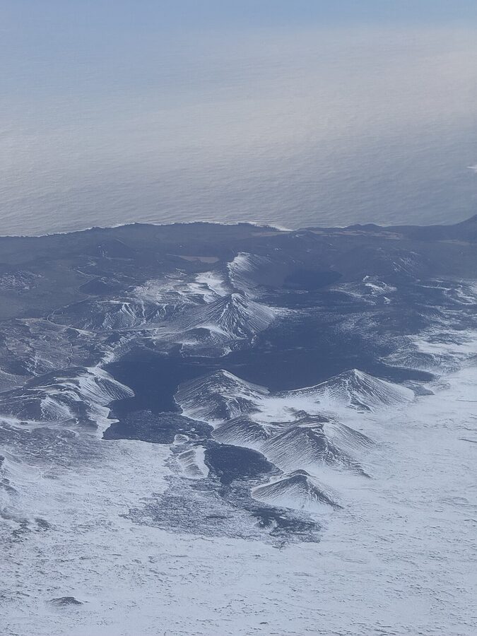
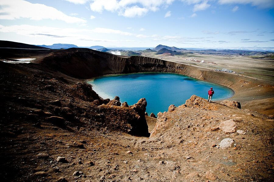
Iceland sits on the Mid-Atlantic Ridge, which is the crack between the North American and Eurasian tectonic plates. The plates are pulling apart at about 2 cm a year, roughly how fast your fingernails grow. The whole country is essentially a pile of lava that has been pushed up into the North Atlantic by this crack for the last 20 million years, and is still being pushed up. So every bit of rock you stand on here is volcanic, and the crack is still active. We have around 130 volcanoes, 30 or so of them classified as active.
And then, on top of all this hot rock, there’s ice. Iceland has about 269 glaciers by the latest count from Veðurstofan (the Met Office), covering roughly 10% of the country’s surface. Vatnajökull alone is about 7,900 km², bigger than the Faroe Islands, bigger than Puerto Rico, the largest ice cap in Europe outside Svalbard. Most of it sits on top of volcanic systems, which means the glaciers are melting from underneath during an eruption, and you get the occasional jökulhlaup, a glacial outburst flood, rolling down towards the south coast at terrifying speed. Grímsvötn, under Vatnajökull, does this regularly.
So when people say “fire and ice,” they aren’t being poetic. They mean, literally, that the ice is sitting on the fire, and a fire-and-ice tour is one that shows you both at close range. What that means in practice depends on what kind of tour you book, and this is where it gets interesting.
The fire side of the coin
For volcanic content, tours fall into three brackets. You’ve got the lava-field walks, which are the cheapest and most common. You’ve got the crater hikes, which are more demanding. And then you’ve got the one weird outlier that no other country has, going inside a dormant magma chamber.
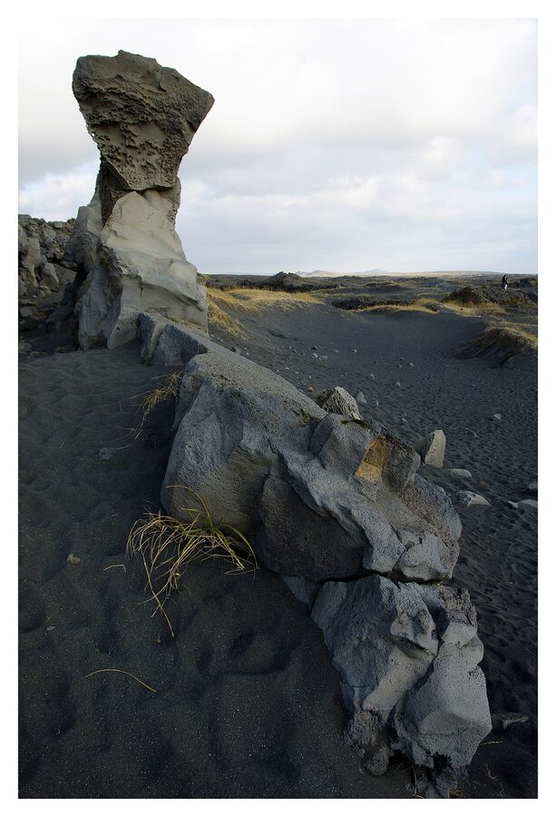
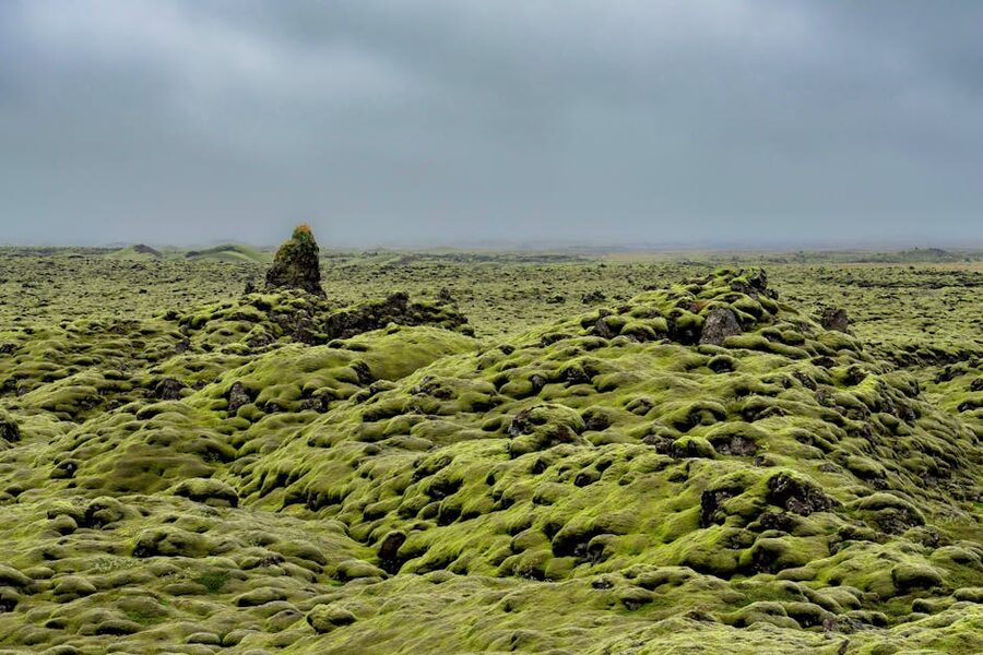
Lava-field walks are easy to slot into any itinerary. Most of Reykjanes, the peninsula that Keflavík airport sits on, is one big lava field. Some of the flows are 800 years old and covered in soft grey-green moss; some are from the 2021–2024 Fagradalsfjall and Sundhnúkagígar eruptions and are still black, still warm where you put your hand to the ground, and still genuinely new. A two-hour guided walk around the edges of the recent flows is a straightforward half-day out of Reykjavík, and because these are short trips, they run year-round unless the weather pushes you off the peninsula.
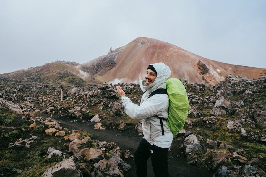
The crater hikes are the next tier up, proper half- to full-day walks up to the rim of an active or recently active volcano. Fagradalsfjall is the headline one right now, when access is open. A moderate three-to-four-hour hike each way brings you up to an overlook of the eruption fissures and, depending on the current activity, sometimes within eyesight of live lava. The route has changed three times in five years because each new fissure opens somewhere slightly different, and the Civil Protection Agency closes the area the moment gases or lava flow directions shift. You cannot plan it far in advance. You plan around it.
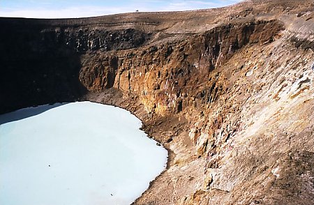
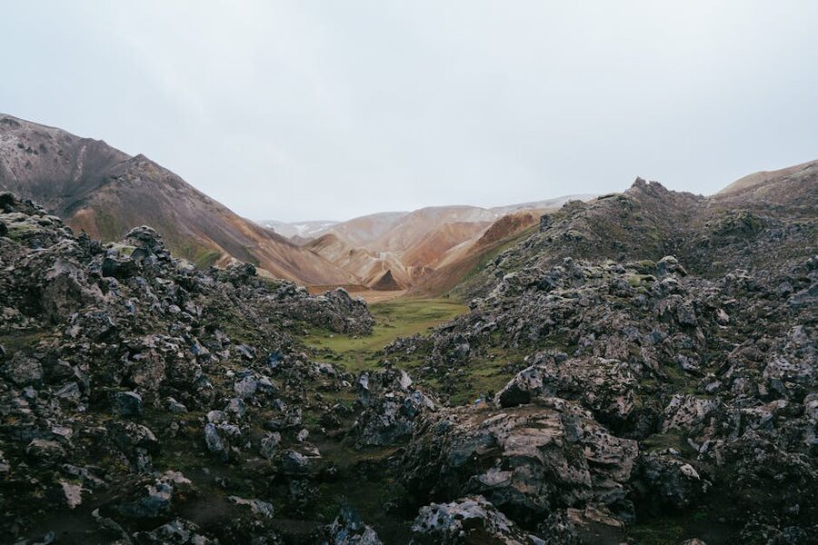
Farther out, there’s Askja in the highlands, a collapsed caldera up in the central interior with a warm geothermal lake (Víti) that you can technically swim in, if you’re happy getting in and out in howling wind at 1,000 m altitude. Askja is super-jeep-only and only runs in summer, late June to early September. The drive there takes most of a day each way, so it’s really a 2-day tour or part of a highland circuit. Not beginner territory. But if you want to stand on the floor of an actual caldera the size of a small town and look up at the walls, this is the one.
Up in the north, above Mývatn, you’ve got Krafla, an active volcanic system with a smaller Víti crater of its own, a geothermal power station humming in the background, and some of the most walkable recent lava fields anywhere in the country. The last Krafla eruption ran from 1975 to 1984, and a lot of that lava is still distinctly new. If you’re doing the Diamond Circle or staying in Akureyri for a few days, Krafla is 90 minutes from town and worth a morning.
Inside the Volcano, the one that’s actually unique
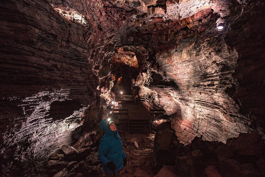
If you only do one volcanic thing in Iceland, this is the one. Þríhnúkagígur (which translates roughly as “three-peaks crater,” and which no visitor will pronounce correctly on the first try) is a dormant volcano about 20 km south of Reykjavík. It last erupted around 4,000 years ago, and when it went quiet, the magma didn’t seal the chamber with cold lava the way most volcanoes do. It just drained. Somewhere down there it either solidified in the walls or sank back into the mantle, leaving a hollow chamber 120 m deep. The opening at the top is narrow enough that nobody went down it until 1974, when a Reykjavík rescue diver called Árni B. Stefánsson rappelled in on a rope and found a cathedral-sized cavity of coloured rock.
It is the only place in the world, as far as geologists know, where the public can walk into an actual magma chamber. The tour is run by 3H Travel, based at a small base camp about a 45-minute walk in over a lava field from the Bláfjöll ski area. You hike in (or get a shuttle back to the road for those who don’t want to walk it twice), spend a few minutes being fitted with a helmet and harness, and then drop into the chamber on an open-sided window-washer’s lift. The ride down takes about six minutes.
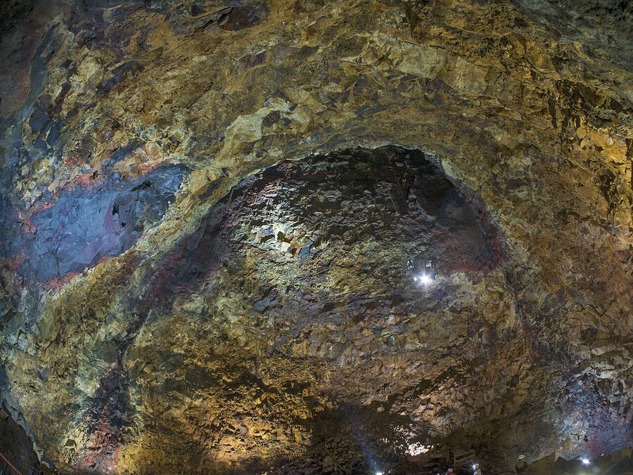
The chamber itself is the size of a large cathedral, big enough, as the operators never tire of pointing out, to fit the Statue of Liberty inside. You get about 20 minutes down there to walk around the floor, take photos, touch the walls. There’s enough daylight from the opening above to see without your helmet light most of the time, but turn the light on if you’re photographing the rust-and-ochre mineral staining on the walls. The rock colours come from gases that cooked the stone a few thousand years ago and left behind iron oxides, sulphur, and copper deposits. It’s the weirdest geology I’ve ever stood on, and I live here.
Practical notes. The tour only runs from early May to late October, the path in is under snow the rest of the year. It costs around 54,000 ISK at time of writing (prices creep up every summer, check the operator). The whole round trip is about five to six hours from your Reykjavík pickup. There’s a cap of roughly 16 people per descent, group sizes are small, and the summer slots sell out three to four weeks ahead on clear-weather days. Book early. There is also a helicopter add-on, skip the hike in, fly in, helicopter back, which doubles the price but which, on a clear day with good visibility, is genuinely worth the money if you have the budget.
One thing worth knowing: if you are claustrophobic, skip this tour. The elevator ride down is fine, open sides, lots of light. But the shaft is narrow enough at the top that the first ten seconds feel like you’re being lowered into a well. The guides have seen all of it; they’ll pull you back up if you need, no drama.
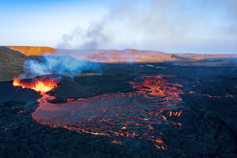
Fagradalsfjall and the Reykjanes fires
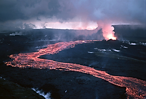
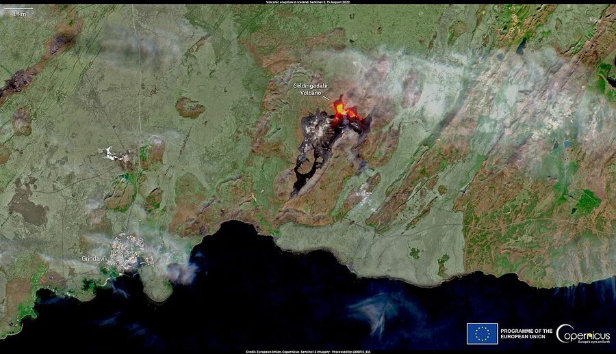
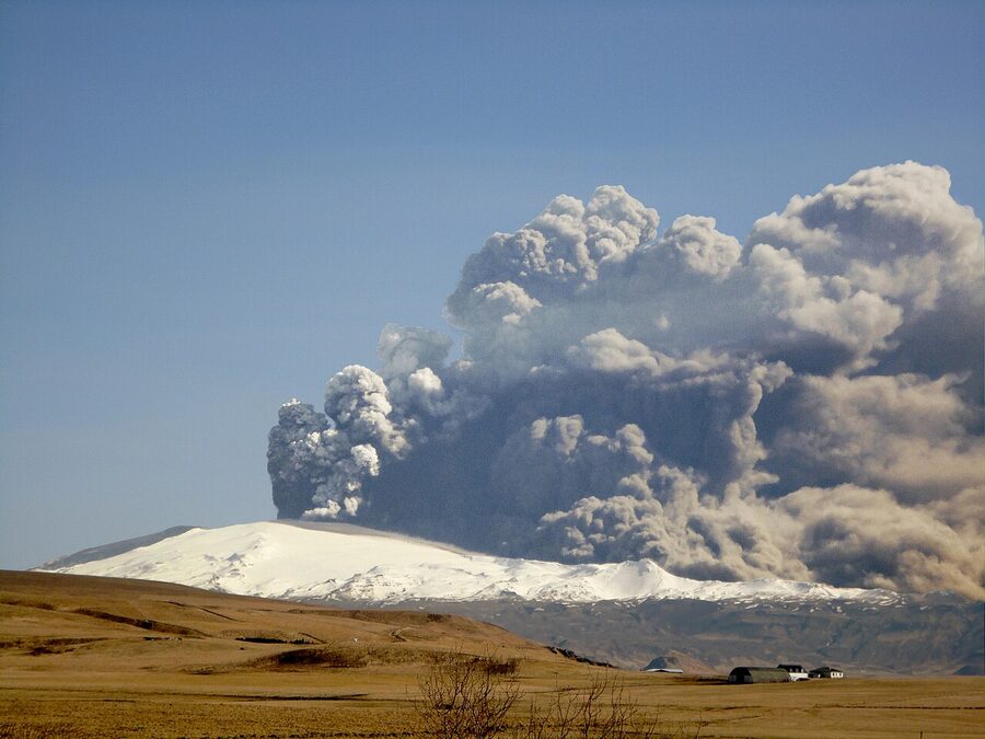
Between March 2021 and mid-2024, Reykjanes woke up for the first time in about 800 years. There were eight or nine separate eruptions in that period, depending on how you count them, along a roughly 25 km stretch of the peninsula between Fagradalsfjall and Sundhnúksgígar, just north of Grindavík. The 2023 Litli-Hrútur eruption and the December 2023 Grindavík fissure were the most visible. Some were walkable with a guide; others closed the entire area because lava was threatening the town.
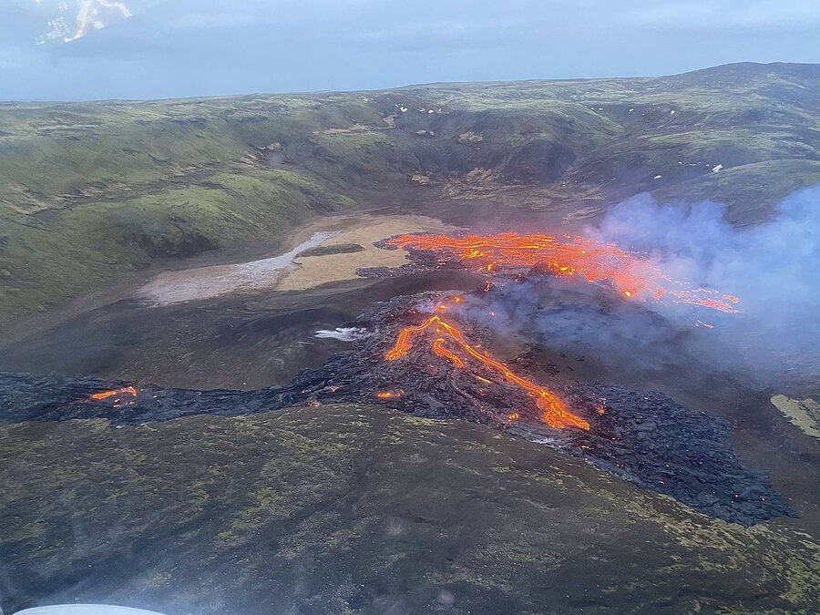
Access depends entirely on what’s happening that week. Check en.vedur.is for current seismic activity and safetravel.is for whether the Civil Protection Agency has the area open. If there’s an active eruption going on and it’s open, book a guided hike, Arctic Adventures, Troll Expeditions, and a handful of Grindavík-based operators run them. If the area is closed, the Lava Show in Vík and Reykjavík is the runner-up option: they pour real molten lava (heated to 1,100°C) into a viewing room, and you get as close to flowing rock as you legally can without standing next to an actual fissure. Touristy, yes. Worth it if the real thing is off-limits, also yes.
Lava tunnels, the low-key fire tour
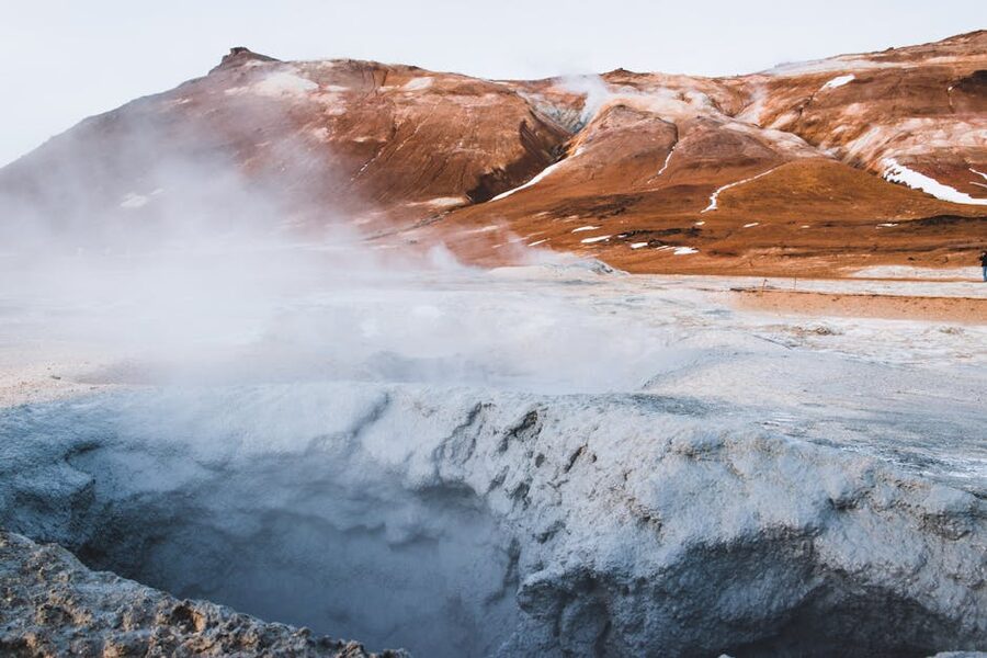
Most lava fields have hollow tubes running underneath them, formed when the outside of a flow cools and hardens while the inside keeps moving and eventually drains out. Iceland has a handful of these open to the public. Raufarhólshellir, about 30 minutes east of Reykjavík, is the easiest one to visit, about 900 m of walkable tunnel with a raised boardwalk, cave lighting, and a reasonably warm 3–4°C inside. One-hour tours year-round, around 7,900 ISK at time of writing. Víðgelmir in the west (an hour past Borgarnes) is the bigger one, about 1,600 m, and colder.
These are not thrilling in the way an active volcano is thrilling, but they’re a useful fire-half filler for winter fire-and-ice tours when Þríhnúkagígur and Fagradalsfjall are both closed. A lava tunnel in the morning and an ice cave in the afternoon is a legitimate, and dry, fire-and-ice day.
The ice side
On the glacier half, you’ve got roughly the same three tiers. Flat glacier walks (easy, year-round). Glacier hikes with crampons (moderate, year-round with the right operator). And ice caves, which are the showstopper but which only exist for part of the year.
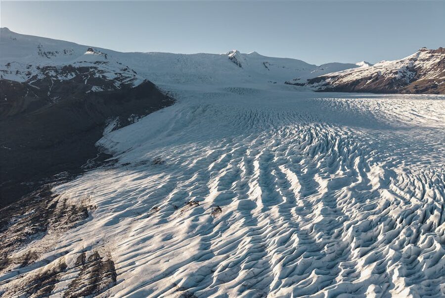
The one everyone starts with is Sólheimajökull, a tongue of Mýrdalsjökull that runs down almost to Route 1 near Skógafoss. It’s a 90-minute drive from Reykjavík on decent roads, which is what makes it the default for any one-day fire-and-ice tour. You park, hike about 15 minutes in over moraine (glacial rubble), put crampons on at the edge of the ice, and then walk onto the glacier itself for an hour or two. Guides run small groups, usually 12 to 15, and give you a pick-axe that you’ll barely use and a helmet you’ll be glad of if anything calves off above you. The ice is dirty with volcanic ash up top, and cleaner blue underneath. You’ll walk past moulins (water holes drilled into the ice by melt) and, depending on the season, small crevasses.
Sólheimajökull is also the glacier that’s most visibly retreating. If you look at photos from 1995 and then stand at the current parking lot, the ice has pulled back by about a kilometre. The lagoon at its foot, which didn’t exist in my grandparents’ time, is now deep enough for small boats. It’s sobering. Any guide worth booking will mention it without being dramatic about it.
Vatnajökull, the big one
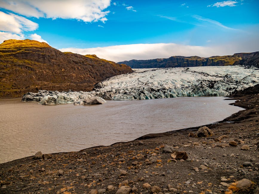
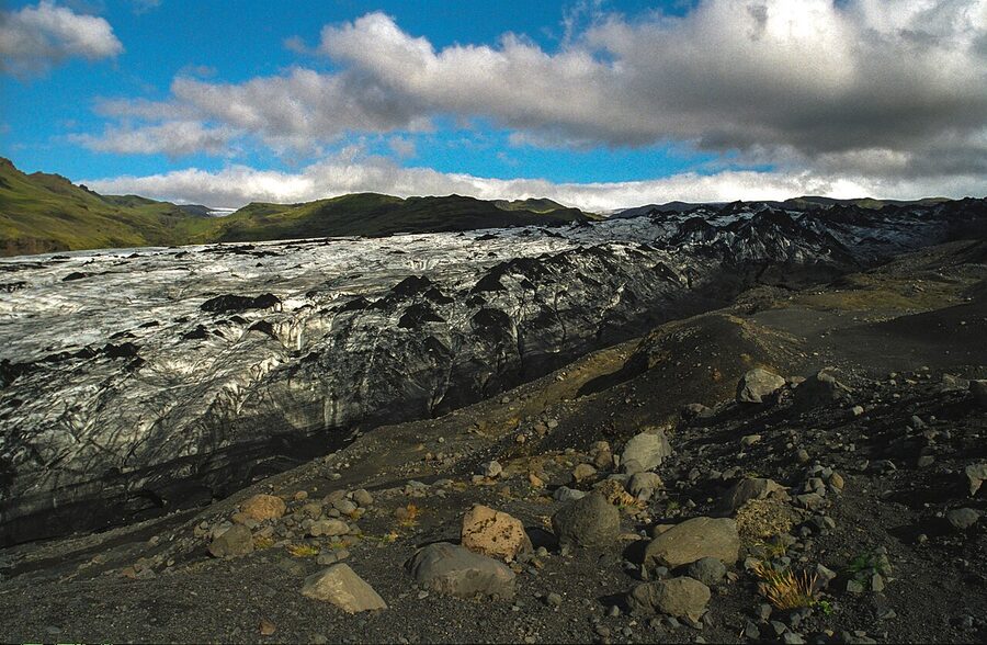
If Sólheimajökull is the glacier everybody does, Vatnajökull is the one worth driving further for. It’s about 7,900 km² of ice sitting on top of Europe’s largest national park, four hours east of Reykjavík by car, and the south edge of it drops towards the sea in a string of outlet glaciers with names you’ll see on every tour brochure, Svínafellsjökull, Falljökull, Skaftafellsjökull, Breiðamerkurjökull. Each one has a dedicated local operator: Glacier Guides work out of Skaftafell, Glacier Adventure out of Hof.
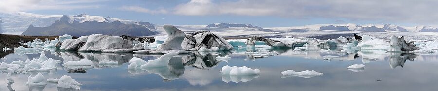
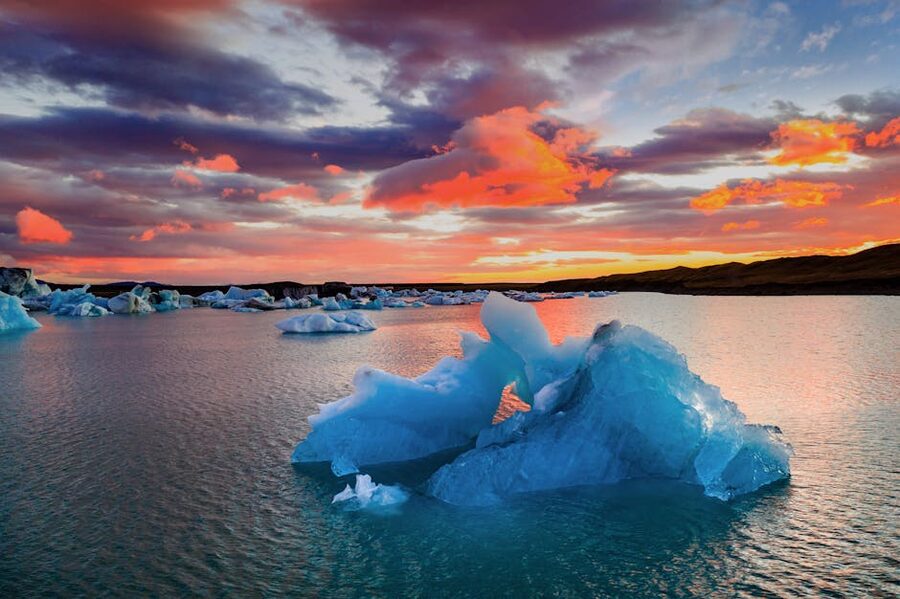
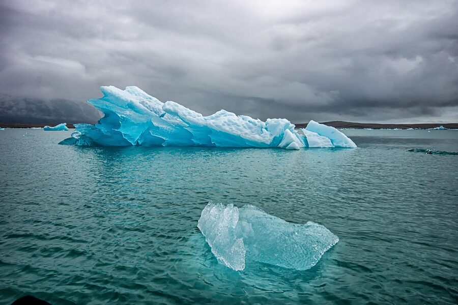
From any of these glacier tongues you can do a half-day hike (4,000-foot ice walls, crevasses, the works) or you can tack on Jökulsárlón, the glacial lagoon where icebergs calve off Breiðamerkurjökull and drift towards the sea. In summer you can take a zodiac boat out among them; in winter the lagoon partly freezes and the icebergs get stuck against the lagoon’s exit channel. Across the road, the Diamond Beach is the black-sand strand where those same icebergs wash up after being swept out to sea. It’s the picture most people have seen before they arrive, and it’s one of the few places in Iceland that lives up to the photos.
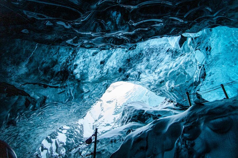
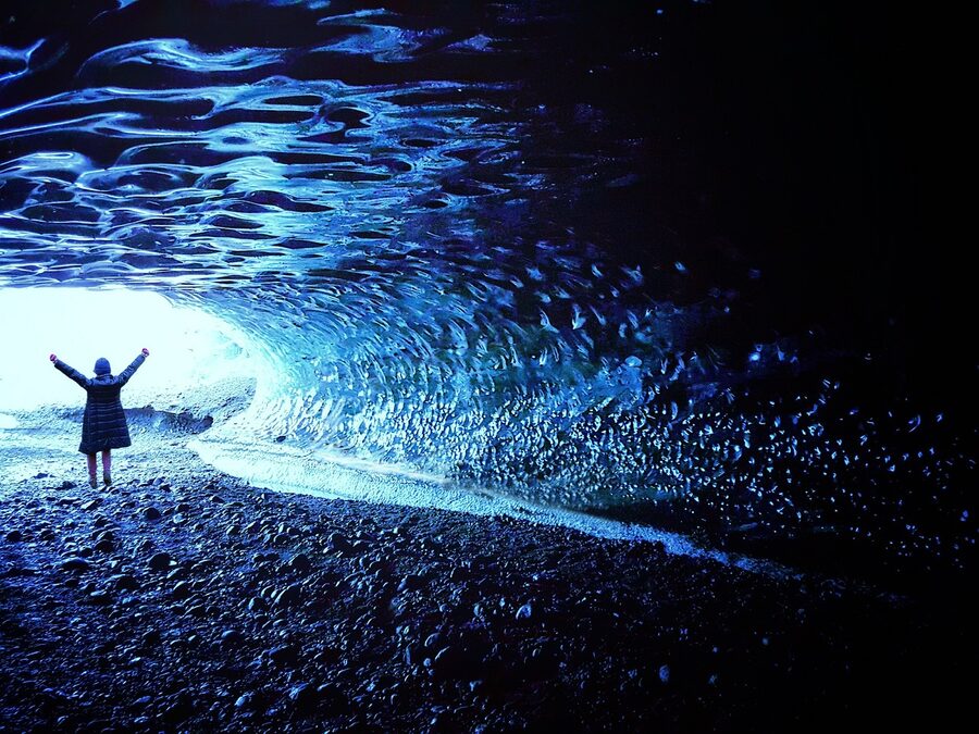
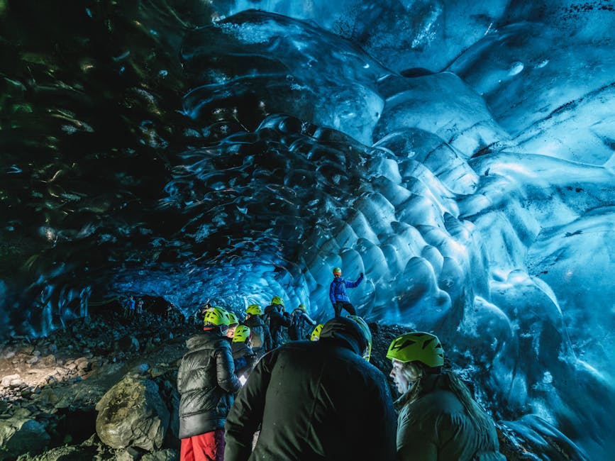
Ice caves, only in winter
Ice caves are the other thing people come for, and they’re also the thing most visitors misunderstand. The natural ice caves in Vatnajökull are seasonal, they form every autumn as meltwater tunnels freeze up, and they collapse every spring as the glacier starts to shift. No cave is in the same place two years in a row. Some years there are four or five good ones; some years two. Guides scout the glacier from late October onwards to find the year’s stable caves.
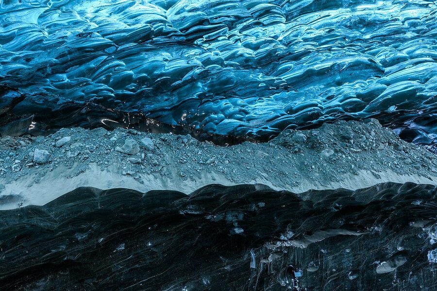
The natural season runs roughly from late October or early November through late March. Outside those months, the caves are full of meltwater and off-limits for safety reasons. Anyone offering “ice cave tours” in July is taking you to a man-made ice tunnel, which is different, more on that in a moment. In winter, the best operators (Local Guide, Glacier Adventure, Glacier Guides, Extreme Iceland) will book you onto a super-jeep from Jökulsárlón that drives up onto the glacier, finds that season’s cave, and gives you about 45 minutes inside with a headtorch and a helmet. Expect to pay 22,000 to 29,000 ISK per person for a standard cave tour, or 35,000+ for the more remote “blue cave” expeditions that involve a longer drive and smaller groups.
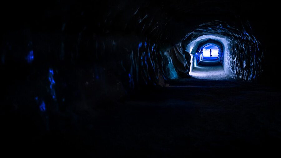
The exception to the season rule is the Katla ice cave, above Vík, and the Langjökull man-made tunnel. Katla is accessible in summer because it’s an ice cave blackened with volcanic ash (the glacier sits on top of the Katla volcano), which stays structurally sound later into spring. The tunnel into Langjökull, run by Into the Glacier, is dug into the ice and open year-round. It’s not a natural cave, which matters to some visitors. For others it’s a perfectly good way to get inside a glacier in July without having to wait eight months.
The one-day fire-and-ice tours from Reykjavík
Most visitors have two or three days of Iceland-day-tours before they fly home, and a single-day fire-and-ice is usually the one they pick. Here’s what that day actually looks like, because the tour listings all look similar and the differences matter.
A typical itinerary leaves BSÍ bus terminal or picks up at your hotel around 8 a.m. You drive east along the South Coast to Sólheimajökull for a two-hour glacier walk with crampons, break for lunch at the N1 petrol station café at Vík (which is exactly as glamorous as it sounds, but it’s the only food for an hour in either direction), then come back via Reynisfjara black sand beach and either Skógafoss or Seljalandsfoss depending on the guide’s choice. You’re back in Reykjavík by 7 p.m. Roughly 10 hours door to door, 24,000–32,000 ISK per person depending on operator and season.
The “fire” part varies. Some tours stop at the Lava Show in Vík (which I rate, it’s a genuine experience, 30 minutes of actual molten lava in a glass viewing room). Some do Kerið crater near Selfoss as a quick photo stop. Some add Raufarhólshellir lava tunnel on the drive home and skip the waterfalls. The itinerary is flexible. If “fire” matters to you, read the full stop-by-stop description before booking, some tours market themselves as “fire and ice” and the only fire element is the basalt columns at Reynisfjara, which, while geologically volcanic, is a bit of a stretch.
Operators I’d book with for a standard south-coast fire-and-ice day: Arctic Adventures, Troll Expeditions, Iceland Rovers, Reykjavik Excursions, and Gray Line. All run comparable itineraries. Arctic Adventures tends to have smaller groups (14 max) and newer vehicles. Reykjavik Excursions has the cheapest price and the biggest buses. Troll Expeditions does a nice small-group super-jeep version that costs more but goes slightly off the tourist trail. Iceland ProCruises does a sea-based variant departing from the old harbour, which I haven’t done personally, but which has a loyal following for photographers.
Super-jeep fire-and-ice
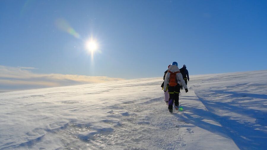
If you want to go further off Route 1 and see things the bus tours can’t, you’re in super-jeep territory. These are modified Land Rovers, Toyota Land Cruisers, and Ford Econolines on 38- or 44-inch tyres, driven by guides who are usually owner-operators and who tend to be the best storytellers in the business. They can cross rivers, drive up glaciers, and take a group of six into highland terrain that’s physically impossible to reach in a standard 4×4.
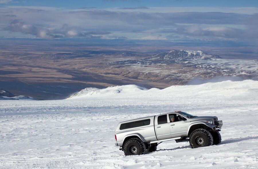
A super-jeep fire-and-ice day is more money, 38,000 to 55,000 ISK per person, but you get fewer people, more time in each place, and access to routes the coach tours can’t do. A good example: Mountaineers of Iceland runs a fire-and-ice combo that does a snowmobile or super-jeep excursion on Langjökull ice cap, a detour to a recent Fagradalsfjall lava field, and a stop at the Hvammsvík hot spring at the end. Roughly 10 hours, max 8 in a vehicle. That’s a far better day than a 50-seat coach to Sólheimajökull.
Mountaineers of Iceland, Ice Explorers, and Midgard Adventure are the three super-jeep operators I’d put at the top. All three take photography seriously, meaning they’ll stop for light when they see it, not just at scheduled stops, and all three have guides who can pronounce Þríhnúkagígur without flinching.
The self-drive version, 2 or 3 days on the South Coast
If you rent a car, you can do a deeper fire-and-ice on your own. The sweet spot is a two or three-day loop along the South Coast.
Day one: leave Reykjavík after breakfast. Stop at the Lava Show in Reykjavík (the newer, more central branch) if you’ve not done it already. Drive to Sólheimajökull, do a two-hour glacier walk with an operator you’ve pre-booked (Arctic Adventures, Extreme Iceland). Continue to Vík. Overnight at one of the Vík guesthouses, Hotel Kría is the nicer one, Icelandair Hotel Vík is the dependable middle-ground choice.
Day two: early start, drive east along Route 1 past Skaftafell (the national park is a worthwhile half-day in itself if you’ve got time). Reach Jökulsárlón by mid-morning, do a zodiac boat trip on the lagoon in summer or an ice cave tour in winter. Walk across the bridge to Diamond Beach. Drive back west in the afternoon, or continue east to Höfn if you have a third day. If you’re overnighting, Fosshotel Glacier Lagoon is the closest hotel to Jökulsárlón and has the best evening light over the glaciers.
Day three (if doing): drive the remaining Vatnajökull tongues, Vatnajökull National Park visitor centre at Skaftafell, a hike to Svartifoss waterfall, and a longer glacier walk with Glacier Guides or Glacier Adventure. Head back to Reykjavík in the evening. Long drive, but doable.
The DIY version costs roughly what a three-day small-group tour costs, 120,000 to 170,000 ISK per person with accommodation, car hire, fuel, and 2 booked guided activities, but you get control over pace, stops, and where you eat. If you’re a confident driver comfortable in winter conditions, I’d do it this way. If you’re not, take the tour. Route 1 in January is not a road to learn on.
The full Ring Road version, 7 to 10 days
If you’ve got longer, the whole Ring Road done as a fire-and-ice circuit is the best way to see the country. You get everything Reykjavík day-trips can give you and then some.
The outline: Reykjavík → Reykjanes (lava fields, Fagradalsfjall if open, Bridge Between Continents on the Mid-Atlantic Ridge) → south coast (Sólheimajökull, Reynisfjara, Vík) → Jökulsárlón and Vatnajökull → east fjords (Djúpivogur, Seyðisfjörður if you have the time) → Mývatn in the north (geothermal area, Krafla, Dimmuborgir) → Akureyri → Snæfellsnes peninsula (Snæfellsjökull glacier, Kirkjufell mountain, lava tubes at Vatnshellir) → back to Reykjavík. Ten days is comfortable; seven is busy; anything less than seven and you’re ticking boxes, not seeing the country.
On a Ring Road fire-and-ice you’ll cross every type of volcanic landscape, new black lava, old mossy lava, caldera floors, crater rims, geothermal fields, and every type of glacier, outlet tongues, ice caps, calving lagoons, the whole Vatnajökull mass from different angles. You’ll also see the bits most fire-and-ice marketing skips: the Mývatn geothermal lake, Dettifoss waterfall fed by glacial melt, Eyjafjallajökull from the north, and Snæfellsjökull, the volcano Jules Verne picked as the entrance to the centre of the Earth.
If you want this done for you, Iceland ProTravel, Nordic Visitor, and Iceland Tours (which is also a local operator and not just a generic name) all package 7-to-10-day guided fire-and-ice trips with accommodation, activities, and a guide. Expect to pay 400,000 to 700,000 ISK per person depending on season and hotel level, and for that you’ll get the kind of attention to routing and pace that an individual would spend a month planning alone. For the purest version of the trip, the expedition cruises, Lindblad/National Geographic, and Iceland ProCruises’ smaller ships, do an 8-to-10-day sail around the island with helicopter or Zodiac landings at the main fire-and-ice spots. Pricey, but the best way to see the coast from the sea.
If you’d rather design your own version of this, pace, stops, accommodation, I wrote a separate piece on building a custom Iceland itinerary that goes deeper into the planning side. The short version: book accommodation in the glacier areas (Vík, Hof, Mývatn) at least three months ahead in summer, six months for ice-cave season.
Timing, what’s open when
The fire half of any fire-and-ice tour runs year-round, with caveats. Lava fields are always accessible as long as there’s not an active eruption closing them. Lava tunnels are year-round. Þríhnúkagígur (Inside the Volcano) is May through late October only. Fagradalsfjall and Reykjanes eruption sites open and close depending on activity, check vedur.is and safetravel.is a few days before you travel.
The ice half has a stronger seasonal pattern. Glacier hikes on Sólheimajökull and the Vatnajökull tongues run year-round, but the character changes. Summer hikes are drier and warmer, with more defined ice textures once the snow layer melts off. Winter hikes have you walking on snowpack for the first 15–20 minutes, which makes the crampons matter less, but the ice caves are open, which is the bigger draw. Natural ice caves in Vatnajökull run November through late March. The Langjökull man-made tunnel is year-round.
For aurora as a bonus on winter fire-and-ice tours: the season runs roughly late September to early April. The sun needs to be below the horizon for decent darkness, KP index needs to be at least 3 for visible lights, and the sky needs to be clear, which it rarely fully is. If you see an aurora on a winter tour, it’s a gift. Don’t come to Iceland expecting to see it, or you’ll be disappointed. Come for the landscape and treat the lights as extra. Check the aurora forecast on en.vedur.is/weather/forecasts/aurora around lunchtime the day of your tour.
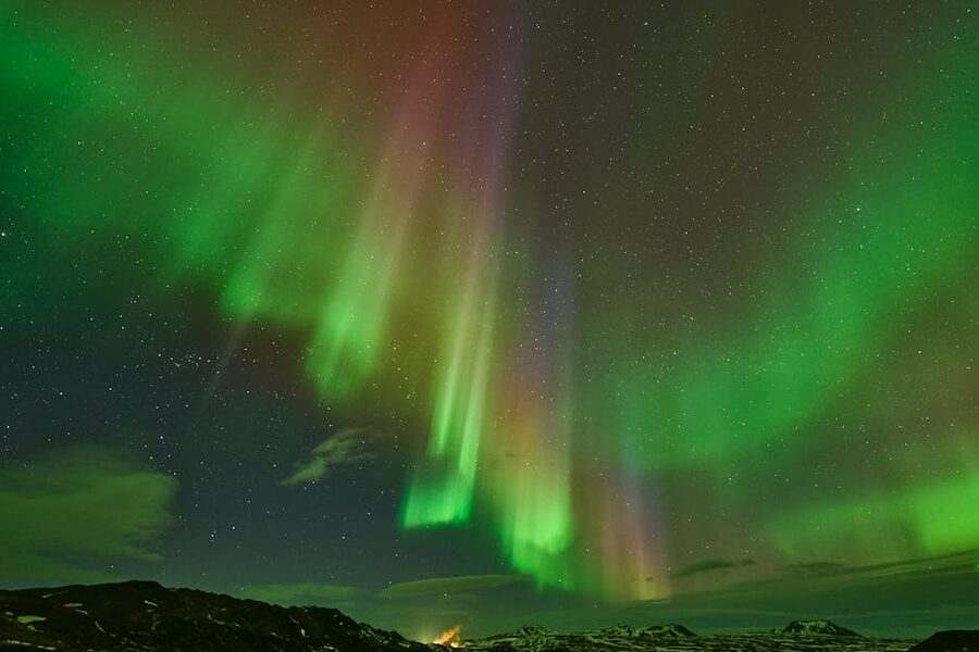
May, June, and September are probably the best months for a full fire-and-ice experience. You get Inside the Volcano open, the glacier hikes at their most photogenic, the Ring Road driveable, and the highlands accessible by super-jeep. July and August are peak summer and peak crowds. November through March is ice-cave season, shorter days, and the highest chance of road closures. February has the advantage of being cheap and quiet, but you lose Þríhnúkagígur and you need to plan around 5 hours of daylight.
Weather and safety, the part that matters
Every fire-and-ice tour I’ve been on has included, at some point, the guide turning around and saying “we were going to do X, but the wind is at 22 m/s so we’re doing Y instead.” This is normal. Icelandic weather changes faster than most places on earth, and the operators that last are the ones willing to reroute. If a guide insists on sticking to the original plan when conditions say otherwise, that’s a red flag, not a virtue.
The things that actually go wrong on a fire-and-ice day tour: weather closes Route 1 between Hvolsvöllur and Vík (happens about six times every winter, usually resolves within a day), lava access gets closed because of gas or movement (happens more often than you’d think, SO2 levels can rise in under an hour), ice cave access is cancelled because the glacier is too unstable (usually early November, or late March), or a super-jeep breaks a half-shaft in the highlands (rare but it happens, every operator has spares). Good guides plan around these. Your job is to build slack into your itinerary: never plan a glacier tour for the morning of your flight home, never plan an ice cave tour on your single clear day of the trip. Give yourself a buffer day if you can.
Safety rules I genuinely would follow, not just the boilerplate ones:
Never walk on a glacier without a guide. Never. People die on Icelandic glaciers every year because they think “it’s only a short walk” and fall into a moulin. The ice is moving, it’s full of holes covered by thin snow bridges, and “I’ll be careful” does not work as a safety strategy.
Never cross a Civil Protection cordon at an eruption site. SO2 and CO2 pockets can form in lava-field depressions and are colourless, odourless, and fatal. Photographers have died. Stay on the marked route.
Always check road.is and vedur.is before driving yourself in winter. The colour-coded road map tells you the truth, a red road is actually closed, not just “not recommended.”
Stay 30+ metres back from the waterline at Reynisfjara. Sneaker waves are the thing nobody photographs until it’s too late.
Þetta reddast, it’ll work out, is the Icelandic phrase every tourist learns, and mostly it’s true. But not if you take stupid risks. Then it doesn’t work out at all.
Operators, the ones I’d actually book with
I haven’t been paid by any of the companies below. I also haven’t tested every tour from every operator. Here’s a general read on who’s currently running good fire-and-ice options based on what I and people I know have done recently.
Arctic Adventures, biggest independent adventure operator, runs everything from glacier hikes to Inside the Volcano to ice cave combos. Small groups (10–14), decent guides, fair pricing. Good default choice.
Troll Expeditions, smaller super-jeep focused operator out of Reykjavík. Great ice cave tours, good photographer-friendly pacing. Slightly more expensive than the coach-based outfits but worth it.
Mountaineers of Iceland, specialise in Langjökull and highland super-jeep work. Their fire-and-ice Langjökull day combines snowmobile on the ice cap with a lava stop. Reliable.
3H Travel, operates Inside the Volcano. Only one option in the market, no real competition. Books out months ahead in peak summer.
Into the Glacier, operates the Langjökull ice tunnel. Year-round, family-friendly, the dependable option for a summer “ice cave” that isn’t really a cave.
Glacier Guides, Glacier Adventure, both based in the Vatnajökull area, both excellent. Glacier Guides is out of Skaftafell; Glacier Adventure out of Hof. Pick whichever matches your accommodation; there’s not much in it on quality.
Reykjavik Excursions, Gray Line, the big two coach operators. Cheaper, bigger groups, less personal. Fine if you’re on a tight budget. They run the reliable bus network to and from BSÍ as well, which is useful.
Iceland ProCruises, Lindblad Expeditions, National Geographic, the expedition cruise side. Pricier but different, you see the country from the water, which changes everything. Good for repeat visitors.
Operators I’d avoid: anyone who claims access to an active eruption zone when Civil Protection has closed it. Anyone selling “ice cave tours” in July without clarifying it’s the Langjökull tunnel, not a natural cave. Anyone whose reviews consistently mention rushed stops or cancelled ice cave bookings without refunds.
Book direct where you can. Most of these operators have their own websites with better pricing than the aggregator platforms. Use GetYourGuide, Viator, or Klook for comparing, but then check the operator site directly before you commit. The markup can be 10–15%.
What a fire-and-ice day actually costs
Rough ISK prices at time of writing (April 2026). All per person, all real market rates:
Lava tunnel tour (Raufarhólshellir): 7,900–9,500 ISK, 1 hour inside plus travel. Cheap, easy, year-round.
Glacier hike on Sólheimajökull (half-day): 13,000–16,000 ISK just for the hike, or 24,000–32,000 ISK if booked as part of a full south-coast day tour with transport from Reykjavík.
Ice cave in Vatnajökull (winter only): 22,000–29,000 ISK for a standard cave tour from Jökulsárlón, 35,000+ for premium “blue cave” small-group tours.
Inside the Volcano (Þríhnúkagígur): around 54,000 ISK including transport from Reykjavík. Add roughly 100,000 ISK if you want the helicopter version.
Langjökull ice tunnel: around 24,900 ISK from Húsafell, or 39,500 ISK from Reykjavík with transport.
Super-jeep fire-and-ice day: 38,000–55,000 ISK per person for a small group (6–8), full day, including one named activity (glacier walk or ice cave depending on season).
Helicopter fire-and-ice tour: 80,000–120,000 ISK for 90 minutes to 2 hours. Worth the money on a clear summer day; waste of money in anything less.
Seven-day guided Ring Road fire-and-ice tour with hotels: 400,000–700,000 ISK per person depending on season and hotel grade. Peak summer is at the top; shoulder season (May, September) is at the bottom.
Self-driving the same seven days: roughly 250,000–350,000 ISK per person if you’re splitting a car and sharing rooms, more if solo. Car hire alone is about 90,000 ISK for a week in winter, 150,000+ in July.
What to actually pack
A fire-and-ice day involves walking on a glacier, standing in wind, and possibly getting rained on. What works here doesn’t match what you’d pack for a ski trip or a hiking holiday elsewhere.
Merino wool base layer, top and bottom. Not cotton. Cotton holds moisture and will freeze on your skin. A thin merino base is warm, wicking, and doesn’t smell after a day out.
Mid-layer fleece or light insulated jacket. Something you can take off without stripping to the base layer when you get on the bus.
Outer layer: waterproof and windproof. Not just water-resistant. Gore-Tex or equivalent. The wind is the thing that will get you, not the cold. A 40-year-old Icelander in January is wearing a shell that would stop a bullet; you should too.
Waterproof hiking boots. High-ankle preferred. You’ll get a pair of crampons fitted over them at the glacier. Running shoes and low-cut trainers are a bad idea on lava and useless on ice.
Wool socks. Two pairs for the day; keep one dry in your bag.
Gloves, two pairs. One thick for standing outside at viewpoints, one thinner liner for operating camera and phone. Touchscreen liners save you a lot of frustration.
Wool hat and a neck buff. Both standard kit.
Headtorch if doing ice cave tours (some operators provide, some expect you to have a small backup). Also useful in December when the light goes early.
Water bottle, tap water in Iceland is some of the best you’ll drink anywhere, and it costs nothing. Carry a 750ml bottle; refill at every N1 or petrol station.
Small lunch / snack, most tours include one stop at a petrol station or café, but the food there is expensive and uninspiring. Bring something.
What you don’t need: thermal underwear rated for Antarctica, a puffer jacket over the shell (it’s usually 0 to -5°C on a fire-and-ice day, not -20), snowshoes (the operator provides crampons), or a cowboy-style waterproof hat (you’ll lose it to the wind in ten minutes; wool beanie only).
If you turn up in Reykjavík without the right gear, 66°North and Icewear on Laugavegur both rent proper shells and boots by the day. Easier than buying and cheaper than freezing.
How I’d pick a fire-and-ice tour
If I had one day in Iceland and wanted the quintessential fire-and-ice experience, I’d book a super-jeep Inside the Volcano morning with 3H Travel, then drive out to an ice cave on Vatnajökull in the afternoon if the season allowed, or a Sólheimajökull glacier walk if it didn’t. That’s a long, intense, memorable day. Summer only.
If I had three days, I’d self-drive the south coast: day one Reykjanes and a Reykjavík Lava Show evening, day two Sólheimajökull hike and overnight in Vík, day three Jökulsárlón and a winter ice cave or a summer zodiac. Book the glacier hike and ice cave in advance; the rest you can do on the fly.
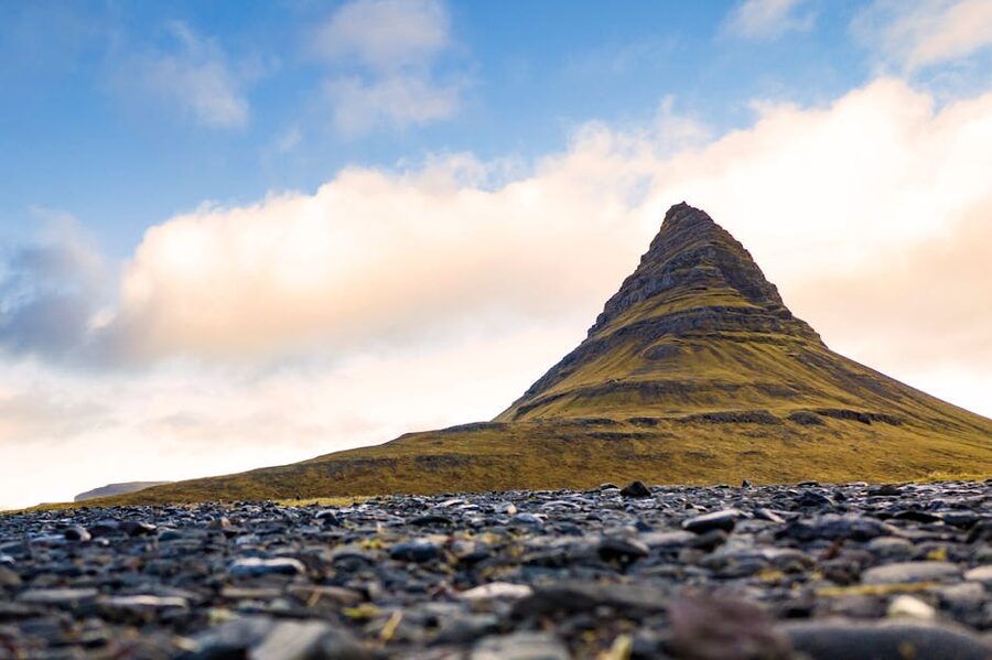
If I had a week or more, the Ring Road fire-and-ice is the best trip Iceland offers. Self-drive if you’re confident; book a small-group guided tour if you’re not. Either way, don’t skip Snæfellsnes and don’t skip Mývatn. Those two peninsulas have the quietest fire-and-ice moments on the whole island.
And if you’ve got zero budget flexibility and two hours in Reykjavík, the Lava Show in the old harbour will get you as close to molten rock as you can get anywhere in the world without a helmet. Not the same as a real eruption, but genuinely impressive, and they let the kids push the button that starts the lava pour. My nieces loved it.
Whichever version you end up with, come prepared for the weather to change your plans. Build in a buffer. Pack the right layers. Listen to your guide. And remember that the volcanoes don’t run on schedules, neither do the glaciers, so the story you come home with probably won’t be the one you booked. That’s usually the better outcome.
If you want to keep reading, I’ve got separate pieces on what Christmas in Iceland actually looks like, a Reykjavík local’s guide to the capital, and a local’s guide to Icelandic food if you’re trying to fit the eating side into your trip too. Or browse the rest of the tour guides category for day trips, photo tours, and customized options.