The Snæfellsnes Peninsula sticks out of west Iceland like a long, knobbly finger pointing at Greenland. It is roughly 90 kilometres long, two and a half hours from Reykjavík by car, and it ends in a snow-capped volcano called Snæfellsjökull that you can see from the city on a clear day. People call it “Iceland in miniature” because in one drive you cross lava fields, climb over a mountain pass, watch waves slam into basalt cliffs, walk a black pebble beach, and look up at a glacier. That is genuinely accurate. It is the only stretch of the country where you do not have to pick.
I have driven the loop maybe twenty times now, in every season, with parents, friends, my own car, rental jeeps, twice in a campervan that was too tall for the wind. What follows is everything I would tell you over coffee at the N1 in Borgarnes before you head out: where to stop, where to skip, what to pack, where to eat, where to sleep, and the small handful of things I wish someone had told me the first time.
In This Article
- What Snæfellsnes actually is
- Getting there from Reykjavík
- The big-picture loop, in driving order
- Stykkishólmur
- Where to stay in Stykkishólmur
- Grundarfjörður and Kirkjufell
- Snæfellsjökull National Park
- Vatnshellir lava cave
- Djúpalónssandur
- Lóndrangar
- Saxhóll crater
- Arnarstapi and Hellnar
- Búðir and the black church
- The smaller stops worth slowing for
- Gerðuberg basalt cliffs
- Hellissandur and the Maritime Museum
- Malarrif lighthouse
- Bjarnarhöfn shark museum
- Ytri Tunga seal beach
- Iceland in miniature, in practice
- When to go
- Eating on the loop
- One-day vs two-day vs three-day
- Where Snæfellsnes ranks if your time is short
- The small things I wish I’d known
- Tours, links, and where to read more
What Snæfellsnes actually is
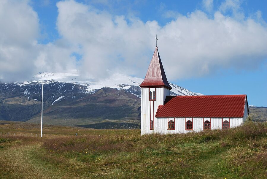
The peninsula sits about 175 km north-west of Reykjavík along Route 1 and Route 54. It is part of the Vesturland (West Iceland) region, between Faxaflói bay to the south and Breiðafjörður bay to the north. The spine of the peninsula is a low mountain ridge that you cross via a couple of high passes. The whole western tip is the Snæfellsjökull National Park, Iceland’s smallest, established in 2001 and run by Umhverfisstofnun (the Environment Agency, ust.is).
You can do the loop in a long day from Reykjavík, and a lot of people do. You can also stay overnight in Stykkishólmur or Grundarfjörður and take two days, which is what I would do if I had the choice. Two days lets you breathe, sit at Búðakirkja in the evening light without rushing back, get the morning shot of Kirkjufell while the day-trippers are still on the bus, eat a proper dinner instead of a sandwich at a petrol station.
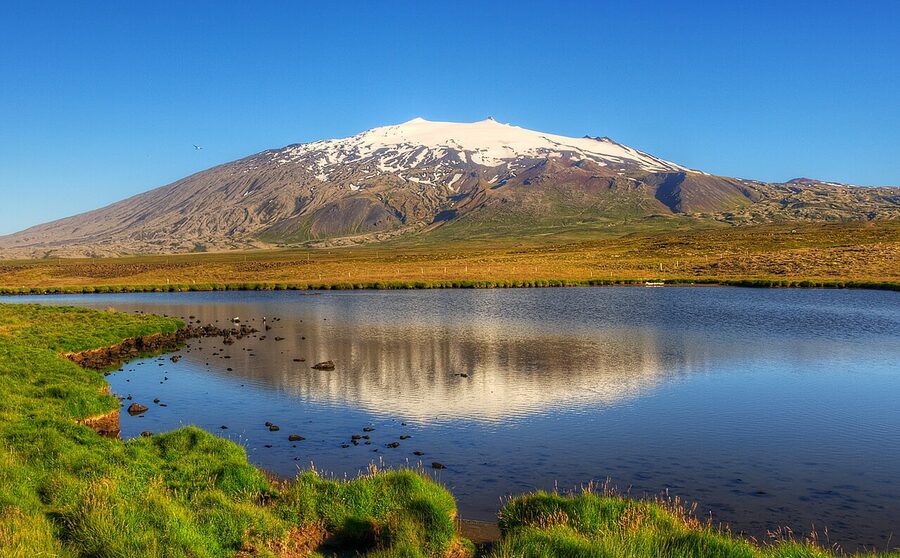
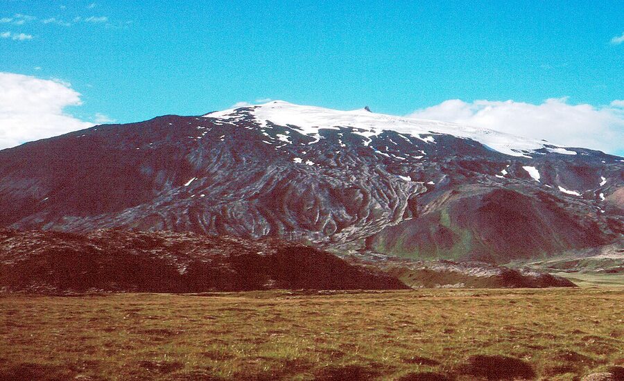
Snæfellsjökull itself is a stratovolcano, 1,446 metres high, with a small icecap that has been retreating for years. It last erupted around 200 AD, give or take, and Jules Verne picked it as the entrance to the underworld in Journey to the Centre of the Earth. People will tell you it has “energy.” A French esoteric group named it one of the seven energy centres of Earth in the 1990s. Take that as you like. It is a beautiful mountain either way.
Getting there from Reykjavík
From the city, head north on Route 1 (the Ring Road) for about an hour to Borgarnes. There is a Geirabakarí bakery on your right as you cross the bridge into town that does decent kanilsnúðar (cinnamon buns) and a flat white that will hold you until lunch. After Borgarnes you turn left onto Route 54, which is the road that wraps the peninsula on both sides. From here it is roughly another hour and a half to Stykkishólmur, three hours total from Reykjavík.
You drive yourself or you take a tour. There is no public bus that does the loop, and the Strætó network only reaches Stykkishólmur from Reykjavík with a single afternoon coach (route 58), which is too late to actually see anything. So practically: rent a car, join a day tour, or if you have more time, base in Stykkishólmur and use it as your hub.
For rentals, I usually point people at northbound.is/cars as a comparison engine, it pulls quotes from most local outfits at once. Blue Car Rental is reliable and reasonably priced. In summer a small 2WD is fine for the paved loop. Between October and April I would rent a 4WD with proper winter tyres and not think twice about it. Route 54 around the western tip can ice up fast, and a section is sometimes closed for hours after a heavy snow.
Day tours from Reykjavík run every day of the year. The big operators are Reykjavik Excursions, Gray Line, Iceland Horizon and a few smaller minibus companies. Expect about 12 hours door-to-door, ISK 15,000 to 22,000 per person, mostly in a 30-40 seat coach with a guide. GetYourGuide and Viator aggregate most of these, sort by reviews and pick a small-group option if your budget allows. The minibuses (12-16 seats) are noticeably better than the big coaches because they can stop in places the coaches cannot turn around in.
The big-picture loop, in driving order
Here is the route I would do as a day-tripper coming from Reykjavík on a clear summer day. It runs counter-clockwise, north coast first, west tip in the middle, south coast on the way back, which puts the late light on Búðakirkja for the photo and ends with the easiest drive home.
The order, with rough times: Reykjavík (8:00) → Borgarnes coffee (9:15) → Gerðuberg basalt columns optional (9:45) → Stykkishólmur (11:00) → Kirkjufell + Kirkjufellsfoss (12:30) → drive over the western tip → Hellissandur and Snæfellsjökull views (14:00) → Djúpalónssandur (14:30) → Lóndrangar (15:15) → Vatnshellir cave (16:00) → Arnarstapi/Hellnar coastal walk (17:00) → Búðir + black church (18:30) → back to Reykjavík (21:00). It is long. Do not stop everywhere. Pick five or six and actually be present at them.
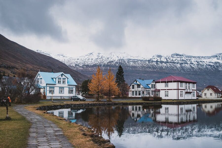
Stykkishólmur
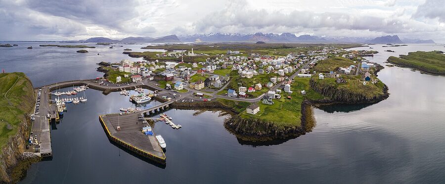
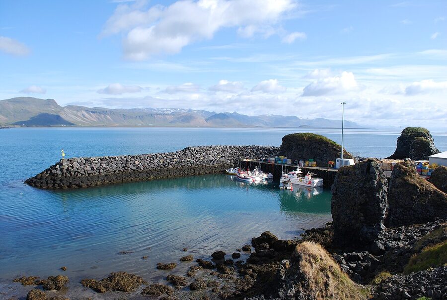
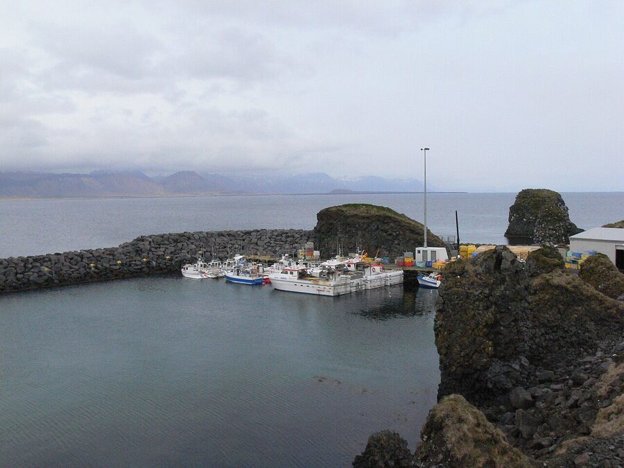
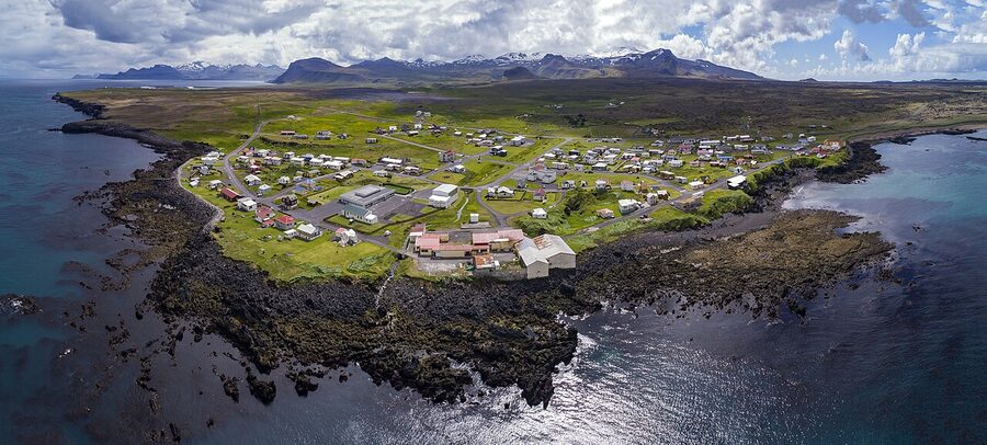
Stykkishólmur is the regional hub, about 1,200 people, neat coloured houses on a slope, a proper harbour, and the only town on the peninsula that feels like a town rather than a fishing settlement that grew. The film and music people noticed years ago. Sigur Rós shot scenes for the Heima documentary here, Ben Stiller used the harbour and the wider area for The Secret Life of Walter Mitty, and on a sunny afternoon the harbour basin with all the small boats is genuinely lovely.
Park near the harbour and walk up Súgandisey, the basalt island connected to the breakwater. Twenty minutes round trip, a small orange lighthouse at the top, and the best free view of the town. Then walk back to the Norwegian House (Norska Húsið), a wooden trader’s house from 1832 that is now a small folk museum. ISK 2,000 to enter, worth it on a rainy hour, skip if you only have a sunny half-day.
From Stykkishólmur the Baldur ferry runs across Breiðafjörður to Brjánslækur in the Westfjords, with a stop on the tiny island of Flatey. Two daily sailings in summer, one in winter. Even if you are not crossing to the Westfjords, the morning sailing to Flatey and back makes a beautiful half-day, it is a 200-person turf-roof island in summer, ten people in winter, and the boat ride alone takes you past hundreds of small islets in the bay.
For dinner in Stykkishólmur I would book Sjávarpakkhúsið down at the harbour (modern Icelandic, fresh fish, small menu) or Narfeyrarstofa on the main street (Nordic-leaning, more formal, more expensive). Both are reliably good. Skip the burger places unless you genuinely want a burger.
Where to stay in Stykkishólmur
Three solid options, all of which I have either stayed at or sent friends to:
- Hótel Egilsen, a small boutique in a 19th-century timber house right by the harbour, ten rooms, breakfast in a tiny dining room with the chef cooking eggs ten feet from your table. Charming, slightly creaky floors, no lift. The one to pick if you want character.
- Fosshotel Stykkishólmur, bigger, a five-minute walk uphill from the harbour, modern rooms, the kind of place a tour group books. Reliable rather than romantic. Decent restaurant.
- Grundarfjörður Hostel (in the next town along), if you are on a budget or you specifically want to be near Kirkjufell at sunrise, this hostel is your friend. Shared kitchen, dorm and private rooms, very Icelandic-functional, friendly.
Grundarfjörður and Kirkjufell
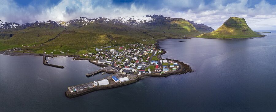
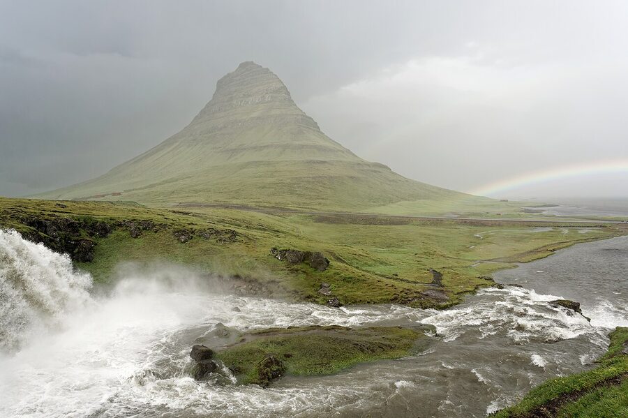
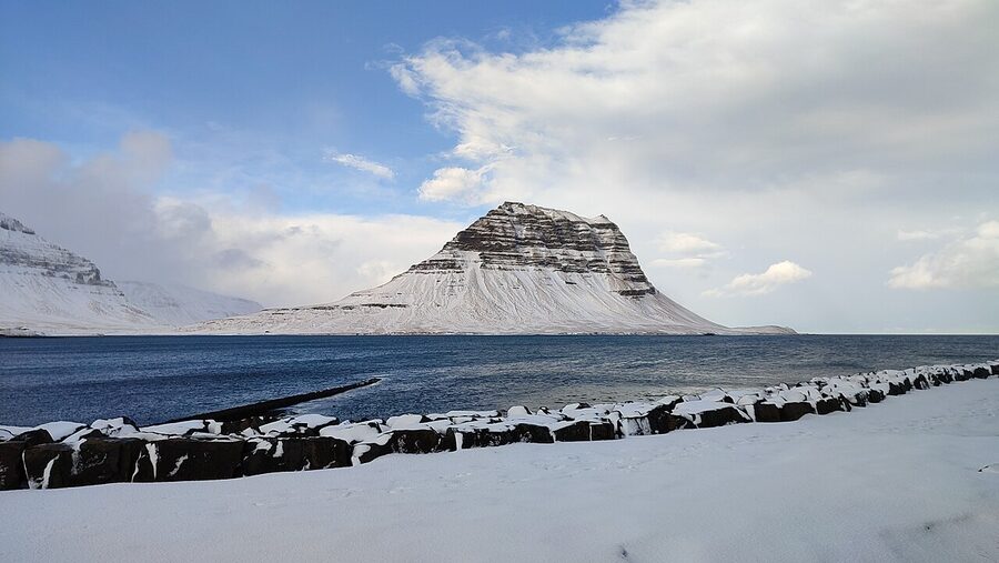
Grundarfjörður is the smaller fishing village 40 km west of Stykkishólmur, and the only reason most travellers stop here is Kirkjufell, the 463-metre mountain that sits just outside town and is the most photographed peak in Iceland. The shape is unmistakable: a steep arrowhead with a flat top, like a child’s drawing of a mountain. Game of Thrones fans will recognise it as “the arrowhead mountain” the Hound and Beric saw north of the Wall in season 7.
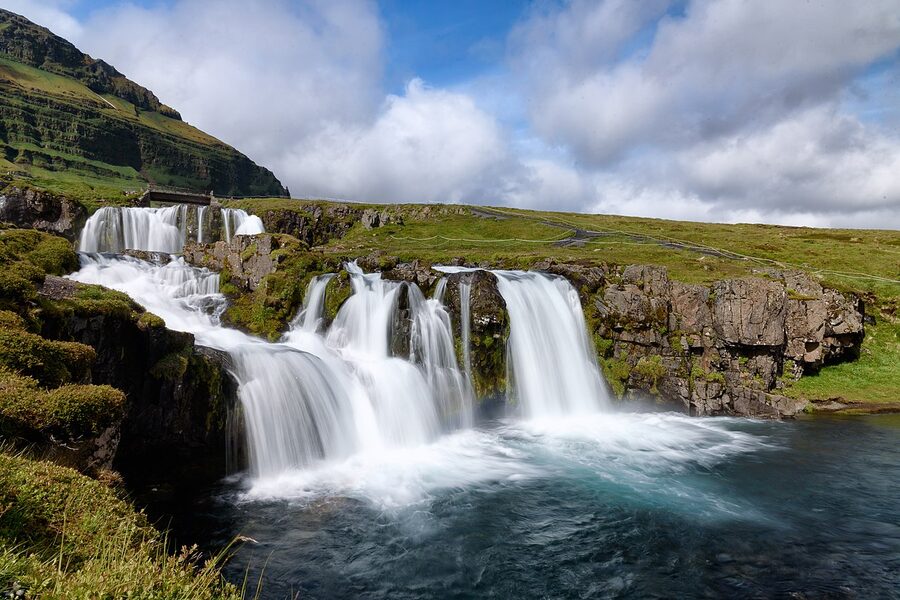
The shot you have seen a thousand times, Kirkjufell rising behind a three-tier waterfall, is taken from Kirkjufellsfoss, a small waterfall in the layby five minutes’ drive west of town. Park in the lot (free, often busy), follow the path under the road, and you are there. The viewpoint is on the right side of the falls, ten metres up the slope. If you want the shot without anyone in it, come at sunrise or at midnight in summer. Sunset works too. Mid-day is fine but you will share it with a coach.
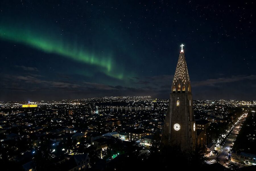
For the aurora-over-Kirkjufell shot, the absolute icon of Iceland photography, base yourself in Grundarfjörður between September and April, watch the aurora forecast on vedur.is, and pray for KP 3 or higher with clear sky. The aurora is not a guarantee. I have stood at Kirkjufellsfoss in early March under a perfect KP 5 forecast and seen exactly nothing because of cloud. I have also stepped out of the hostel kitchen at midnight in November to a sky that was on fire. Pack patience.
For dinner in Grundarfjörður, Bjargarsteinn Mathús is the local hero. Tiny, fish-forward, slow service in the best way, you can watch the kitchen plate from the bar. Book ahead in summer, walk in the rest of the year. If it is full or closed, the café at the petrol station is fine for a soup-and-bread.
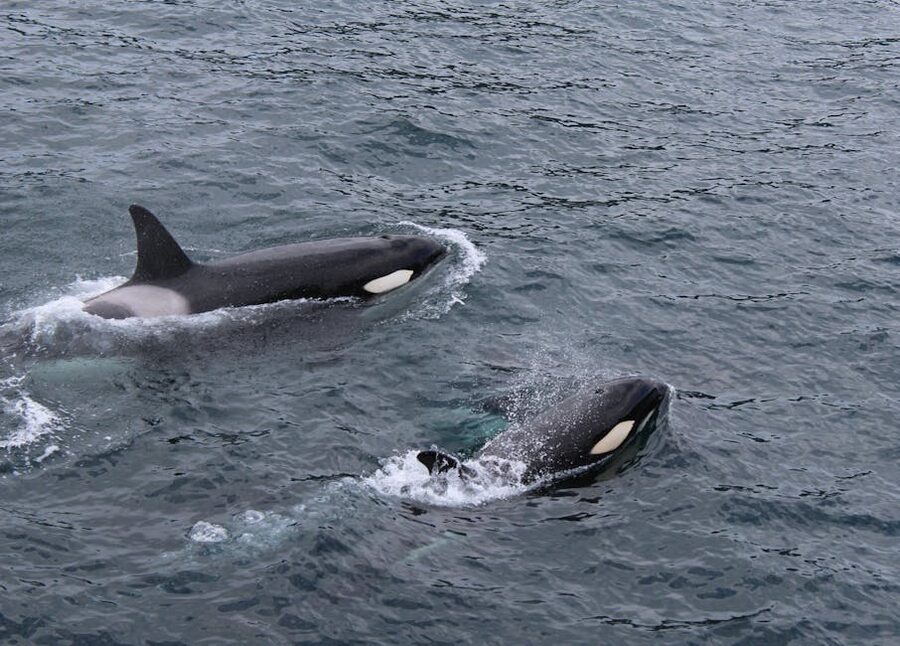
Whale watching from Grundarfjörður is a draw in its own right. Láki Tours runs orca-spotting trips out of the harbour and, between roughly February and June, has one of the highest orca-success rates in Europe, they follow the herring shoals into Breiðafjörður and the orcas are right there with them. Year-round you will likely see white-beaked dolphins, harbour porpoises, and minke whales. ISK 14,000-19,000 depending on season, three to four hours, dress in everything you own.
Snæfellsjökull National Park
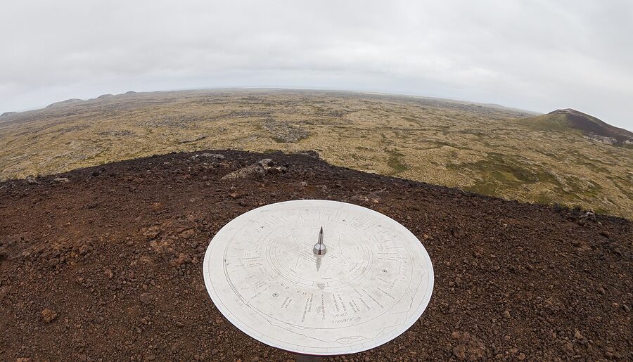
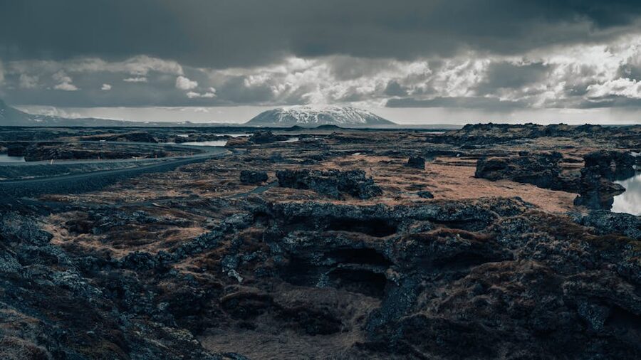
The whole western tip of the peninsula is national park, established in 2001 and managed by Umhverfisstofnun. It is the smallest of Iceland’s three national parks at 170 km², which is a virtue, you can drive across it in 30 minutes and see most of the highlights. Route 574 is the loop road that wraps the tip, and it is paved the whole way. Free to enter, no gate, no ticket, no fuss.
The park ranges from sea level black-sand beaches up to the 1,446-metre summit of Snæfellsjökull. The lower slopes are old lava fields, mossy and lumpy, with deep cinder cones rising every few kilometres. Higher up it gets bare and scoured. The icecap on top has been retreating steadily, at the current rate the glaciologists at the University of Iceland reckon it could be gone within fifty years. Worth seeing while it is still there.
You can summit the glacier on a guided snowmobile-and-walk trip with operators based out of Arnarstapi (Summit Adventure Guides and Snæfellsjökull Glacier Tours both run them, ISK 35,000 to 45,000 depending on group size, summer only). On a clear day from the top you see for 100 km in every direction. On a cloudy day, which is most days, you see fog. Check the forecast on vedur.is the morning of and reschedule if it is socked in.
Vatnshellir lava cave
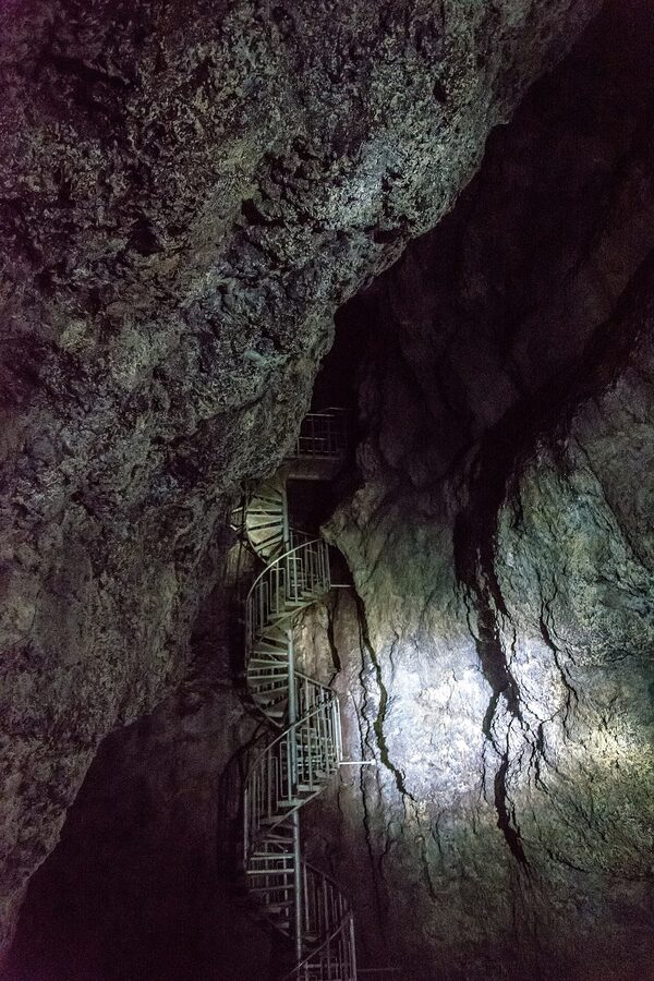
Inside the park, off Route 574 about 10 km east of Hellissandur, is Vatnshellir, an 8,000-year-old lava tube. Tours run hourly between 10:00 and 18:00 in summer (May-September) and on a reduced schedule the rest of the year. ISK 4,500 per adult, ISK 2,500 per child, includes a hard hat and headlamp. The tour is 45 minutes underground, easy on the body, fine for kids over five, and a real glimpse of how lava actually moves, molten rock cooling around itself and leaving the tube empty when it drained out. Book on summitadventureguides.is or just turn up; rarely full outside July and August.
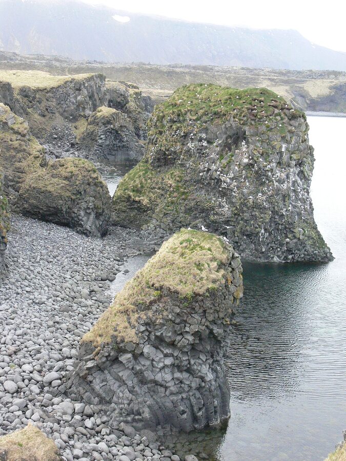
Djúpalónssandur
Djúpalónssandur is the black pebble beach on the south-west tip of the park. You park, walk five minutes down a path past two basalt formations called Gatklettur (Hole Rock) and the Kerling troll, and the beach opens up. The pebbles are perfectly smooth and round, like polished marbles, the result of constant Atlantic surf grinding them down for centuries. Locals call them Djúpalónsperlur, Djúpalón pearls, and you are not supposed to take them. People still do. Don’t.
The rusted iron scattered across the beach is the wreck of the British trawler Epine GY7, lost in a March 1948 storm. Fourteen of the nineteen crew drowned. The wreckage stays where it is, a war-grave-style memorial that you walk among. It is not a postcard moment.

On the path down to the beach are four lifting stones used historically to qualify men for fishing crews. They run from 23 kg up to 154 kg. If you only lifted Amlóði you didn’t get a place on the boat. Try them. They are heavier than they look. I usually get to Hálfsterkur and pretend that is enough.
One safety note that gets repeated and ignored: the Atlantic at Djúpalónssandur, like the more famous Reynisfjara on the south coast, has sneaker waves. Do not stand on the wet sand with your back to the sea. Every couple of years a tourist gets pulled in. The sea is colder than you think, the current is faster than you think, and there is no one to call.
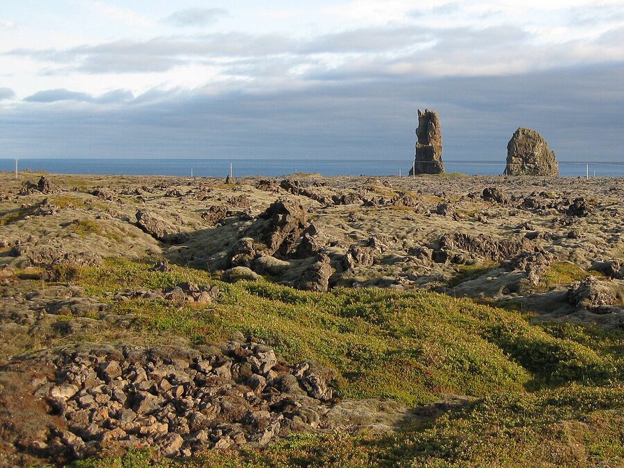
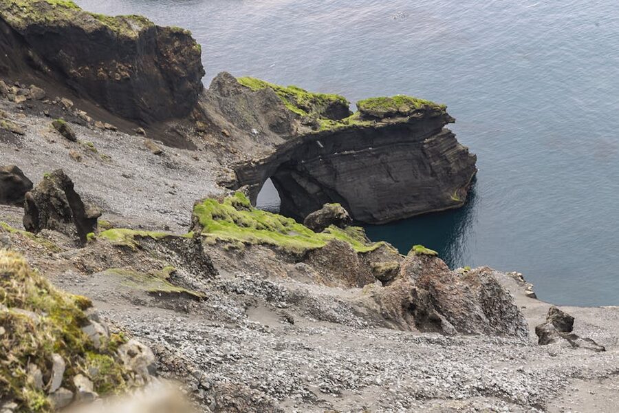
Lóndrangar
Five minutes east of Djúpalónssandur off the same Route 574 is Lóndrangar, two basalt sea stacks 75 m and 61 m tall, the eroded remains of an old volcanic crater. There is a small viewing platform and a longer cliff-top trail if you want to walk for an hour. The stacks themselves are striking from the parking pull-off. The walk is for people who want to be moving rather than seeing more, the views from the platform are already excellent.
Saxhóll crater
Just inside the park boundary on the north side, there is Saxhóll, a 100-metre cinder cone with a metal staircase straight up the side. About 100 steps. Five minutes if you stop for a photo, fifteen if you bring grandparents. The crater rim gives you a 360-degree view of the lava fields running to the sea, with Snæfellsjökull on one side and the sweep of the north coast on the other. Best small payoff per minute of effort on the whole peninsula.
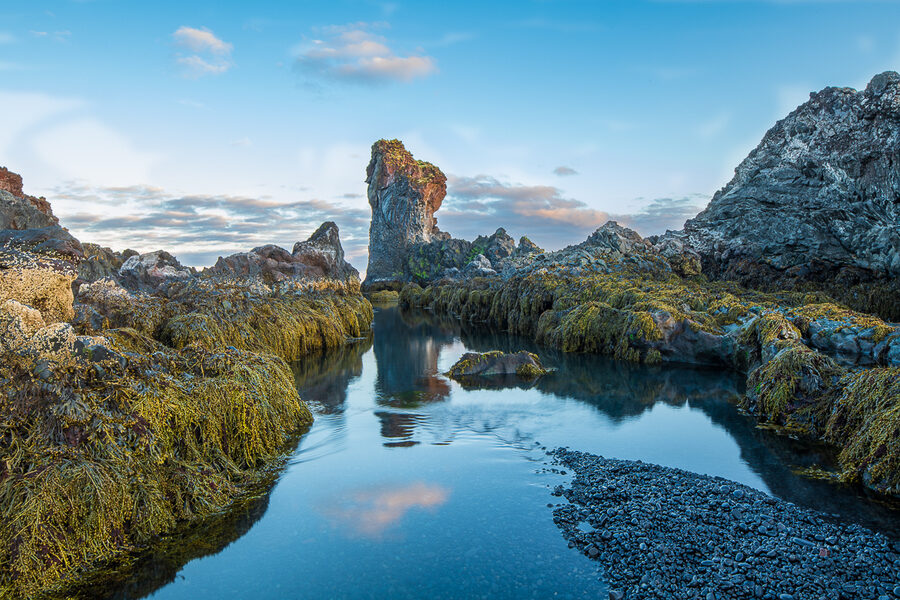
Arnarstapi and Hellnar
On the south coast of the western tip you have two of my favourite small villages on the peninsula: Arnarstapi and Hellnar. They sit 2.5 km apart along the coast and the walking path between them is the best single hour you can spend on the whole loop. Park at Arnarstapi, walk west to Hellnar along the cliff path, have coffee at Fjöruhúsið in Hellnar (the small café right on the water, open May-September, soup and homemade cakes), then walk back. Total time about two hours with the coffee stop. The path is well-marked, mostly flat, and there is no obstacle for normal fitness.
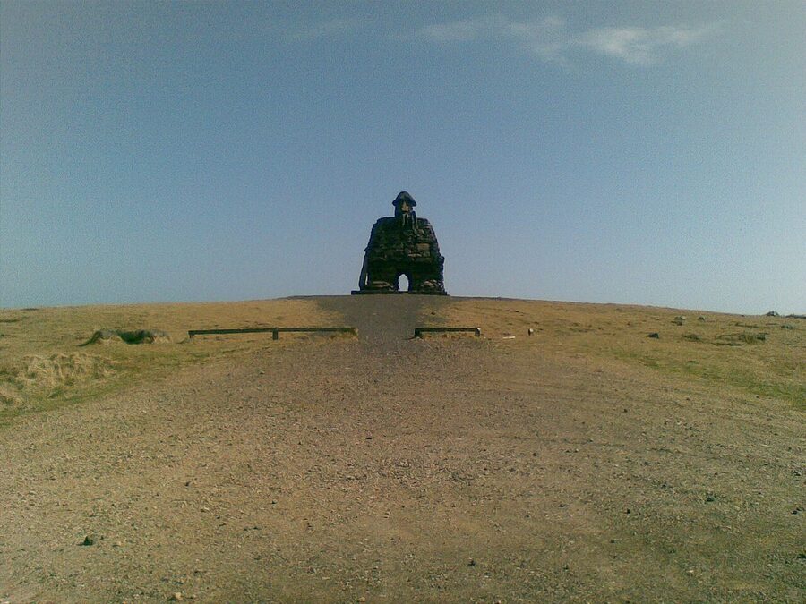
Along the way you pass Gatklettur, a natural basalt arch you can stand right next to (do not climb on it, the rock is more fragile than it looks), and a colossal stone statue of Bárður Snæfellsás. Bárður is the half-troll, half-human guardian spirit of the peninsula in Icelandic folk tradition, born of a giant father and a human mother, he is said to have walked into the glacier and become its protector. The statue, by Ragnar Kjartansson the elder, is built up out of stacked stones and rises above the path like a small standing army. Children love it. Adults pretend not to but circle back for photos.
The village of Hellnar itself is tiny, fewer than a dozen houses, with a small black-stone church and a minute pebble cove that fishermen used for centuries. The legend is that a giantess called Sólveig lived in the rocks above the cove and the local fishermen would leave her offerings before going out. They still do, sometimes. Mostly tourists, now, but the offering shelf is still there.
If you want to base yourself near the coast walk, Fosshotel Hellnar is right there. Quiet, modern, slightly motel-feel rooms but the location is unbeatable, you walk out of the door into the national park, the glacier above you, the cliff path twenty metres away. Restaurant on site if you do not want to drive after dinner.
Búðir and the black church
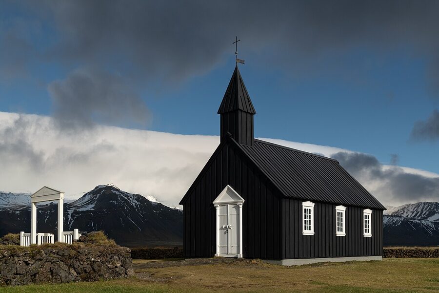
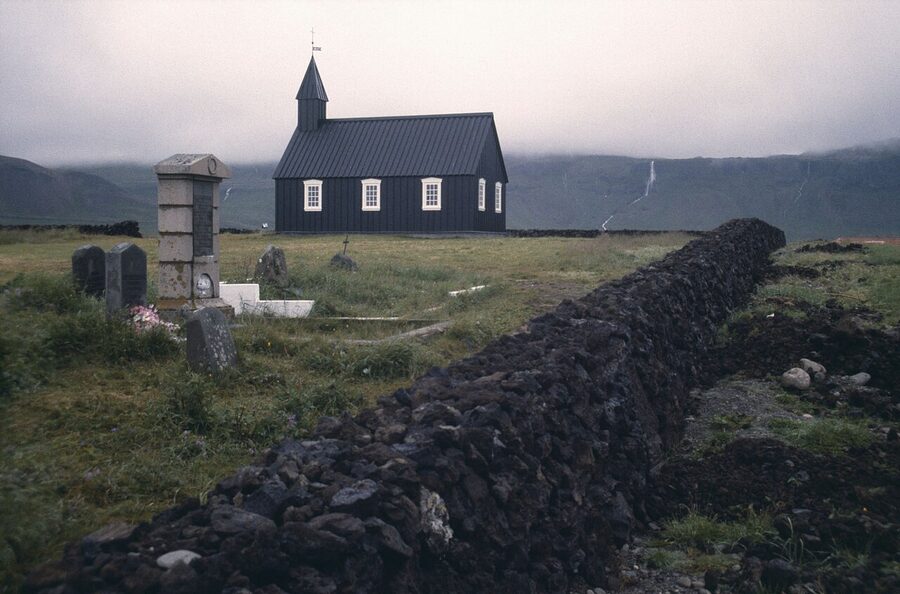
Drive 25 minutes east of Hellnar along Route 54 and you reach Búðir, which is barely a village, a hotel, a tiny black church, a flat lava plain ending in dunes and the sea. The church is the thing. Búðakirkja was first built in 1703, fell into disrepair, and was rebuilt in 1987 by Steinunn Jóhannesdóttir, a local woman who fought a long fight for the permit to put it back on the original spot. It is the most photographed church in Iceland for good reason, black timber walls, white window frames, a white cross, set on lava with the sea behind and the mountains on the other side. In late summer light, it is genuinely something.
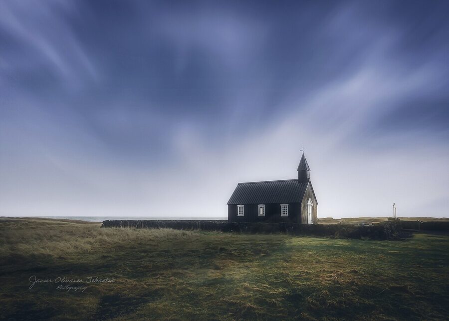
Next to the church is Hotel Búðir, the boutique on the edge of the lava plain that has been running since the 1830s in one form or another. The current building is from the 1990s, all timber and big windows looking at the mountains. Expensive, beautiful, the restaurant is one of the best in west Iceland, the breakfast is lavish. If you are doing a 2-day Snæfellsnes loop and want one really nice night, this is where I would put it. If you are on the long day from Reykjavík, just stop for an early dinner around 6 pm, you’ll get the church in evening light and a proper meal before the drive back.
The smaller stops worth slowing for
Gerðuberg basalt cliffs
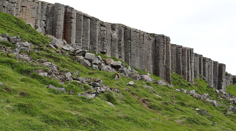
About 20 minutes after you turn off Route 1 onto Route 54, watch for a small sign on the left to Gerðuberg. It is a 500-metre wall of hexagonal basalt columns, formed when lava cooled slowly enough to crack into the geometric pillars you see at the Giant’s Causeway in Northern Ireland. Park at the gravel pull-off, walk 200 metres up to the base, take five minutes. It is not a destination on its own but if you are passing it is worth the detour.
Hellissandur and the Maritime Museum
Hellissandur is the westernmost village on the peninsula, fifteen minutes from Snæfellsjökull, with a tiny but well-kept Maritime Museum (Sjómannagarður) showing the oldest preserved fishing boat in Iceland, Bliki, from 1826. It is genuinely worth ten minutes if you have any interest in how fishing communities lived. ISK 1,500 to enter, summer only. The village also has a giant radio mast that is the tallest structure in western Europe at 412 metres, interesting in a “huh” way, not worth a stop.
Malarrif lighthouse
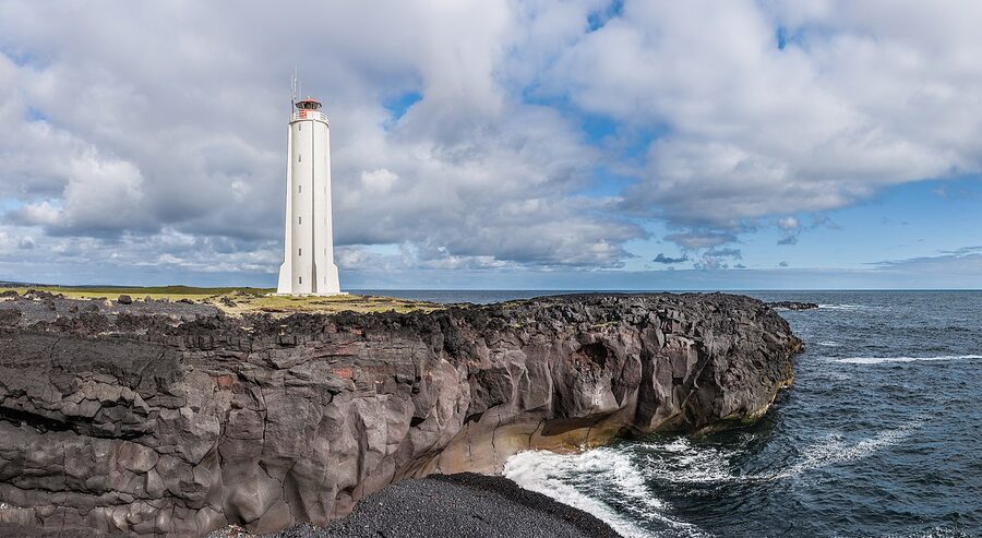
Two kilometres east of Lóndrangar is the Malarrif lighthouse and the Snæfellsjökull National Park visitor centre, a small, free building with a 20-minute exhibit on the park’s geology, flora and folklore. Worth a stop on a wet day. There are also coastal trails from the centre running both east and west. The lighthouse itself, white with a red top, is photogenic against the cliffs but you cannot enter.
Bjarnarhöfn shark museum
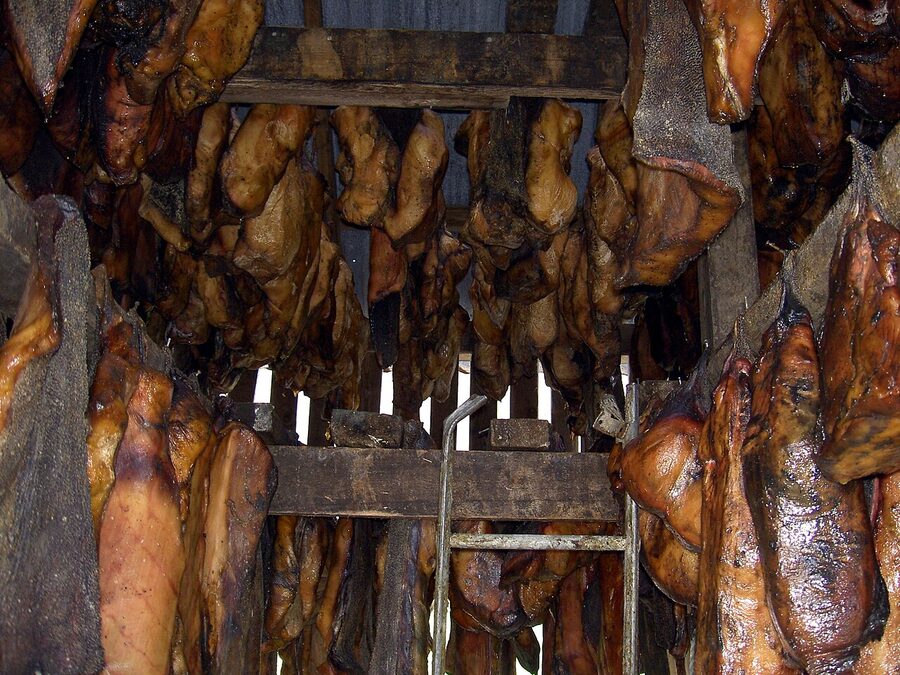
On the north coast 15 km east of Stykkishólmur is the Bjarnarhöfn Shark Museum, a working hákarl (fermented shark) farm that does 30-minute tours including a tasting. ISK 2,000 per person. To be straight about it: hákarl tastes like old cheese marinated in ammonia. The first time I had it I was nine years old at my grandmother’s at Þorrablót and I genuinely thought my mouth was on fire. Twenty years later I still avoid it. The museum is interesting if you want the cultural-curiosity experience and you have an extra hour. Skip if you would rather spend that hour at Kirkjufellsfoss.
Ytri Tunga seal beach
On the south coast east of Búðir, off Route 54, there is a small beach called Ytri Tunga where harbour seals haul out on the rocks. They are there year-round, most reliably May to August. Park at the small lot, walk five minutes to the beach, scan the rocks at low tide. Bring binoculars if you have them. The seals are 50-100 metres offshore, they will not let you closer, and you should not try.
Iceland in miniature, in practice
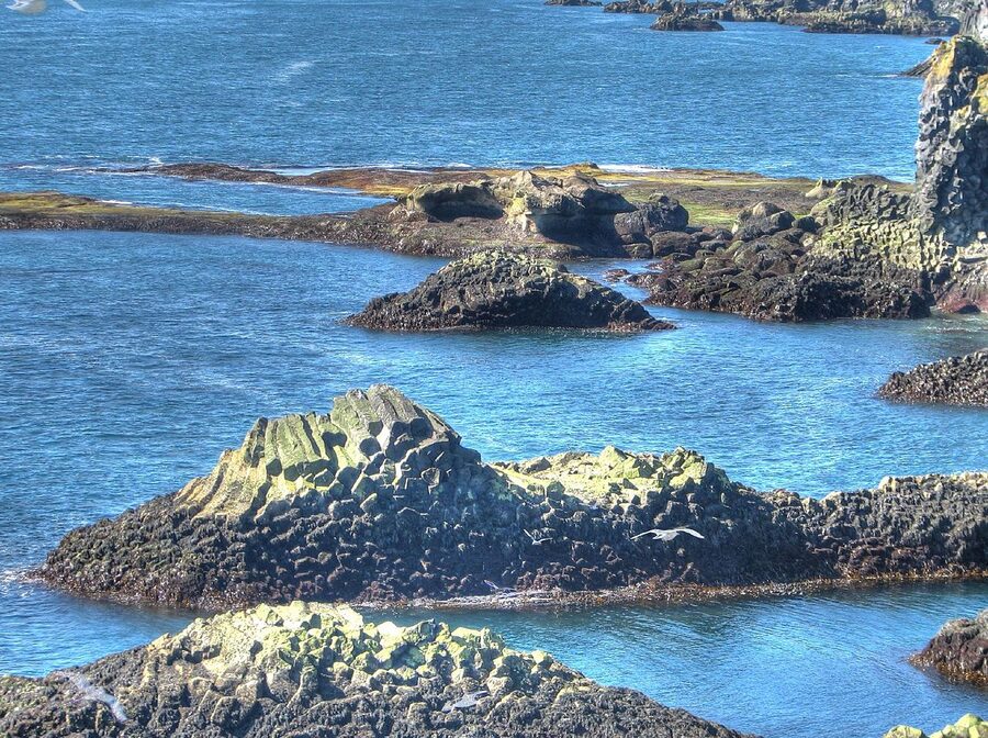
The “Iceland in miniature” line is overused but it is also true. In one driving day on Snæfellsnes you cross every major Icelandic landscape:
- Glacier (Snæfellsjökull)
- Active volcano (the same)
- Lava fields (the entire western tip)
- Black pebble beach (Djúpalónssandur)
- Basalt sea cliffs and stacks (Lóndrangar, Arnarstapi)
- Hexagonal basalt columns (Gerðuberg)
- Hot-spring action (the smaller pools at Lýsuhólslaug)
- Fishing villages (Stykkishólmur, Grundarfjörður, Hellissandur)
- Bird cliffs and seal beach
- Whales and orcas in the bay
The Westfjords have more drama, the south coast has more famous waterfalls, the Highlands have the wildest interior. But none of those gives you the variety in a single short drive that Snæfellsnes does. That is the case for putting it on a short trip if you only have time for one extra region beyond the south coast and the Golden Circle.
When to go
Each season is its own thing on Snæfellsnes:
Late May to early September. The easy season. Long daylight (24-hour sun in June and July, 18 hours either side), all roads open, every restaurant serving, all the cave and glacier tours running, puffins on the cliffs from late May to early August. Weather is still Iceland, pack rain layers, you will use them, but you can drive the whole loop without thinking about ice. Whale watching peaks for orca February-June so the back end of this window crosses with the orcas if you time it right.
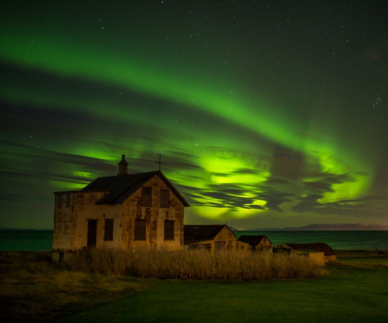
Mid-September to mid-November. My favourite shoulder. Coach tours thin out, the autumn light gets long and golden by 4 pm, the aurora becomes possible most nights with a clear sky. Some restaurants and the Vatnshellir cave shift to a reduced schedule but the core is still open. Pack proper waterproofs and you will have it half to yourself.
Late November to February. Hard mode. Daylight collapses to four or five hours, Route 54 around the western tip can close on short notice, and the storms come in from the Atlantic without much warning. But, and this is a big but, the aurora odds peak in the dark months, the snow on Kirkjufell turns the photo into a different image entirely, and the entire peninsula empties out. If you have driven in winter conditions before and you have a 4WD with proper tyres, this is the most rewarding time to come. Watch road.is hourly for closures.
March to early May. Shoulder coming back. Days lengthen fast, snow melts off the lower roads, the orca trips out of Grundarfjörður are at their peak. Conditions still wintry above the lower passes. A good window if you want a mix of snow scenery and longer driving days.
Eating on the loop
The peninsula is a fishing region first, so order fish. Specifically:
- Bjargarsteinn Mathús, Grundarfjörður. Best meal on the peninsula. Tasting-menu vibe, fresh-from-the-boat fish, slow service, intimate room. Book ahead in summer. Around ISK 12,000-15,000 a head with one drink.
- Sjávarpakkhúsið, Stykkishólmur. Down at the harbour, modern Icelandic, the langoustine is the standout. ISK 9,000-13,000.
- Narfeyrarstofa, Stykkishólmur. More formal, more Nordic, more expensive. The lamb if it is on the menu, otherwise the fish of the day.
- Hotel Búðir restaurant. The room itself is a draw, big windows on the lava plain. Try the fish soup. ISK 14,000+ for three courses.
- Fjöruhúsið, Hellnar. Tiny seaside café. Soup, cake, coffee, May to September. ISK 2,500 for a bowl of soup with bread.
The N1 petrol stations at Borgarnes (going up) and at Vegamót (coming back, where Route 54 meets Route 55) both have decent self-service food and are open late. They are fine if you have driven too long and just need to refuel both car and human.
One-day vs two-day vs three-day
One day from Reykjavík. Doable but rushed. You will see the highlights from a coach window, get an hour at Kirkjufell, walk down to Djúpalónssandur, take ten minutes at Búðakirkja, and roll back into the city around 9 pm exhausted. If a long bus day is your thing or a tour is what your time allows, do this. Pick the smallest minibus you can find, coach versions of this trip are a slog.
Two days with one overnight. The sweet spot. Drive yourself, leave Reykjavík around 9 am, do the north coast and Stykkishólmur on day one, sleep in Stykkishólmur or Grundarfjörður, do the western tip and the south coast on day two, finish at Búðir for early dinner, drive home in the long evening light. This is what I send friends on when they ask. Two nights is even better, it gives you a proper non-driving evening, but two days is enough to do it well.
Three-day West Iceland combo. Add a day at the beginning for the rest of the west: Hraunfossar and Barnafoss waterfalls, the Deildartunguhver hot spring (Europe’s most powerful, churning out 180 litres of 100°C water per second), Reykholt and the Snorri Sturluson historic site, and a soak at Krauma spa. All clustered around an hour east of Borgarnes. Sleep in Borgarnes the first night, drive over to the peninsula the second day. Makes a complete West Iceland trip without doubling back.
Where Snæfellsnes ranks if your time is short
Realistic pecking order if you only have a few days in Iceland and have to choose:
- 3-4 days: Reykjavík + Golden Circle + the south coast (Seljalandsfoss, Skógafoss, Reynisfjara). Snæfellsnes can wait.
- 5 days: Add a day for the Blue Lagoon or Sky Lagoon and a buffer day in Reykjavík. Still skip Snæfellsnes.
- 6-7 days: Now Snæfellsnes makes sense. Do the south coast and Golden Circle as one block (3 days), then the peninsula as a 2-day add-on, then a day in Reykjavík and a buffer. This is the ideal first-trip Iceland length and Snæfellsnes earns its place.
- 8+ days: Do everything above, slowly, with time to actually sit at Búðakirkja in evening light. Then add a day for whale-watching out of Grundarfjörður or for the Westfjords ferry to Flatey.
If your trip is shorter than six days, my flat advice is to skip the peninsula and do the south coast properly instead. You will get to Snæfellsnes on a future trip, and it is the kind of place that improves on a return visit, when you stop trying to see everything and start lingering.
The small things I wish I’d known
- The wind at the cliff tops at Lóndrangar and Hellnar can change direction in a second. Stay back. People have been blown off.
- The Atlantic at Djúpalónssandur kills people. Stand 30 metres back from the wet sand and don’t turn your back.
- Petrol stations are 40-50 km apart at the western tip. Fill up at Stykkishólmur or Hellissandur before the loop, not after.
- There is no mobile signal in chunks of the western park. Download Google Maps offline before you leave town.
- The summit road on Snæfellsjökull (Route F570) is a 4WD-only mountain road. Do not drive it in a 2WD even in dry summer, and your insurance will not cover damage either way.
- If a tour bus pulls in at Kirkjufellsfoss, walk back to the car for fifteen minutes and come back. They never stay long.
- Iceland uses the krona (ISK). Most places take card, but the small café at Hellnar is sometimes cash-only at the start of season.
- Búðakirkja graveyard is consecrated ground. There is a low wall around it, stay outside the wall when shooting.
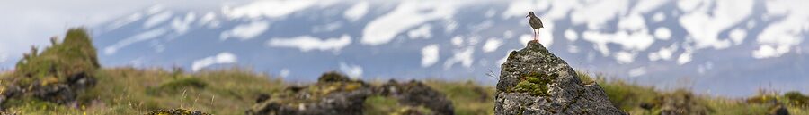
- The summer puffin colonies on the western cliffs are smaller than at Látrabjarg or the Westman Islands. If puffins are a primary goal of your trip, go elsewhere.
- Þetta reddast, it’ll work out. The weather will turn, a road will open, the cloud will lift, the orcas will surface. They mostly do. Build in buffer time and stop checking the forecast every thirty minutes.
Tours, links, and where to read more
If you want to book a guided day tour from Reykjavík rather than drive, both GetYourGuide’s Iceland page and Viator’s Iceland page have a dozen Snæfellsnes options each. Look for “small group” in the title, under 16 people. The big-coach versions are cheaper but you lose the ability to stop at the smaller places.
For a custom Snæfellsnes itinerary built around your dates and the weather forecast, see our custom Iceland tours guide. We’ve put together two-day Snæfellsnes plans with Stykkishólmur or Búðir as the base, both with and without a glacier walk on day two.
Other related pieces on this site that match a Snæfellsnes trip well:
- Best day tours from Reykjavík, Snæfellsnes is one of the four classic Reykjavík day-tour options, alongside the Golden Circle, the south coast, and the Blue Lagoon.
- Glaciers, geysers and the Golden Circle, pair this with Snæfellsnes for a Fire-and-Ice west Iceland combination.
- Photography tours of Iceland, Kirkjufell is on every photo-tour itinerary in west Iceland for good reason.
- Wildlife in Iceland, for more on orcas, whales and seals around Breiðafjörður.
- Other destinations on the site, for Reykjavík, the Golden Circle, the south coast, and so on.
For weather and road conditions before you leave, two essentials: vedur.is for the forecast (also the aurora forecast), road.is for live road conditions and closures, and safetravel.is for the search-and-rescue alerts. Check all three the morning of your drive and again before the western tip.
The peninsula is small enough that you do not need to plan it to the minute. Drive the loop, stop where it pleases you, eat fish, watch the weather. Þetta reddast.