If you draw a Ring Road on a napkin and hand it to someone who has just landed at Keflavík, they will give the south coast three days, the Golden Circle one, the north two, and try to do the East Fjords in an afternoon. They will then be confused when the afternoon turns out to be eight hours of driving and they have not stopped for lunch. The East Fjords are the slowest quarter of the road. The fjords are deep, the road follows every fold of the coast, and there is a reindeer somewhere ahead of you. You cannot rush them. The good news is you do not want to.
About 10,500 people live in the whole region. That is one in 35 Icelanders, scattered across maybe 120 km of coastline as the puffin flies and far longer as the car drives. The largest town, Egilsstaðir, has 2,500. The next nine settlements between them house most of the rest. The traffic is light. The hotels are cheaper than the south. The light, when it cooperates, is the kind of long sideways gold that photographers fly here for. And then there is the international ferry from Denmark, which still arrives every Wednesday in summer carrying camper vans and motorbikes from people who decided to bring the car instead of fly. The East Fjords are the bit of Iceland that still has its own pace, and a guide to them is really a guide to slowing down.
This is the article I would talk through with you over a coffee at the N1 in Höfn before you head north. What the region is, what is worth stopping for, what to skip if you are short of time, where to sleep, what to eat, and how the famous Norröna ferry actually works. If you are mapping a Ring Road trip and want context, start with the broader Ring Road of Iceland guide. If you have a week and want to compare which remote region to give your time to, the Westfjords piece is the sister to this one. They are very different places.
In This Article
- What the East Fjords actually are
- Getting there
- Driving from Reykjavík via the Ring Road
- Flying to Egilsstaðir
- The Norröna ferry from Denmark and the Faroes
- Bus and onward transport
- Stokksnes and Vestrahorn, the postcard mountain
- Höfn, the langoustine town
- Djúpivogur and the eggs of Merry Bay
- The southern fjords and Petra’s stones
- Fáskrúðsfjörður, the French village
- Reyðarfjörður and the wartime story
- Eskifjörður and the sparkling stones
- Neskaupstaður, the easternmost town
- Mjóifjörður, the side trip the locals know about
- Egilsstaðir, the inland capital
- Lake Lögurinn, the forest, and the Loch Ness of Iceland
- Hengifoss and Litlanesfoss
- Seyðisfjörður, the rainbow village over the mountain
- Borgarfjörður Eystri, puffins and elves
- Vopnafjörður, the salmon village in the north
- Reindeer, sheep and the rest of the wildlife
- When to go
- How to fit it into a Ring Road trip
- Two-day East Fjords (the realistic one)
- Three-day East Fjords (the version I would actually do)
- Costs and practical bits
- What I would skip
- The slow gift
What the East Fjords actually are
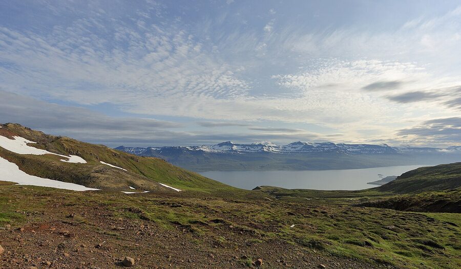
Geologically, the East Fjords (Austfirðir in Icelandic, which translates to “the East Fjords”) and the Westfjords are the two oldest parts of Iceland, between 12 and 16 million years old. The active volcanoes are all in the middle, where the North American and Eurasian plates are pulling apart. The two coasts are the cooled-off edges, eroded by ice ages into the fjord pattern you see today. No active eruptions here, no fresh lava, no Reykjanes-style steam vents. What you have instead is basalt and water and an enormous amount of cliff.
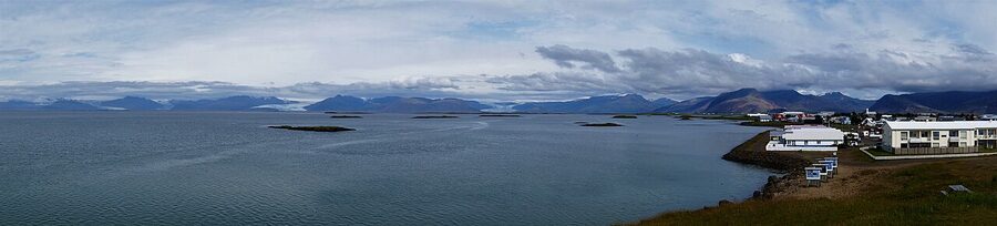
The administrative region called Austurland runs from Berufjörður in the south up to Vopnafjörður in the north, with the inland market town of Egilsstaðir as its capital. Roughly 10,500 people. About a fifth of the country’s land, about a thirtieth of the country’s population. The coast is dotted with old fishing villages that were once busy and are now tactically quiet, propped up by tourism, aluminium smelting at Reyðarfjörður, and one stubborn salmon river up at Vopnafjörður that fly fishermen pay astonishing money to fish.
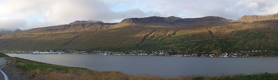
The thing that defines the region for the visitor is the geometry. Each fjord cuts inland between two ridges of basalt, sometimes 800 metres tall. The road runs along the coast on Route 1, the Ring Road, which means you spend an hour driving in along one side, ten minutes around the head of the fjord at the village, and another hour back out the other side, often watching the same farmhouse across the water for the whole journey. To get from Djúpivogur to Egilsstaðir as the gull flies is about 75 km. The road covers around 215 km. This is the maths that breaks itineraries.
Getting there
Three real options, plus the famous boat. Each has its own reason to be the right one.
Driving from Reykjavík via the Ring Road
This is what most people do. Reykjavík to Höfn (the southern gateway to the East Fjords) is about 460 km on Route 1, a drive of around 6 hours of pure driving and easily 8 to 10 with the south coast stops at Seljalandsfoss, Skógafoss, Vík and Jökulsárlón. Most people sleep at Vík or Höfn the night before they cross into the East Fjords. From Höfn the East Fjords loop runs north through Djúpivogur, Stöðvarfjörður, Fáskrúðsfjörður, Reyðarfjörður and so on up to Egilsstaðir, then crosses the inland heath to Lake Mývatn in the north. That stretch from Höfn to Egilsstaðir is about 250 km and a full day if you stop properly. Eight hours including breaks is realistic. Four hours is nominal driving time and ignores the entire point of going.
Route 1 through the East Fjords is fully paved. Some of the side fjord roads (Mjóifjörður is the obvious one) are gravel and worth a 4WD. There are several tunnels, including Almannaskarð near Höfn (free) and the longer Norðfjarðargöng to Neskaupstaður (also free as of 2026). Watch road.is for closures. road.is shows real-time conditions and will tell you if Hellisheiði (the inland pass to Mývatn) has shut. vedur.is has the wind forecast, which matters more here than the rain forecast.
Flying to Egilsstaðir
The fastest way in if you have limited days. Icelandair flies Reykjavík (the city airport, not Keflavík) to Egilsstaðir once or twice daily, takes about 60 minutes, costs roughly 25,000 to 35,000 ISK return depending on season. The flight is reliable by Icelandic standards. Pick up a rental at the airport and you are on the road within an hour of landing. This is the move if you have three days and want to skip the south coast entirely on this trip.
The Norröna ferry from Denmark and the Faroes
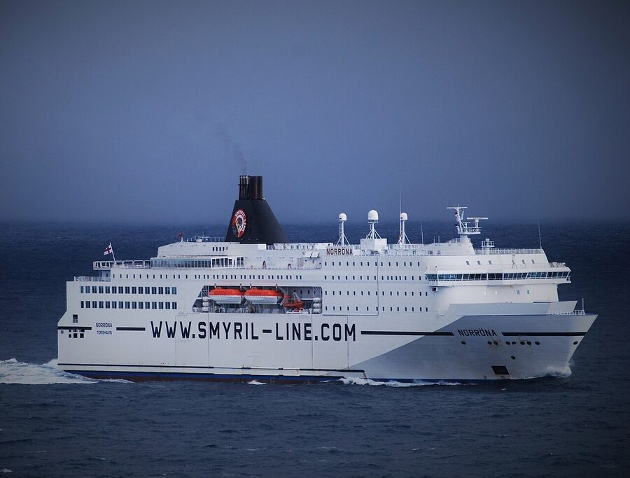
This is the romantic option and the practical option for European travellers who want their own vehicle. The MS Norröna is operated by Smyril Line, a Faroese company, and is the only car and passenger ferry that connects mainland Europe to Iceland. It runs from Hirtshals on the north coast of Denmark, calls at Tórshavn in the Faroes, and arrives at Seyðisfjörður in the East Fjords on Wednesday morning in summer. Departs Iceland the same day for the return.
For 2026 the schedule is roughly weekly from late March to late October, with twice-weekly departures from Hirtshals during peak summer (some Saturday departures route via Tórshavn with a multi-day stopover). Crossing time is two nights Hirtshals to Tórshavn, then one further night Tórshavn to Seyðisfjörður. Total elapsed time door to door is about three days each way. Cost depends entirely on the cabin, the vehicle, and the season; budget from around 90,000 ISK each way for a small car plus driver in a basic couchette, more for a private cabin or motorhome. Check the live Smyril Line schedule for exact dates because the dates published in winter sometimes shift in spring.
Two reasons to do it. One, you bring your own camper or motorbike, which saves a fortune on Icelandic rentals if you are staying for two or three weeks. Two, you actually like ferries. The Norröna has a restaurant, a sauna, a small cinema, and a top deck where in late June you can watch the sun not quite set. It is not a budget option for two people on a one-week holiday; for that, fly. It is a brilliant option for a six-week round trip with a Land Rover and a tent.
Bus and onward transport
There is a Strætó long-distance bus (route 56) from Reykjavík to Egilsstaðir three times a week in summer, taking about 11 hours and costing around 13,000 ISK. It is fine if you are travelling on a tight budget and not in a hurry. Once in the East Fjords there is a small local network connecting Egilsstaðir, Seyðisfjörður, Reyðarfjörður and Eskifjörður. It will not get you to Borgarfjörður Eystri or to a Vestrahorn sunrise. For real movement around the region you need a car. See our Iceland car rental guide for the operators and what to expect.
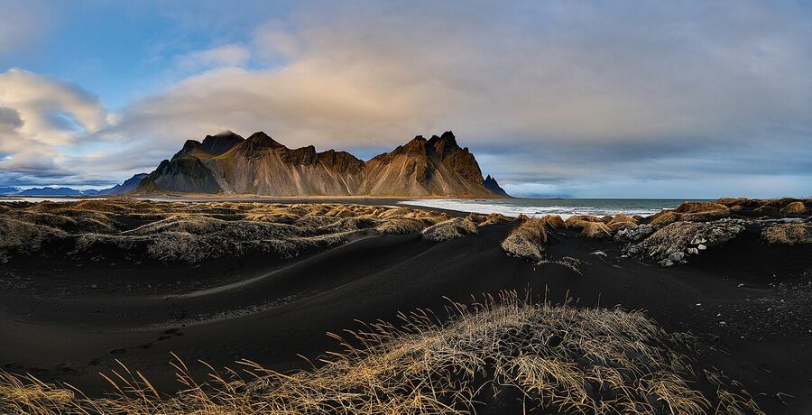
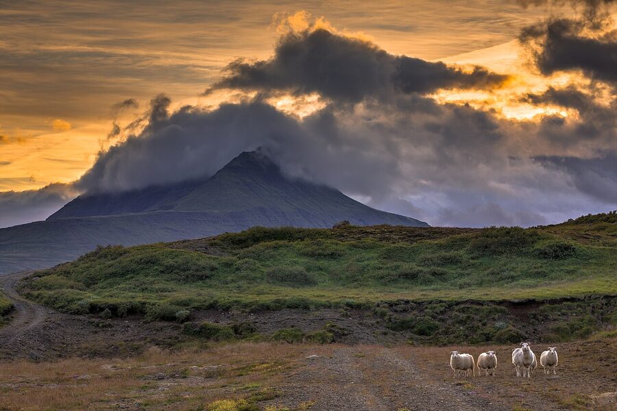
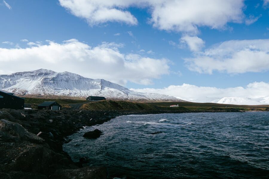
Stokksnes and Vestrahorn, the postcard mountain
Just east of Höfn is the headland of Stokksnes, and on it stands Vestrahorn. Strictly speaking this is the southeast corner more than the East Fjords proper, but every Ring Road traveller passes within five kilometres of it and almost everyone agrees it belongs in the East Fjords story. It is a 454-metre wedge of black basalt that rises out of a black sand beach, with the bay on one side and the headland on the other. In the right light, with a few centimetres of fresh snow on the peak and clouds streaming around the top, it is one of the most photographed mountains in Iceland.
The land is privately owned by the family who run the Viking Café, a small place at the gate. To enter the headland and the beach you pay 1,100 ISK per adult, payable inside the cafe or at a self-service kiosk if you arrive at 4 in the morning for sunrise. Children under 16 are free. Camping or sleeping in your car on the property is not allowed. The cafe is open daily 8 am to 8 pm in summer, 8 am to 7 pm the rest of the year. There is a small Viking village film set on the property, originally built for a movie that never finished filming, that you can wander around for the same ticket.
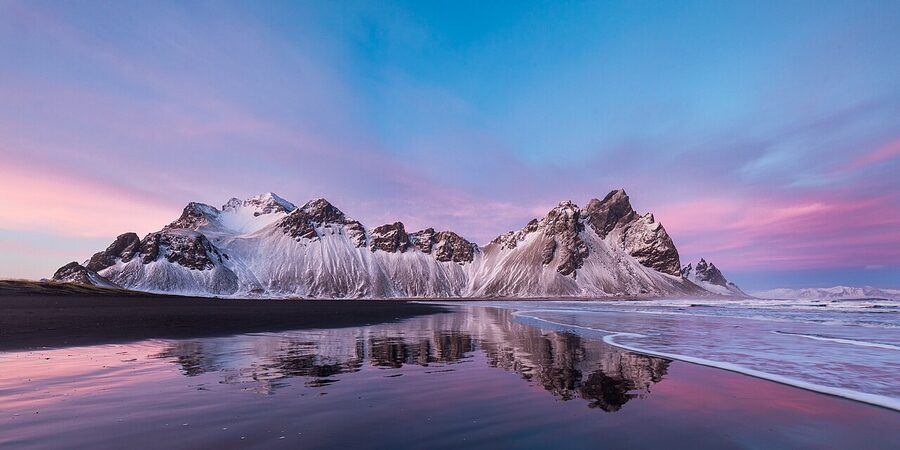
What I would do. Pay the fee, no debate. The land really is private and the family maintain the road and the parking. Time your visit for low side light, which in summer is anything from about 8 pm onward, or in winter the entire short window of midday. If the weather is grey and the mountain is hidden, drive on. There is no point paying for fog. If the weather looks promising for sunrise the next day, sleep at one of the Höfn hotels (more on those below) and drive out at 4 am. The mountain is at its photogenic best when the wind is light enough that the tide pools on the beach hold a still reflection. That happens about one morning in five. The other four are still worth it for the basalt itself.
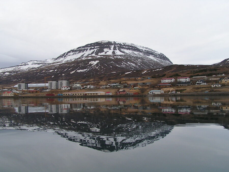
Höfn, the langoustine town
Höfn í Hornafirði (which translates to “Harbour in the Horn Fjord”) is the practical base for the southeast corner. Population around 2,400, sat on a peninsula in a tidal lagoon with the Vatnajökull glacier as its back wall. The harbour is still a working langoustine port, and the town sells what comes off the boats. Two restaurants do this seriously.
Pakkhús, in a 1932 fish warehouse on the harbour, runs langoustine tails baked in butter and garlic at around 8,500 ISK as a starter or 11,000 as a main, and an excellent langoustine soup at around 4,500 ISK. They do not take reservations and they get busy in summer; the buzzer system handles the wait. The other one is Humarhöfnin a few doors down, which is a touch more polished and a touch more expensive. Either is genuinely worth the money. Both are open seasonally roughly May to September.
Where to sleep in Höfn. The Hotel Höfn is the central option, a few minutes from the harbour, comfortable but not exciting, around 30,000 to 45,000 ISK a night in summer. The Fosshotel Glacier Lagoon is a 45-minute drive west toward Jökulsárlón, useful if you are doing the lagoon and Stokksnes on the same trip. The smaller Seljavellir Guesthouse in Höfn is the friendlier mid-range bet, family-run, modern rooms, breakfast included.
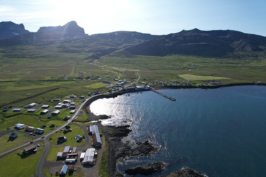
Djúpivogur and the eggs of Merry Bay
Djúpivogur (Deep Bay) is where the East Fjords properly begin if you are coming up from the south. Around 470 people, a working harbour, the oldest trading post in the east (in business since 1589, longer than half the European capitals you can think of), and a charter to take the slow approach to life. In 2013 it joined the international Cittaslow movement, the slow-cities network started in Italy. It is a town that has decided it is not going to chase. You can feel that within ten minutes of walking the harbour.
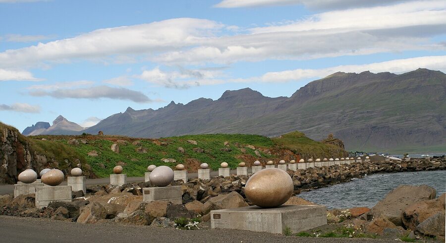
The thing every visitor stops for is Eggin í Gleðivík, the Eggs in Merry Bay. A 200-metre line of 34 granite eggs sat on old concrete pedestals along the shore. Each one is a scaled-up replica of the egg of one of the 34 bird species that nest in the bay, with the loon’s egg as the centrepiece because the loon is the local district’s symbol. The artist is Sigurður Guðmundsson, an Icelandic conceptual artist who proposed the idea when the council asked him what to do with the redundant pipeline plinths from the old fish factory. The eggs were carved in China from black and white granite and installed in 2009. It is free to visit, takes 20 minutes to walk along, and is the kind of public art that makes more sense the longer you stand in front of it.
From Djúpivogur there is a small boat trip in summer to Papey, the small island offshore. Papey is named for the Irish monks (the Papar) who Norse settlers found living there when they arrived in the 9th century. The island is uninhabited, has a tiny wooden church, and in puffin season is rowdy with the birds. The trip used to run daily; in recent years it has been on and off depending on the operator. Ask in town before counting on it.
Where to sleep in Djúpivogur. The Hotel Framtíð is the obvious pick, a renovated 1907 Faroese trading building on the harbour, around 25,000 to 35,000 ISK a night. The hotel restaurant does a fish soup that is locally good, not destination good. The Berunes hostel a few minutes south is a 1942 farmhouse converted by the family who still farm the land, popular with hikers and cyclists.
The southern fjords and Petra’s stones
North of Djúpivogur the road runs around Berufjörður, a wide flat-bottomed fjord that gives you the first proper East Fjord drive. About 90 minutes to drive its full circumference if you take the coast option (which I would). The shortcut over Öxi pass on Route 939 is shorter and saves an hour but is gravel, steep, and in the rain or wind genuinely unpleasant. In summer, weather permitting, it is fine in a 4WD. In winter or shoulder season, take the coast.
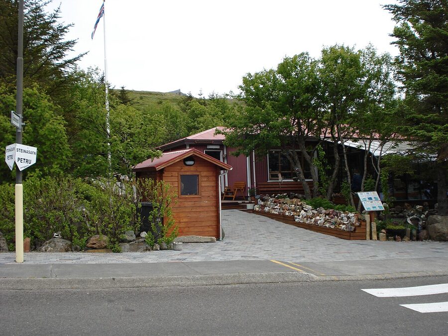
At the head of Berufjörður, the road climbs over a low pass into the next fjord and you drop down into Stöðvarfjörður (population 190). Almost the only thing here is a stone collection, which sounds dull until you go in. Petra’s Stone Collection (Steinasafn Petru) is the work of a single woman, Ljósbjörg Petra María Sveinsdóttir, who spent more than 80 years walking the mountains around her village picking up minerals. Quartz, jasper, calcite, geodes the size of footballs. She kept the lot in her own garden and house, and after her death in 2012 her family turned it into a museum that runs on the same principle of hospitality. You walk through her front door, pay around 1,800 ISK at the kitchen table, and look at thousands of rocks arranged with a kind of obsessive love. The garden is the best part. Open daily May to mid-October.
A short drive further north, Breiðdalsvík has 130 people, a craft brewery (Beljandi, which does a pale ale and a stout that punch above their weight), and a small art and craft cafe in the old co-op building. There is a chance you will see wild reindeer on the slopes above town, particularly in late autumn when they come down looking for grass. The village hotel is the renovated Hotel Blafell, around 22,000 to 32,000 ISK, which is the cheapest decent hotel for many kilometres in either direction.
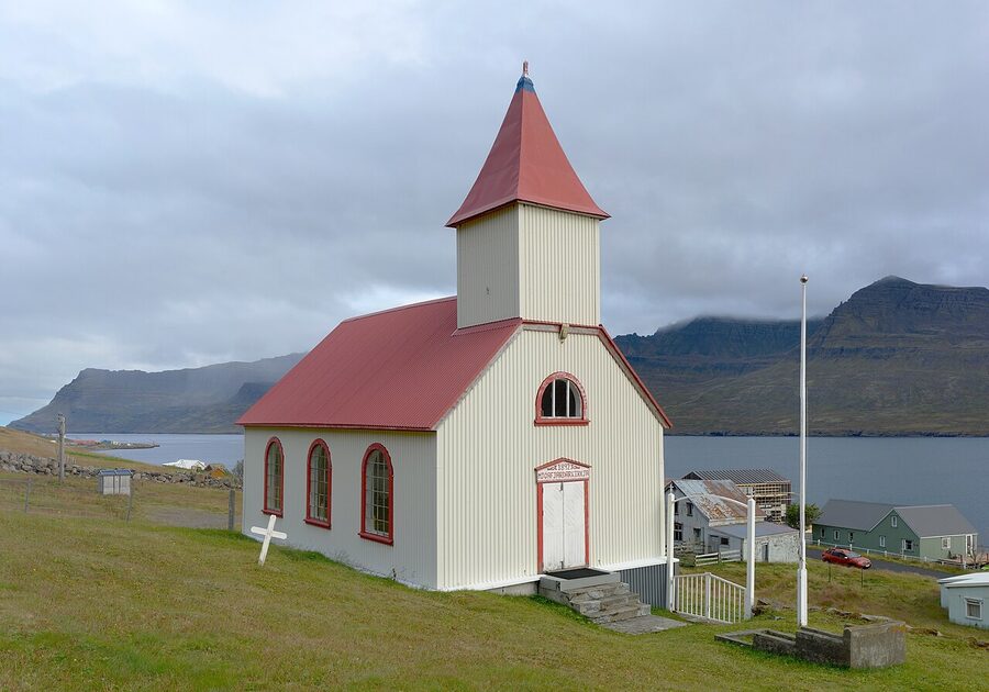
Fáskrúðsfjörður, the French village
If you are going to remember one improbable East Fjord story, this is it. Between roughly 1880 and 1935 several hundred French fishermen worked the cod grounds off the East Iceland coast every summer, and Fáskrúðsfjörður was their base. The French government built a hospital, a chapel and a cemetery here. The town signs are bilingual in French and Icelandic to this day. There are around 600 people now, and the centre of the village is the immaculately restored 1903 hospital, which is now the boutique hotel Fosshotel Eastfjords and the small French Museum (Franski spitalinn). Around 1,500 ISK to enter the museum, open daily June through August, weekdays the rest of the year.
The French cemetery is a 10-minute walk along the shore east of town. About 50 graves of fishermen who died at sea or in the hospital. The wooden crosses were renewed in the 1990s by the French embassy. It is a sober, beautiful spot and one of those quiet East Fjord places where you suddenly realise how connected to the rest of the world this empty coast actually was, a hundred and twenty years ago.
Fosshotel Eastfjords itself is one of the better-located hotels on the loop, in the central old hospital building with a restaurant that does decent fish dishes for around 5,500 to 8,500 ISK. Booking is sensible in summer because there are not many beds in the village.
Reyðarfjörður and the wartime story
Reyðarfjörður (around 1,200 people) is a fjord that surprises you twice. First, the size: it is the longest fjord in the east, 30 km from mouth to head, and the road takes a serious chunk of an hour to come around it. Second, the history. During the Second World War, Reyðarfjörður was the site of the largest Allied military base in Iceland, with up to 4,000 British and American troops stationed here from 1940. The little Iceland Wartime Museum in town tells that story with original Nissen huts, weapons, mess kits and oral histories. Opens roughly June to September, around 1,800 ISK. It is a reminder that this empty coast was, briefly, a strategic Atlantic asset.
Reyðarfjörður is also where you start to notice the modern industry. The Alcoa Fjarðaál aluminium smelter opened in 2007 and is now the largest single employer in the East Fjords. You can see it from the highway. Locally it is divisive (it brings jobs and air pollution and built the new tunnel to Neskaupstaður), but most people you talk to have made their peace with it. It is part of the place.
Eskifjörður and the sparkling stones
A short coast drive on from Reyðarfjörður is Eskifjörður (around 1,000 people), tucked under the conical mountain Hólmatindur. The village itself is a row of pastel timber houses along a single waterfront street, with a small maritime museum (Sjóminjasafn Austurlands) in a converted 19th-century salt house. Worth half an hour for the old longliners and the navigation room.
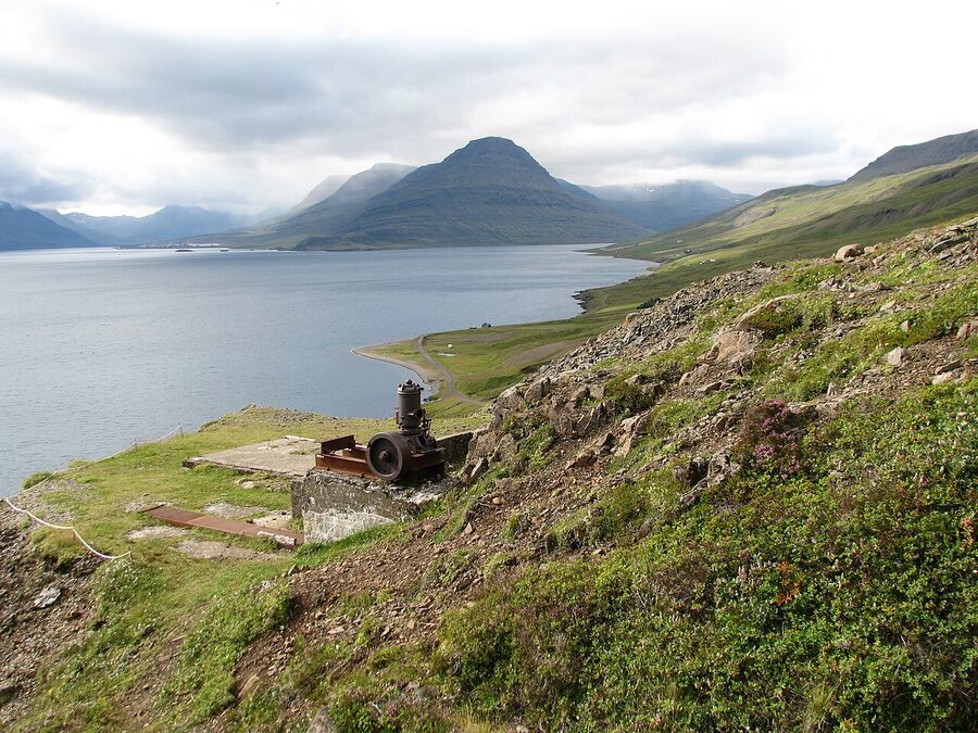
The strange story here is the Helgustaðir mine just east of the village. Between roughly 1668 and 1925 this was the world’s most important source of optical-grade calcite, the colourless transparent crystal known as silfurberg in Icelandic and “Iceland spar” in English. The crystals split light into two beams, and they were essential for early polarising microscopes and lab instruments. By the late 19th century almost every European university lab had a piece of Eskifjörður calcite on a bench somewhere. The mine is now a small free protected site, a 15-minute walk up from a parking area. You can still see the workings; you can still pick up small crystal fragments on the slope, although collecting larger pieces is forbidden. Drop in if you have an hour. It is the kind of obscure piece of industrial history that makes the East Fjords feel layered.
Neskaupstaður, the easternmost town
Neskaupstaður (population 1,500) is the easternmost town in Iceland, sat at the head of Norðfjörður. To get there you used to drive over the mountain pass Norðfjarðarheiði, a high road that closed for half the winter and is still the white-knuckle drive any local over 40 talks about. Since 2017 there is a new tunnel, the Norðfjarðargöng, that takes you under the mountain in a few minutes and is open all year. The village itself is a working fishing town with a small art museum, a single-screen cinema in an old wooden building, and the country’s easternmost swimming pool. You can hike east of town along a marked trail to the Páskahellir cave and a small puffin colony, about 90 minutes there and back, if the weather is decent.
Neskaupstaður is not on most one-day East Fjord itineraries. If you are doing two days, it is worth the detour for the tunnel drive and the easternmost-Iceland selfie. If you are doing three days, definitely.
Mjóifjörður, the side trip the locals know about
If you want a single afternoon that captures everything good about the East Fjords, drive into Mjóifjörður. Population 35. It is not on the Ring Road and you have to detour off Route 1 just north of Reyðarfjörður onto Route 953, a 16-km gravel road that switchbacks down a steep mountain side. In a regular 2WD in summer it is fine but you will be braking the whole way. In a 4WD it is straightforward. Closed in winter from roughly November to April.
What is at the bottom is one of the most beautiful little fjords in the country, almost no one in it, the small village of Brekka with its 1892 wooden church (Mjóafjarðarkirkja, the oldest standing church in the east), the small guesthouse Sólbrekka run by the family who run almost everything else here, and a chain of waterfalls along the road in called Klifbrekkufossar. There is a tiny cafe in summer that opens when the boat from Norðfjörður is in. There is no fuel station. Bring sandwiches. Plan three to four hours minimum, including the drive in and out.
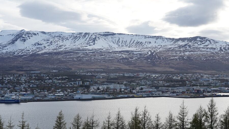
Egilsstaðir, the inland capital
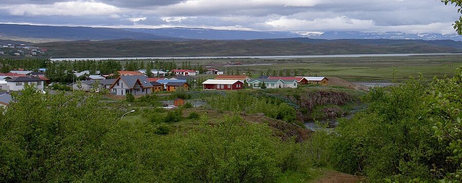
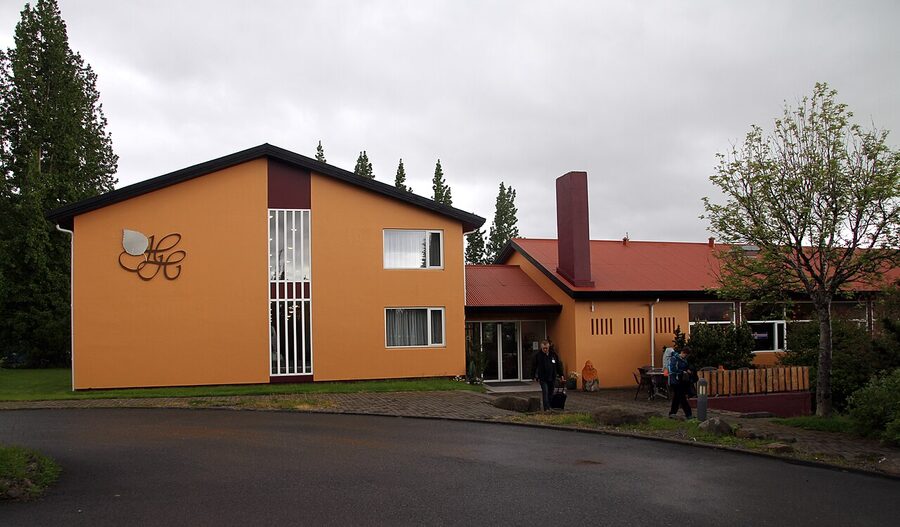
Egilsstaðir (around 2,500 people) is where the East Fjords loop arrives at if you have come up from the south, and where the inland route to Mývatn begins. It is also the only proper inland town in the region, sat in a flat valley by the river Lagarfljót with farms all around it. As a place to walk around it is nothing special. As a place to base yourself for one or two nights to see Lake Lögurinn, Hengifoss, the Hallormsstaður forest and the Seyðisfjörður road, it is exactly right. Decent supermarket, three petrol stations, a brewery, half a dozen restaurants, and an airport that gets you back to Reykjavík in an hour if the weather plays.
Where to sleep. The Icelandair Hotel Hérað in the centre of town is the obvious pick, modern, comfortable, around 28,000 to 42,000 ISK a night, with one of the better restaurants in the region (the lamb shank is the locals’ move). The Hotel Edda is open summer only and cheaper. The Hotel Hallormsstaður is 25 km out of town in the forest, beautiful position by the lake, particularly good in autumn when the larches turn.
Where to eat in Egilsstaðir. Salt Café & Bistro on Miðvangur does proper bistro plates (lamb, fish, a passable burger) for around 4,500 to 7,500 ISK and stays open later than anything else in town. Tehúsið in a converted schoolhouse a couple of streets back is more relaxed and does soups, sandwiches, cakes, and the only espresso in the region that I would happily order a second of. Both are walking distance from the Hérað hotel.
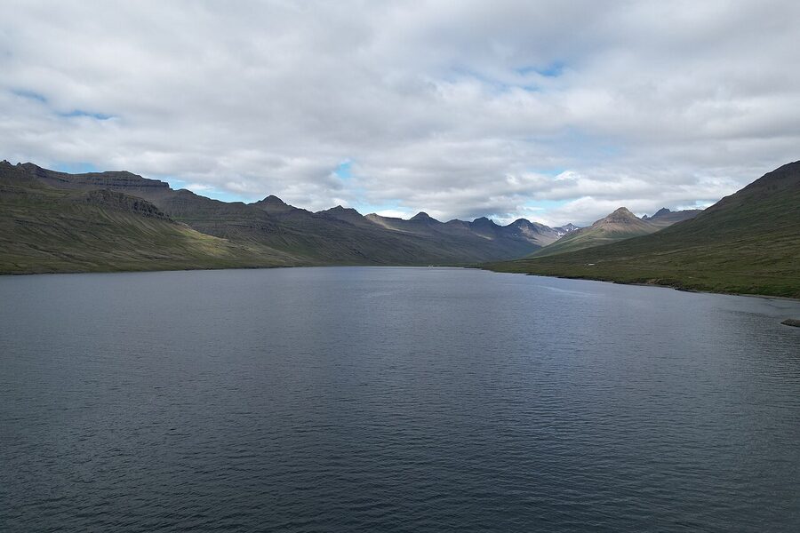
Lake Lögurinn, the forest, and the Loch Ness of Iceland
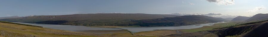
Just south of Egilsstaðir is Lake Lögurinn (also written Lagarfljót, the same body of water), 25 km long, narrow, deep, and the largest lake in Iceland by volume after Þingvallavatn. It is also home to the Lagarfljótsormur, the lake serpent. The first written sighting is in the Annals of Skálholt in 1345 and the last reasonably credible one (a video that went viral and was studied by sceptics for months) is from 2012. Locals are split between treating it as folklore for the tourists and quietly believing in it. I am with the second group, but only after a glass of brennivín.
Around the south side of the lake is Hallormsstaðaskógur, the largest forest in Iceland. About 740 hectares, planted from 1903 onward in a country that lost almost all its original birch woodland to settlement-era grazing and timber-cutting. There are 85 different tree species in the arboretum, marked walking trails ranging from 30 minutes to three hours, and a forest campsite that is the prettiest in the east. The Hotel Hallormsstaður mentioned above is right on the edge of it. Take a walk in the late afternoon when the light comes sideways through the larch and Sitka. It is the closest thing Iceland has to a proper forest experience.
Hengifoss and Litlanesfoss
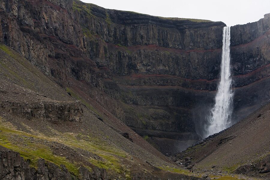
Hengifoss is the third tallest waterfall in Iceland at 128 metres, dropping into a canyon walled with horizontal stripes of red clay laid down between basalt eruptions millions of years ago. From the trailhead car park (well signed, free, with toilets) the hike is about 2.5 km and 250 metres of climb to the top viewpoint. Plan two hours including stops. The path is graded gravel for most of it with one steep loose section near the top; trainers are fine in summer, hiking boots in shoulder season.
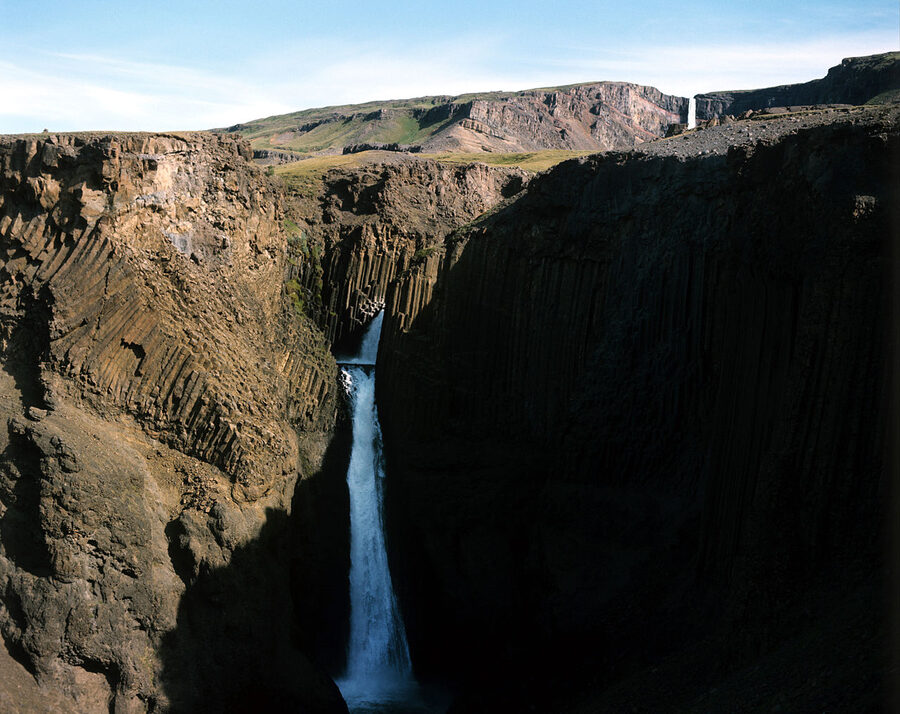
Halfway up the same trail is Litlanesfoss, a smaller waterfall with the most striking basalt column wall in the East Fjords. The columns are hexagonal and tightly packed and look unreal in the way that natural basalt sometimes does. Litlanesfoss alone is worth the lower half of the hike if Hengifoss is in cloud, which it sometimes is. From the parking it is about 25 minutes up.
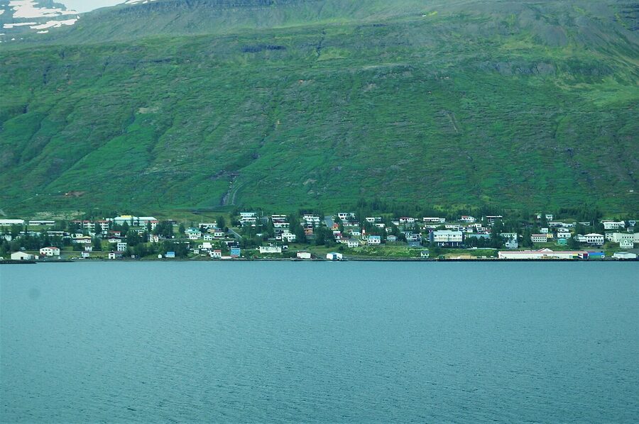
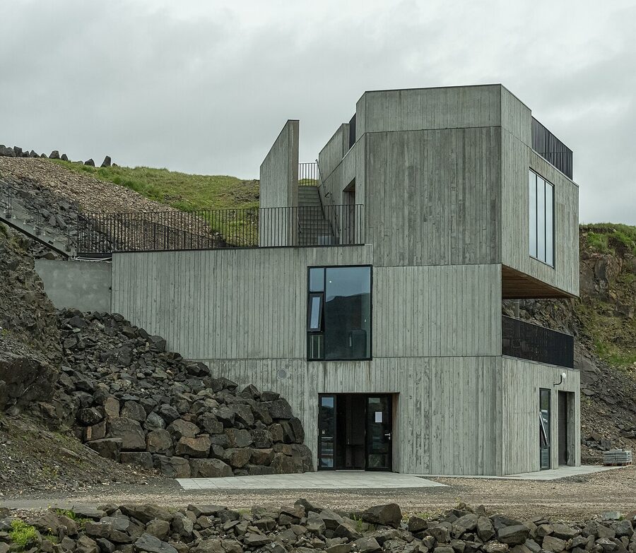
Seyðisfjörður, the rainbow village over the mountain
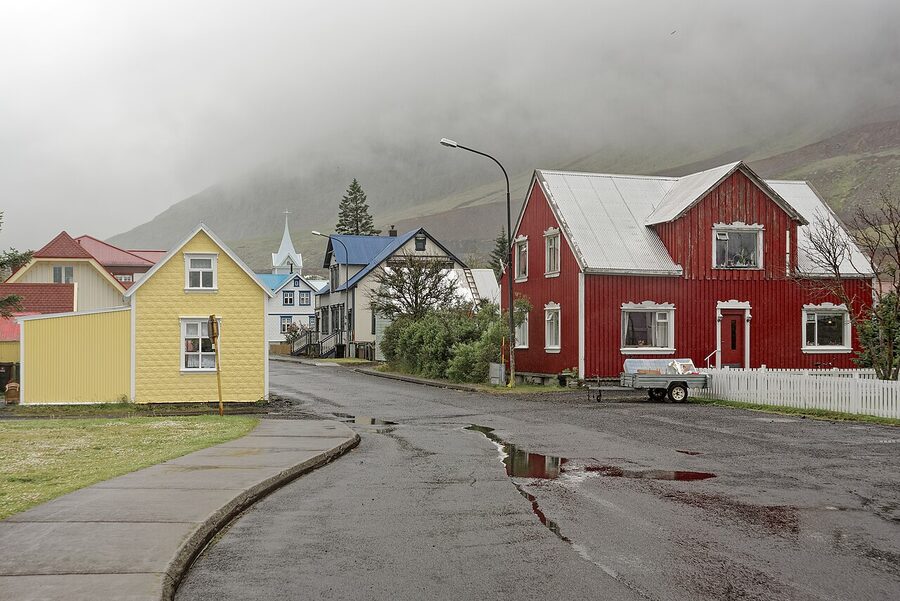
Seyðisfjörður (population around 700) is the village you have seen on Instagram and possibly do not realise is in the east. It sits at the head of a long, narrow fjord 27 km from Egilsstaðir over the mountain pass Fjarðarheiði. The drive over the pass is one of the most spectacular short drives in Iceland, climbing to 620 metres and dropping you into the village past the small but pretty waterfall Gufufoss. In summer it is a beautiful 30 minutes; in winter the road sometimes shuts in storms and you wait it out. There has been talk for years of a tunnel under the pass; as of 2026 the project has been approved but not yet built.
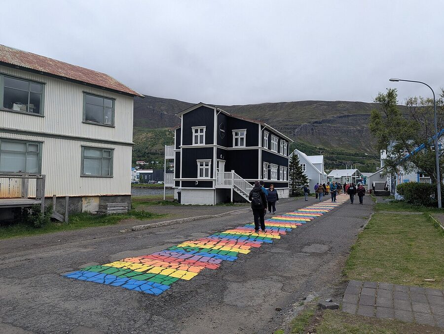
The village itself is the photogenic part. Pastel-painted timber houses around a small harbour, the Norröna ferry dock, a working fishing fleet, and the famous rainbow-painted street that leads up to the blue Lutheran church (Seyðisfjarðarkirkja, built 1922, brought in pieces from Norway). The street is officially Norðurgata. The rainbow was painted in 2016 by local volunteers as part of a Pride event and the town has kept it up ever since. It is a 60-second walk from the harbour and in July you will queue with several dozen other phone cameras at midday. Go at 7 am and you will have it to yourself.
What else to do here. The Skaftfell Centre for Visual Arts in the old Hotel Snæfell building runs rotating shows by Icelandic and international artists; entry is free and the gallery cafe (Skaftfell Bistro) does the best wood-fired pizza in the east, around 3,800 to 4,800 ISK. The hike to the Tvísöngur sound sculpture, a Lukas Kühne installation of five interconnected concrete domes on the hillside above the village, takes about 30 minutes one way and ends with one of the best views of the fjord. Free, always open, marked trail from a car park signed off Hafnargata. There are sea kayak tours that paddle out to the small islands near the head of the fjord; the Seyðisfjörður visitor info site lists the operators.
Where to eat in Seyðisfjörður. The standout is Norð Austur Sushi & Bar, on the upper floor of Hotel Aldan. Sushi in a fishing village in East Iceland sounds wrong on paper. In practice it works: the fish is bought off the boats every morning, the chef trained in Japan, and the room is small and busy. A 12-piece nigiri set is around 5,500 ISK, a chef’s selection (omakase) around 9,500. Open Wednesday to Sunday in summer, less in winter, and reservations are essential.
Where to sleep. Hotel Aldan is the obvious pick, the timber building with the sushi bar above and a separate annex by the harbour, around 28,000 to 42,000 ISK a night. The cheaper option is the Hafaldan HI Hostel, with private rooms and dorms, in the old hospital building.
Borgarfjörður Eystri, puffins and elves

If you only do one detour off the main loop, make it this one. Borgarfjörður Eystri is the easternmost inhabited fjord in Iceland, around 100 people in the village of Bakkagerði, an hour’s drive from Egilsstaðir on Route 94. The first 30 km of road is paved; the last stretch over the pass Vatnsskarð is gravel but graded and fine in any 2WD in summer. In rain or snow it shows you it is actually a mountain road. The pass tops out at 380 metres with one of the best views in the east on a clear day.
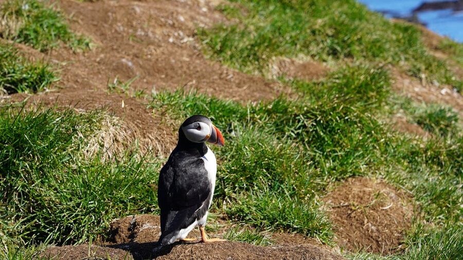
The reason most people come is the puffin colony at Hafnarhólmi, a small islet at the harbour 10 minutes by foot from the village. From mid-April to early August around 10,000 pairs of Atlantic puffins (lundi in Icelandic) nest here, plus kittiwakes, fulmars and eider ducks. The colony has built wooden boardwalks and viewing platforms that put you at eye level with the burrows, no fence-climbing required. The puffins have got used to humans and will potter past at ankle height. Best light is early morning or late evening when the birds are coming back from fishing. Free to visit, no opening hours, donations encouraged at a small box.
The other thing about Borgarfjörður Eystri is the elves. The village is locally famous as Iceland’s elf capital. The hill behind town, Álfaborg (the Elf Rock), is supposed to be the seat of the Icelandic queen of the elves. There is a small marked walk to the top, 15 minutes, and a sign explaining the local stories. Whether you take it seriously or not is up to you. Most Icelanders enjoy the ambiguity.
The annual Aldrei fór ég suður music festival in nearby Ísafjörður (a Westfjords festival, not eastern, but often mentioned in the same breath) is mirrored in Borgarfjörður Eystri by Bræðslan, a small two-day music festival in late July held in a former herring-rendering factory. Free or very cheap, around 8,000 ISK for a day pass. Acts are mostly Icelandic; the atmosphere is what people travel for.
Where to sleep. The Blábjörg Resort is the local pick, on the shore at the village, with rooms, a hot tub, and a restaurant that does a fine plate of arctic char. Around 30,000 to 40,000 ISK a night. Borg Restaurant Guesthouse is the cheaper alternative, simple rooms above the village pub.
Vopnafjörður, the salmon village in the north
Vopnafjörður (population 540) is the most northern of the East Fjord villages and the one most travellers skip. To reach it from Egilsstaðir you turn off the Mývatn road and follow Route 85 along the coast for around 90 minutes, much of it gravel. There is an easier paved inland alternative on Route 917 over Hellisheiði eystri pass, 626 metres, fine in summer but closed in winter. The reasons to go are the North Atlantic Salmon Centre (a small museum about wild salmon and the famous local rivers Selá and Hofsá that fly fishermen pay 4,000 USD a day to fish), the village swimming pool with views over the bay, and the fact that you will see almost no other tourists at any time of year.
If you are completist about the East Fjords and want to say you did them all, drive up here. If you have only two days, skip it and stay south of Egilsstaðir. There is no shame in the second choice.
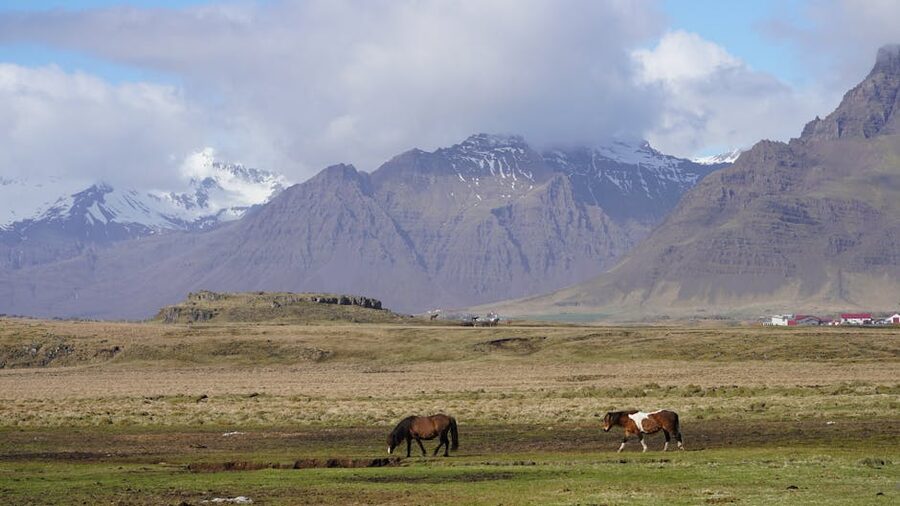
Reindeer, sheep and the rest of the wildlife
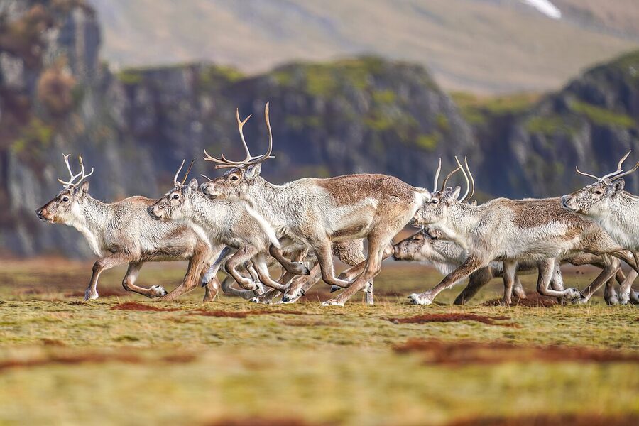
Iceland has the only reindeer population in the whole country here in the east. They were brought from Norway in the 1780s as a domestication experiment that did not work, escaped into the highlands, and have lived wild ever since. The current population is around 7,000, controlled by an annual hunting season in late August and September. In summer they live high in the mountains and are hard to spot. From October through to spring they come down to the lowlands and you will routinely see herds of 30 or 50 along the Ring Road between Höfn and Egilsstaðir, particularly in the early morning. A herd crossing the road is a thing to slow down for; they will not get out of your way fast.
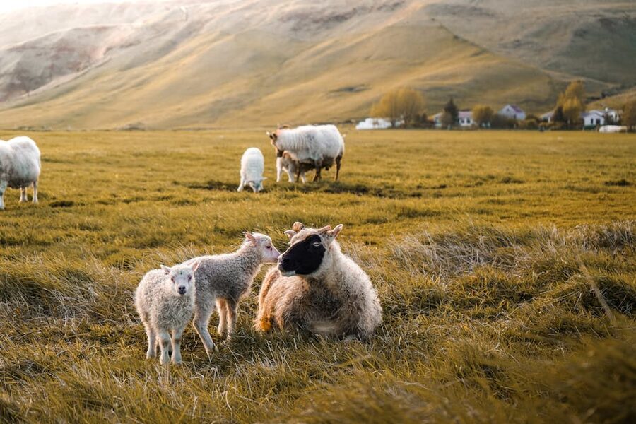
The other animal you will see, constantly, is sheep. Iceland has more sheep than people during summer, and the East Fjords are no exception. They are loose on the unfenced roads from June through to the autumn round-up in mid-September. Slow right down when you see them; they like to make a decision about crossing only when the front bumper is two metres away. There is a national insurance system for hitting one, but the paperwork is no fun and the sheep does not enjoy it either.
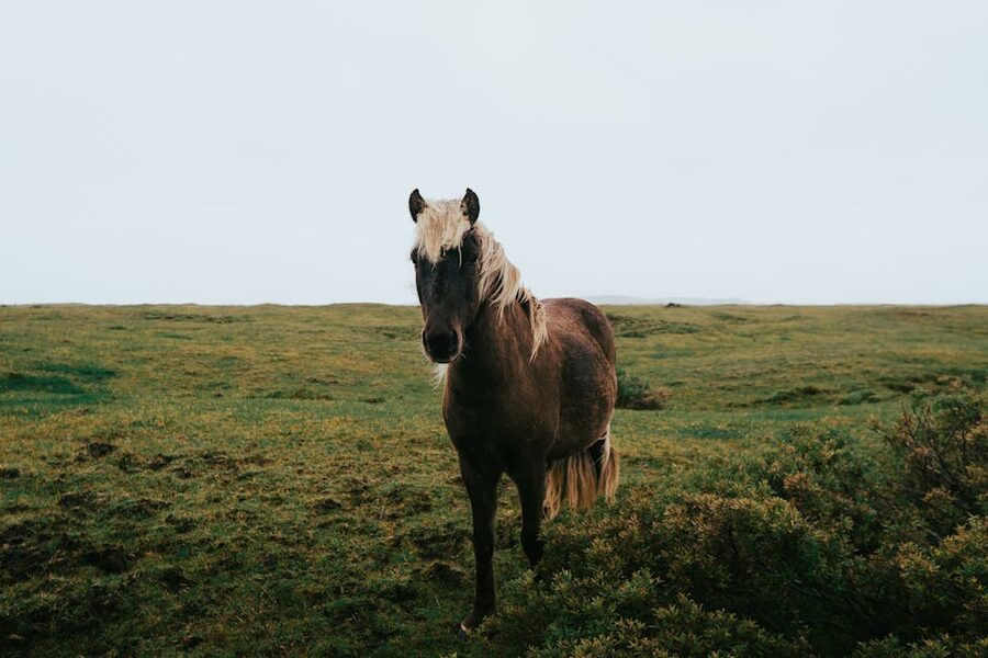
For more on the country’s wildlife in general (whales, foxes, the famous Icelandic horse, eider ducks, sea eagles), see the animals of Iceland piece. For more on the puffins specifically, including the better cliffs at Látrabjarg in the Westfjords, see the bird watching guide.
When to go
Summer (June to August) is the obvious answer. All roads open including Mjóifjörður and Borgarfjörður Eystri, the Norröna ferry running, the puffins in residence, restaurants and museums fully open, and the midnight sun giving you 22 hours of usable light in late June. The downside is everyone else has had the same idea, the hotels need booking weeks ahead, and the petrol stations get queues at the busiest times. It is still the right choice for most people on a first visit.
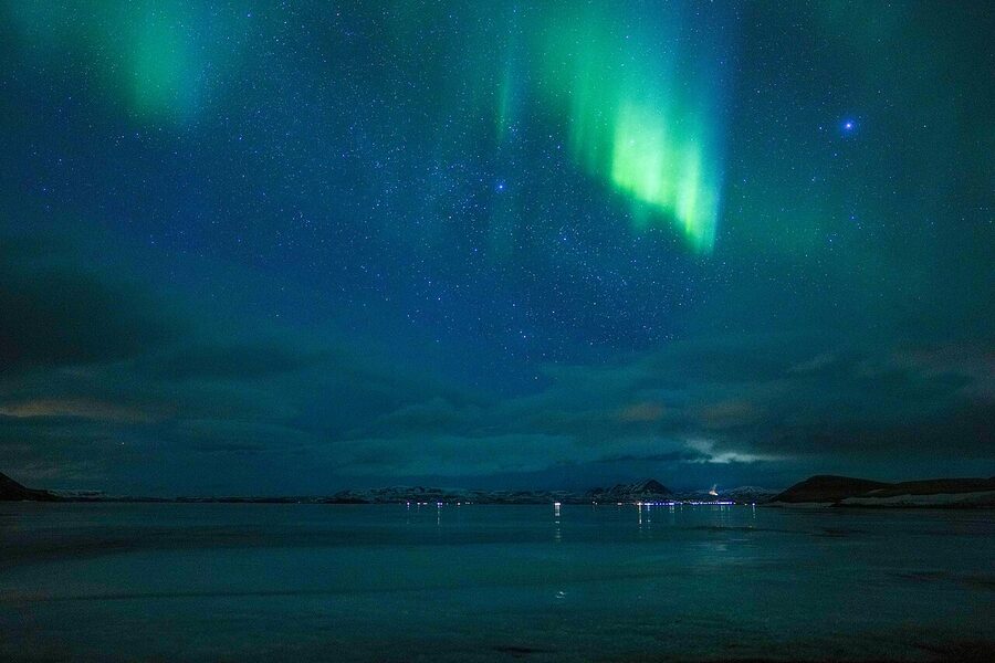
Shoulder season (May and September) is the smarter call if you can flex. Most roads open, ferry running through October, far fewer people, lower hotel rates, and in September the autumn colours in the Hallormsstaður forest are genuinely worth a detour. Late September brings the first chance of seeing the northern lights as the nights start to darken again.
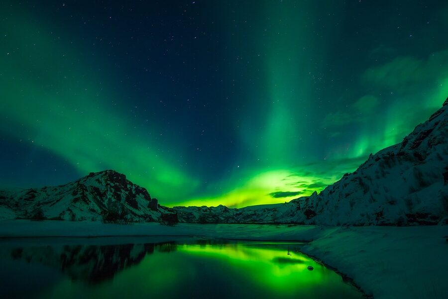
Winter (November to March) is for experienced winter drivers. Many side roads close, the daylight collapses to four hours around solstice, and the weather can shut Route 1 for a day at a time. The reward is empty villages, the chance of aurora, and the genuine quiet that summer cannot give you. If you are coming in winter, hire a 4WD, allow buffer days, and read the road.is conditions every morning before you leave the hotel. The aurora forecast guide covers the practical side of how to read the KP index and the cloud cover map.
How to fit it into a Ring Road trip
Real talk: most people give the East Fjords half a day and they are wrong. Even one full day is rushed. Two days is the right answer for a 7-day Ring Road trip. Three days lets you do Borgarfjörður Eystri, Seyðisfjörður and Mjóifjörður properly without resenting the schedule. Here are the two itineraries I would actually run, depending on which one you have time for.
Two-day East Fjords (the realistic one)
Day 1. Leave Höfn after breakfast. Stokksnes for the morning if the weather is good (skip if it is grey). Drive up through Berufjörður around the coast. Stop at Djúpivogur for an hour to see Eggin í Gleðivík and grab coffee. Stöðvarfjörður for Petra’s stones, 60 minutes. Continue through the southern fjords with one or two photo stops. Coffee at Fáskrúðsfjörður and a quick walk past the French museum. Reyðarfjörður and onward to Egilsstaðir. Sleep at the Hérað hotel. Dinner at Salt or Tehúsið. Total drive day, around 7 hours including stops.
Day 2. Leave Egilsstaðir at 9 am. Drive south on Route 931 to the Hengifoss trailhead. Hike up, two hours including stops. Drop down to Hallormsstaður forest for a forest walk and lunch at the lake. Mid-afternoon, drive over Fjarðarheiði to Seyðisfjörður. Walk the rainbow street, the Tvísöngur sound sculpture, and the village. Dinner at Norð Austur (book ahead) or Skaftfell Bistro. Drive back over the pass to Egilsstaðir or sleep at Hotel Aldan if you can wait until morning to leave. Next morning, drive up to Mývatn.
Three-day East Fjords (the version I would actually do)
Day 1. Höfn to Djúpivogur via Stokksnes. Sleep at Hotel Framtíð. Walk the eggs in late afternoon light, eat fish soup at the hotel restaurant.
Day 2. Djúpivogur slowly north. Petra’s stones at Stöðvarfjörður. Coffee at Beljandi brewery in Breiðdalsvík. French museum and lunch at Fáskrúðsfjörður. Detour into Mjóifjörður in the afternoon if it is dry, otherwise straight to Egilsstaðir. Sleep at the Hérað.
Day 3. Hengifoss in the morning, lunch at Hallormsstaður, then over to Borgarfjörður Eystri for the puffins at Hafnarhólmi in the late afternoon when the birds are returning to feed. Sleep at Blábjörg, drive back over to the Mývatn road the next morning. This day is the one most people skip, and it is the one that converts the East Fjords from a road you drove to a place you went to.
Costs and practical bits
Hotels are roughly 25 to 40 percent cheaper than equivalent rooms on the south coast, which is the silent gift of the region. A summer night in a comfortable mid-range place runs around 28,000 to 38,000 ISK. Restaurants are at standard Icelandic prices, around 4,500 to 8,500 ISK for a main, with the langoustine specialists in Höfn and Pakkhús pushing higher. Petrol stations are spaced about 60 to 100 km apart along the loop; fill up in Höfn or Egilsstaðir to be safe. The N1 in Egilsstaðir takes cards including foreign credit. There are a few unmanned pumps on side roads (Mjóifjörður, the smaller villages) that need a chip and PIN card; if you are on a US-style swipe-and-sign you will not be able to fill there.
Tours and guided trips. GetYourGuide and Viator have a thin selection of East Fjord tours, mostly day trips out of Egilsstaðir to Hengifoss or photography workshops at Stokksnes. The local outfit Wild Boys runs small group photography tours into Vestrahorn from Höfn. Iceland Photo Tours include the East Fjords on most of their multi-day workshops; see also our photography tours guide. Most people, though, do this region as a self-drive and hire local skill only for specific things like a half-day kayak in Seyðisfjörður.
Safety. The East Fjords have the same Icelandic basics as the rest of the country. Safetravel.is is the official trip-plan registration; if you are doing serious hiking (Hengifoss in winter, anything in Mjóifjörður off the road, the Víknaslóðir trails inland from Borgarfjörður Eystri) leave a plan with them. The roads are well-engineered but the weather is unpredictable. If road.is says yellow, listen. If it says red, do not go. The wind in the East Fjords gets local effects in the mouths of the fjords that can flip a small car onto its side. Leave the doors closed when parked at viewpoints; rental insurance does not cover door-into-wind damage.
What I would skip
Trying to do the East Fjords in four hours. You will see the road and not the place. If you really only have four hours, pick one good stop (Stokksnes if the weather is right, Djúpivogur if not) and accept that the rest is for next time. The Öxi pass shortcut on Route 939 in any weather worse than dry summer: the gravel is unfun and the views are no better than the coast. Hotel Hallormsstaður on a one-night stop in winter; the road in shuts often, and you will be stuck. The Mjóifjörður road in November to April unless you genuinely know what you are doing on a snowed-in mountain switchback. The Norröna ferry as a budget choice for two adults on a one-week trip; for that length, fly.
The slow gift

If you are racing the Ring Road in seven days, the East Fjords are the part of the trip you are most likely to short-change and most likely to regret. Add one more day. Sleep at Egilsstaðir on the Tuesday and Seyðisfjörður on the Wednesday. Drive Borgarfjörður Eystri in the afternoon for the puffins, drink the bad coffee at the harbour, sit on a bench, watch the birds come back from the sea. The reindeer will probably trot across the road on your way back. The rainbow street will be your own at 10 in the evening. The light, if you are lucky, will be the long sideways gold the photographers fly here for.
Or look at the Norröna timetable on Smyril Line and book yourself a cabin from Hirtshals next summer with the car loaded down. There are very few border crossings in Europe as quietly satisfying as standing on the Norröna deck at 8 in the morning, coffee in hand, watching Seyðisfjörður come around the headland. That is the East Fjords too, and it is what makes them the slow quarter of the road, in the best way.