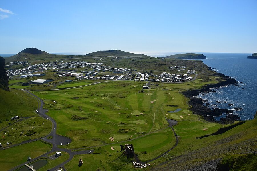
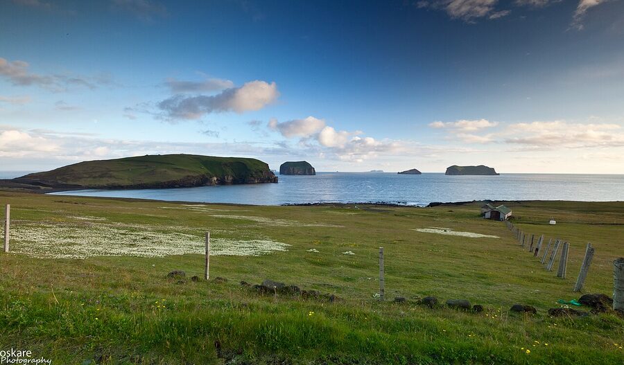
The Westman Islands sit fifteen kilometres off Iceland’s south coast, close enough that on a clear day you can spot them from the Ring Road as a dark line of cliffs rising out of the sea. There are fifteen of them, give or take, depending on whether you count the rock stacks and the still-cooling Surtsey. Only one is inhabited. Heimaey, the Home Island, holds about 4,400 people, the largest puffin colony in the Atlantic, two volcanoes (one of which surfaced in living memory and ate part of the town), and the largest annual festival in Iceland. For the size of the place (Heimaey is roughly fourteen square kilometres) the density of stories is absurd.
I’ll get this out of the way: the Westman Islands are one of the best places in Iceland and one of the most underrated. Most visitors do the South Coast loop and never look across to them. Some get as far as the ferry pier at Landeyjahöfn and turn around because the wind picks up. The ones who actually go over almost always come back saying the same thing: they wish they’d given it two days instead of one.
This is a long guide because the islands deserve one. I’ll cover the history (which is darker and stranger than you expect), the practical stuff (ferries, parking, the weather problem), the volcano hike that runs ten minutes from the town centre, the puffin colony at Stórhöfði, the Eldheimar museum built around a buried house, and Þjóðhátíð (the festival that brings sixteen thousand people to a town of four thousand for a single weekend in August). I’ll also tell you what I would actually do if I had two days, where to eat, and which hotel to book if you can.
In This Article
- What the Westman Islands actually are
- The name
- How to get there
- The ferry from Landeyjahöfn
- When the weather doesn’t cooperate
- Flying in
- Should you bring a car
- The 1973 eruption
- Eldheimar, the museum built around a buried house
- Hiking Eldfell
- The lava field walk
- Puffins and Stórhöfði
- Where to actually see them
- The puffling rescue
- Sæheimar and the live puffin in the aquarium
- Heimaklettur and the harder hike
- The other walk: Helgafell and Herjólfsdalur
- Þjóðhátíð and the festival weekend
- Surtsey and the youngest island
- What I would actually do
- Day one, afternoon arrival
- Day two, full day
- Day-trip version
- Where to stay
- Hotel Vestmannaeyjar
- Guesthouse Hamar and Lava Guesthouse
- Bjarmaland and Guesthouse Árný
- Puffin Nest Capsule Hostel
- Camping
- Where to eat
- Slippurinn
- Tanginn
- Gott
- Næs
- The petrol station
- Boat tours and seeing the islands from the water
- Booked tours from Reykjavík
- The 1627 raid
- Practical bits
- Weather and when to go
- Money, signal, walking
- Bike and car rental on the island
- The football stadium
- What to skip
- What you walk away with
What the Westman Islands actually are
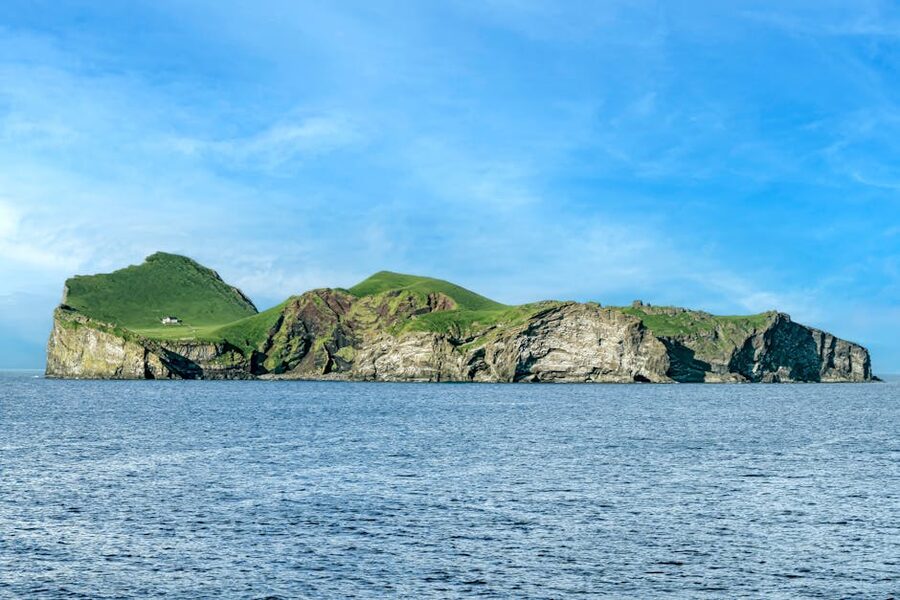
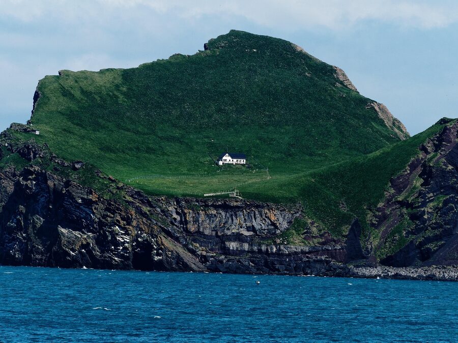
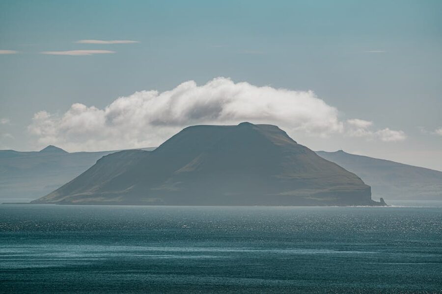
The archipelago is volcanic and young. The oldest islands are roughly twelve thousand years old; the newest, Surtsey, surfaced in November 1963 and was still erupting when American naval crews from Keflavik dropped by to gawk. The chain runs north to south for about thirty kilometres, with Heimaey at the top end and Surtsey at the bottom. Most of the smaller ones are sheer-sided rock stacks topped with grass: green Christmas puddings dropped into the North Atlantic. A few have huts on them used by hunting clubs who go out for sea birds and eggs in summer, climbing the cliffs with ropes the way islanders have done for a thousand years. Ellidaey, the one with the famous lone cottage that the internet keeps insisting belongs to Björk or a recluse, is one of those.
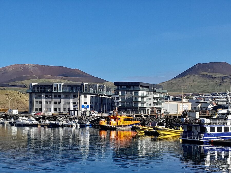
Heimaey is the only one anyone lives on year-round. The town is also called Vestmannaeyjabær (Westman Islands Town) and from the harbour it climbs up a gentle slope between two volcanoes and a pair of basalt cliffs. The cliffs on the north side, Heimaklettur and its neighbours, hem the harbour in and were the reason the Norse settlers picked this spot. They make for a sheltered anchorage in any weather a fishing boat can be talked into going out in.
The name
“Westman” doesn’t mean men from the west of Iceland. It comes from vestmenn, the Norse term for the Irish. The story is in the Landnámabók, the medieval book of settlements: Hjörleifur, the foster-brother of Iceland’s first settler Ingólfur Arnarson, brought a group of Irish thralls (slaves) with him from Ireland in 874. The thralls killed Hjörleifur, took his cattle and his women, and fled to these islands offshore. Ingólfur tracked them down and slaughtered them. The islands took the killers’ name and have kept it for over a thousand years. It’s a grim founding story for a place that is genuinely one of the prettiest spots in the country, but Iceland is full of those.
How to get there
Two options, and a third one that’s mostly theoretical for visitors. The ferry from Landeyjahöfn is what you want.
The ferry from Landeyjahöfn
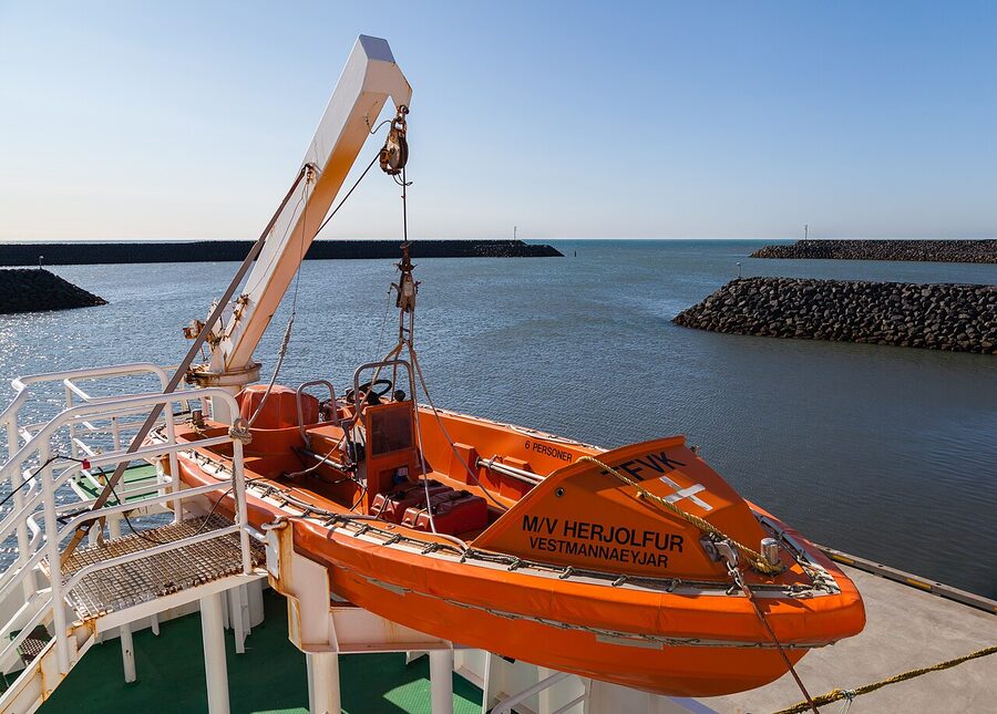
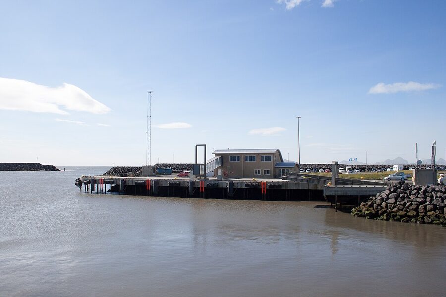
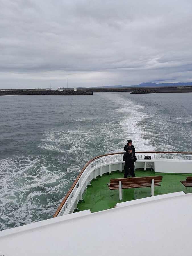
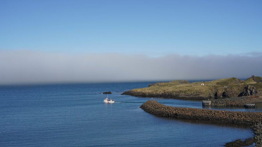
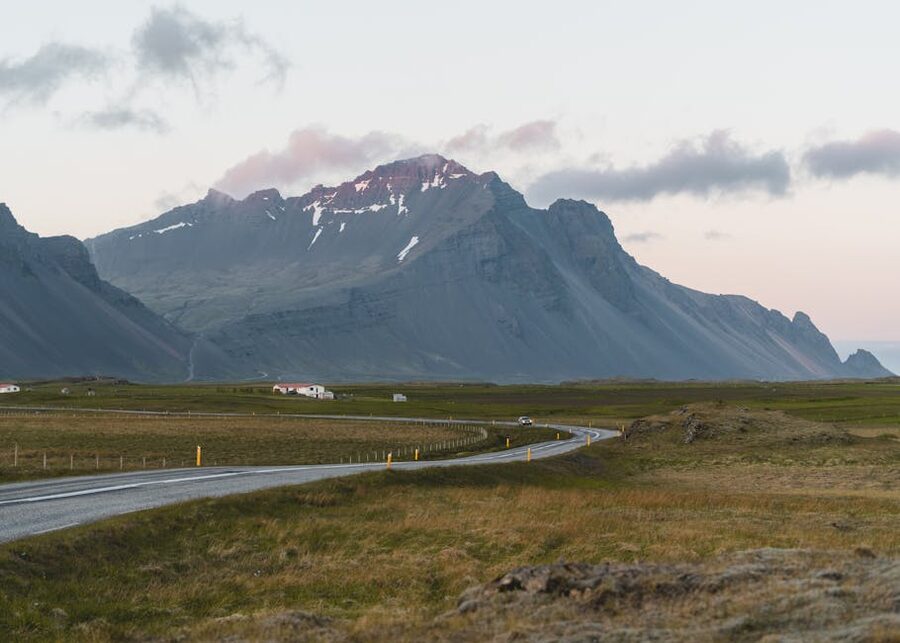
Landeyjahöfn is a small purpose-built ferry harbour on the south coast, opened in 2010, about an hour and a half from Reykjavík via Route 1. From there the Herjólfur ferry runs to Heimaey in roughly thirty-five to forty minutes. There are usually seven sailings a day in summer (the first leaves Landeyjahöfn around 08:15 and the last around 23:15), with a corresponding return schedule from Heimaey, but timetables shift seasonally and you should check herjolfur.is directly. That site is the only official ticket seller; everywhere else is a re-seller taking a cut.
Foot-passenger fare is around 2,000 ISK each way for an adult. A car is somewhere around 9,000 to 11,000 ISK on top of that, depending on size and season. Booking opens months in advance for summer, but on a normal weekday in July you can usually get a foot ticket the day before. Cars during peak July weekends are a different story; book those as soon as you know your dates.
The ferry is a sturdy modern boat with a heated indoor cabin, a café, and outdoor decks. In good weather the crossing is one of the best parts of the trip. The cliffs of Heimaklettur grow out of the horizon, and on the way in you pass small islands stippled with sea birds. Most people go up to the open deck for the last fifteen minutes. Bring a layer.
When the weather doesn’t cooperate
Landeyjahöfn is shallow and exposed. When the wind kicks up or the seas get heavy the ferry can’t dock there safely, and it diverts to Þorlákshöfn, a bigger and deeper harbour about an hour east of Reykjavík. From Þorlákshöfn the crossing is roughly two and a half to three hours, on rougher water. This happens maybe ten to twenty days a year, mostly between October and April but occasionally in summer too. If you’re planning a tight day trip, check the ferry website on the day. It updates the departure point in real time. Þorlákshöfn detours can ruin a day-trip schedule if you’re driving from Reykjavík and back.
Flying in
Eagle Air runs small turboprops between Reykjavík’s domestic airport (right in town, not Keflavik) and Heimaey. Flight time is about twenty-five minutes. It’s not cheap (figure 25,000 to 35,000 ISK round trip, sometimes more) and the planes are small enough that wind cancels them more easily than it cancels the ferry. The advantage is you can do a one-day round trip from downtown Reykjavík with no driving. The disadvantage is you can also get stranded. If you go this route, build in a buffer day. Their schedule and bookings are at eagleair.is.
Should you bring a car
It depends on how long you’re staying and what you want to see. Heimaey is small. The town centre to Stórhöfði (the southern headland where the puffins are) is about four kilometres each way. You can walk it, and it’s a real road walk along the verge with cars going past. In nice weather it’s fine, even pleasant. In horizontal rain, which can roll through on five minutes’ notice, it’s miserable. If you’ve got just a day and the forecast looks good, leave the car at Landeyjahöfn (free parking) and go over as a foot passenger; you save money and you save the stress of car booking. If you’re staying overnight, or if you want to do Eldfell, Stórhöfði, and Heimaklettur all in one day, take the car. Bike rental is also available right by the harbour and works well for shorter loops in summer.
The 1973 eruption
You can’t talk about the Westman Islands without the eruption. It’s the spine of the modern story.
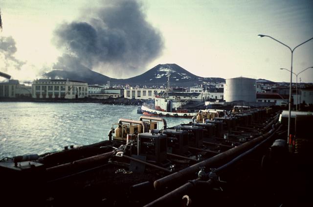
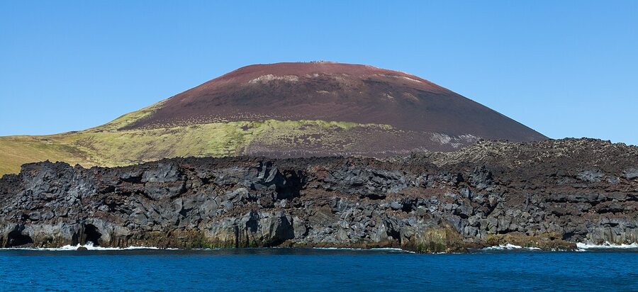
It began at 01:55 on the morning of 23 January 1973. A fissure two kilometres long opened across the eastern edge of Heimaey, two hundred metres from the closest houses. By the time anyone realised what was happening, lava fountains were going up five hundred feet into the sky. The fishing fleet was in port, freakishly enough; a winter storm had kept boats from going out the previous day. Within five hours, the entire population of around 5,300 people had been ferried to the mainland. Nobody died, although one person collapsed from gas exhaustion later in the eruption.
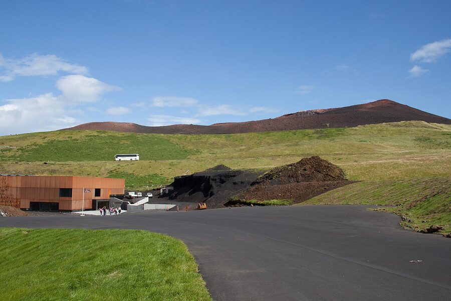
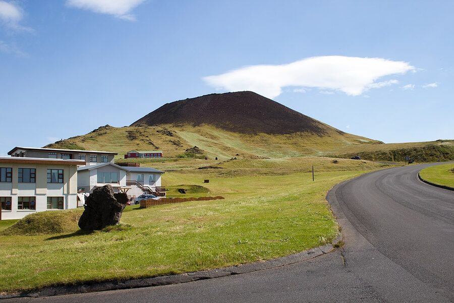
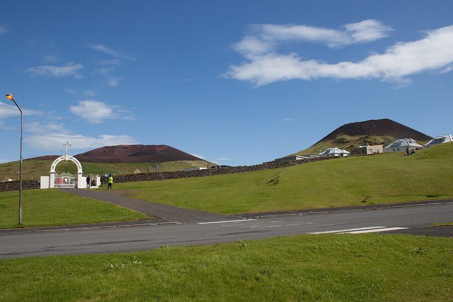
The eruption ran for roughly five months. It built a new volcano: Eldfell (“Hill of Fire”), two hundred metres tall, where there had been a flat field. It buried about 360 buildings under ash and tephra. And it sent a slow wall of lava rolling west toward the harbour, which is the part of the island the entire economy depended on.
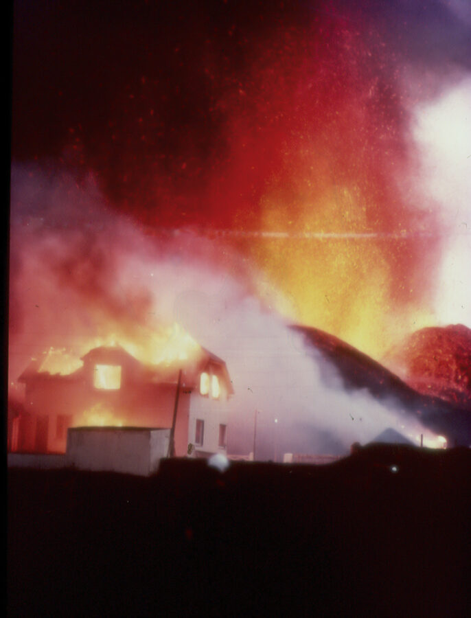
Closing the harbour would have been the end of the islands as a working community. So they sprayed the lava with seawater. For weeks, the islanders and a rotating cast of engineers, with help from the U.S. military, ran pumps off fishing boats and dragged hoses across the lava field, dumping cold North Atlantic water onto the advancing front to chill it and slow it down. They moved billions of gallons. It worked. Barely. The lava stopped just inside the harbour entrance, narrowing it without blocking it, and in a quirk of physics the new geography actually made the harbour better sheltered than it had been before. The eruption ended quietly in July. Most people moved back. The town rebuilt around the new volcano, which from town now looks like a cinder cone parked at the end of the high street. You can hike up it in twenty minutes.
Eldheimar, the museum built around a buried house
If you only do one indoor thing on Heimaey, do this. Eldheimar opened in 2014 and it is the best volcanic-eruption museum I have ever been to. They built it around a single house at Gerðisbraut 10 that was buried up to the eaves in tephra during the eruption and dug out decades later in 2005. You walk inside the museum and there’s the house propped up on what was once the back garden: the broken windows, the partly collapsed roof, a child’s bicycle leaning against a wall, a rotary phone on a side table, the curtains still hanging in the kitchen. Ash has poured into every room. They left it more or less as the volcano left it.
The exhibits around the house tell the eruption story properly: the geology, the night-of evacuation logbook with timestamps, the seawater pumping operation, archive footage of the lava flow, and a small section on Surtsey upstairs. There’s an audio guide in English that doesn’t talk down to you. Allow ninety minutes to two hours; budget more if you read everything. Entrance is around 2,500 ISK. It’s open 11:00 to 18:00 in summer (May to mid-September), shorter hours off-season. The website at eldheimar.is has current hours.
I will say this: it’s a quiet museum and the buried house is a sobering thing to see up close. Take your time. There’s a small café upstairs with a window onto the lava field if you need a sit-down after.
Hiking Eldfell
This is the single best short hike on Heimaey, and it is genuinely short. About thirty to forty minutes round trip if you’re not pausing to take photos, more like an hour if you are. The most common trailhead is the small car park at the western base, just up the hill from Eldheimar. The track is loose red and black tephra and it switchbacks up the cone. It’s steep enough to make your calves work but not so steep that you need to be a hiker. I’ve seen people doing it in trainers and jeans on a calm summer day and they were fine.
The reward at the top is the view. To the east, the older volcano Helgafell and the green flank of the island. To the west, the harbour with its candy-coloured fishing boats and the white terrace of the town climbing the slope. To the south, Stórhöfði and the rock stacks. To the north, the cliffs of Heimaklettur and, on a clear day, the south coast of Iceland with the Eyjafjallajökull glacier behind it. There are still patches on Eldfell where the ground is warm to the touch. Push your fingers into the loose tephra near the summit and you’ll feel it. Fifty years on. Don’t dig deep, the gases can be hot.
One thing I’d flag: this hill is open to the wind. On a calm day it’s idyllic. On a windy day it’s a tunnel. If the forecast says gusts over 15 m/s, swap it for the museum and the harbour. The view will keep.
The lava field walk
If you don’t want to climb the volcano, the Pompeii-of-the-North walk between Eldheimar and the harbour is the consolation prize, and a good one. There’s a marked path through the lava field with information boards along the way. Brass plaques in the ground mark where streets used to be: Kirkjubæjarbraut, Heimagata, Gerðisbraut. Stand on one and look up: where you’re standing was once a street where children walked to school. Now it’s about fifty feet below your boots.
There’s a section called the “Rainbow Steps” or stigarnir, a flight of bright-painted concrete steps that climbs up the lava and emerges on top of the new ground. From there you look down at the rooftops of houses that survived because the lava stopped just short of them. People still live in those houses. It’s an unusual feeling.
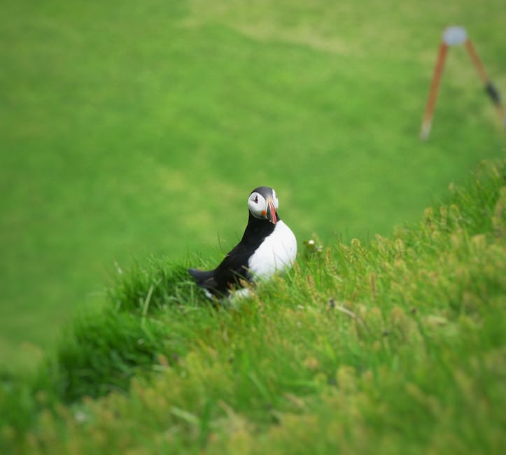
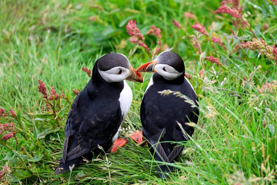
Puffins and Stórhöfði
Around 1.1 million pairs of Atlantic puffins nest in the Westman Islands every summer, which is a serious chunk of the world’s total population (somewhere around ten percent). They start arriving in the second half of April, peak in number through June and July, and start drifting back out to the open ocean from mid-August. By the second week of September they’re more or less gone, and the cliffs go quiet. If you’re visiting outside that window, you will not see puffins. There is no off-season exception. They are out at sea, hundreds of miles away, and they don’t come back until spring.
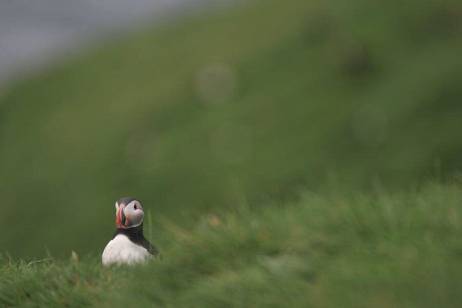
Where to actually see them
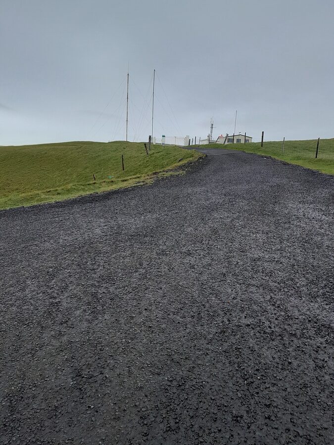
Stórhöfði is the headland at the southern tip of Heimaey, around four kilometres from town. The drive takes ten minutes; the walk takes an hour. There’s a small parking area near the top, and just below it on the western side there’s a wooden bird-watching hide called Skyttuhúsið (basically a shed with one-way glass) built right at the edge of the cliffs where the puffins are nesting. You can stand in there with binoculars and watch them for as long as you like, no entrance fee. It’s a free, slightly improvised, and quietly perfect setup.
From the hide you’ll see puffins doing all the things puffins do: shuffling out of burrows, fighting over patches of grass, taking off awkwardly into the wind, coming back with beaks full of sand eels. They are smaller than you expect (a puffin is roughly the size of a pigeon) and noisier than you expect. The sound the colony makes is somewhere between a chainsaw and a low growl, multiplied by tens of thousands.
Two practical notes. First, Stórhöfði is either the windiest weather station in Europe or close to it, depending on whose record you trust. It is genuinely, properly windy. The recorded average is around 11 m/s, with gusts that have been measured well above 60 m/s on the worst winter days. Wear more than you think you need, and keep small loose objects zipped away (phones, lens caps, hats). Second, stay back from the cliff edge. The grass overhangs the rock, the puffin burrows undermine it, and people have died here. The viewing hide is at a sensible distance for a reason.
The puffling rescue
This is one of the more charming things in Iceland. Late August into early September, the year’s puffin chicks (called pufflings in English; lundapysjur in Icelandic) leave their burrows for the first time and try to fly out to sea. They navigate by moonlight on the open water. The lights of Vestmannaeyjabær confuse them. Every year, a fair number of pufflings end up flapping into town, landing on roofs, garden hedges, and the streets, where they will not survive the night.
So the local kids stay up late with cardboard boxes and headlamps. They walk the streets after midnight, scoop up the lost pufflings, and keep them in the box overnight. The next morning, families take their boxes down to the cliffs at the edge of town and toss the pufflings into the wind off the cliff (gently, two-handed, slightly underhand). The pufflings spread their wings, glide a few seconds, and either fly off properly or pancake into the water and start swimming. They mostly make it. It’s been going on for generations and there’s a small monitoring programme that tracks rescues each year. Locals call this the pysjuvertíð (the puffling season).
If you happen to be on the islands in late August or early September, you can join a community puffling-release morning at the cliffs. Sæheimar (the small aquarium and natural-history museum in town) co-ordinates the visiting programme; drop in and ask. It’s the kind of thing you remember years later.
Sæheimar and the live puffin in the aquarium
Sæheimar is small and slightly old-fashioned and I love it. It’s a single-room aquarium with tanks of local fish and one rescued, hand-reared puffin called Tóti who waddles freely around the staff area. The volunteers will explain that you can’t pet him (puffin feathers have a delicate oil layer that human skin disrupts), but he doesn’t seem to mind people watching him, and watching a puffin walk around at floor level is genuinely funny in a way photos never quite capture. Entry is around 1,500 ISK. It’s a thirty-minute visit, very kid-friendly, and a good rainy-hour fallback. They also run the puffling release programme.
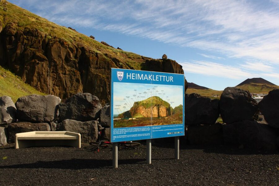
Heimaklettur and the harder hike

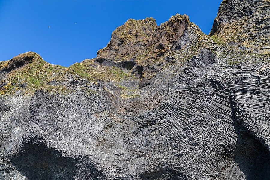
If Eldfell is the easy hike, Heimaklettur is the serious one. It’s the big basalt-and-grass cliff opposite the harbour entrance. When you sail in, it’s the wall of rock on your left. The trail up starts from a small parking spot just past the eastern end of the harbour and climbs about 280 metres. The first section is an actual ladder bolted to the rock, then a series of fixed ropes and chains across exposed grass, then a fairly normal grass slope to the summit cairn.
I want to be clear: this is not a “dangerous” hike in the technical sense, there’s no real route-finding, the fixed gear is in good condition, and people do it in trainers, but it is exposed and steep enough that if you have a genuine fear of heights or are visiting with small kids, you should skip it. People have fallen here, including locals. In wet weather the grass becomes greasy. In strong wind, don’t even start. On a clear, dry, low-wind summer day, however, the view from the top is among the best on the whole island. You see the entire town directly below, the harbour mouth, the lava field, both volcanoes, and the chain of smaller islands stretching south. Allow two and a half to three hours round trip with photo stops.
The other walk: Helgafell and Herjólfsdalur
Helgafell is the older, gentler cone next door to Eldfell. About 5,800 years old, and a very tidy little volcano. It’s a thirty-minute walk to the top from town, and the views back down to the harbour are excellent. If you’ve already done Eldfell, Helgafell is overkill on the same day; pick it as a morning warm-up if you’re staying overnight, or skip it entirely.
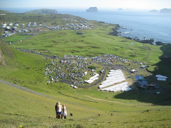
Herjólfsdalur, on the western side of the island, is the natural amphitheatre at the foot of the cliffs where the festival happens. Outside festival weekend it’s a quiet grassy bowl with a few replica turf houses and an easy walking loop. There’s a longer trail that climbs up the ridge above Herjólfsdalur for views back over the bay; that one takes about two hours and is well worth it on a clear evening when the light goes long and gold.
Þjóðhátíð and the festival weekend
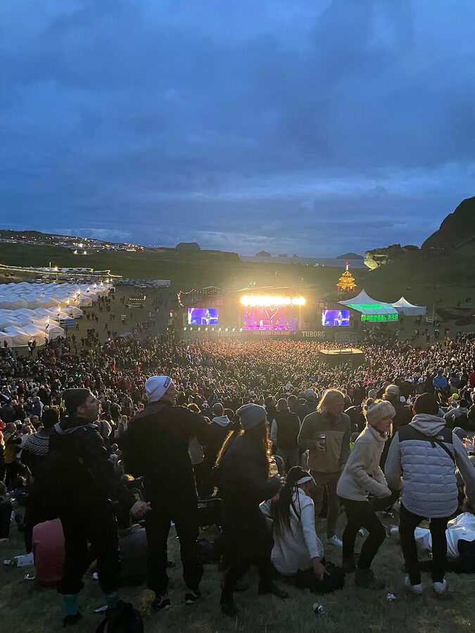
If you’ve heard one thing about the Westman Islands beyond the puffins and the volcano, it’s probably Þjóðhátíð. The name means “national festival” (locals just call it þjóðhátíð or the verslunarmannahelgi, “merchant weekend”). It has been running on the first weekend in August every year since 1874. It’s the longest continuously-running festival in Iceland and the biggest single weekend on the Icelandic social calendar.
The numbers are wild. Heimaey has roughly 4,400 residents. Þjóðhátíð pulls about sixteen thousand people for three days. Mainlanders fly in. Whole extended families take the weekend off. The campsite at Herjólfsdalur fills up with white tents in geometrical rows; the harbour is loud at every hour; the ferry runs extra crossings and is fully booked months in advance. It is loud, sleep-deprived, and entirely Icelandic. Tourists are welcome, but you’re a guest at someone else’s family reunion.
The shape of the weekend: Friday is a torch parade up to the cliffs and a bonfire at sundown. Saturday is the headline night with fireworks and the singalong of the year’s þjóðhátíðarlag (the festival song, written each year specifically for the event). Sunday is the slow, sentimental finale with the brekkusöngur (the cliff sing-along) where the entire crowd faces the slope of Herjólfsdalur and sings together for hours. If you’ve never seen sixteen thousand Icelanders harmonising into a hillside, it is worth the airfare.
If you’re considering going: book accommodation and ferry six months in advance, budget for a weekend ticket (around 25,000–30,000 ISK at last check), and bring a tent. Hotels sell out almost the day they open bookings. Wild camping is not allowed; you stay at the official campsite at Herjólfsdalur or you don’t stay at all. I’ll also flag that the festival has had ongoing issues with sexual assaults in past years. The local response has tightened considerably, but standard care applies: go in a group, look out for each other, and don’t let strangers walk anyone home.
If you’re not going to Þjóðhátíð specifically, avoid the islands during that weekend. The hotels are full, the ferry is full, and the town is not in a sightseeing mood.
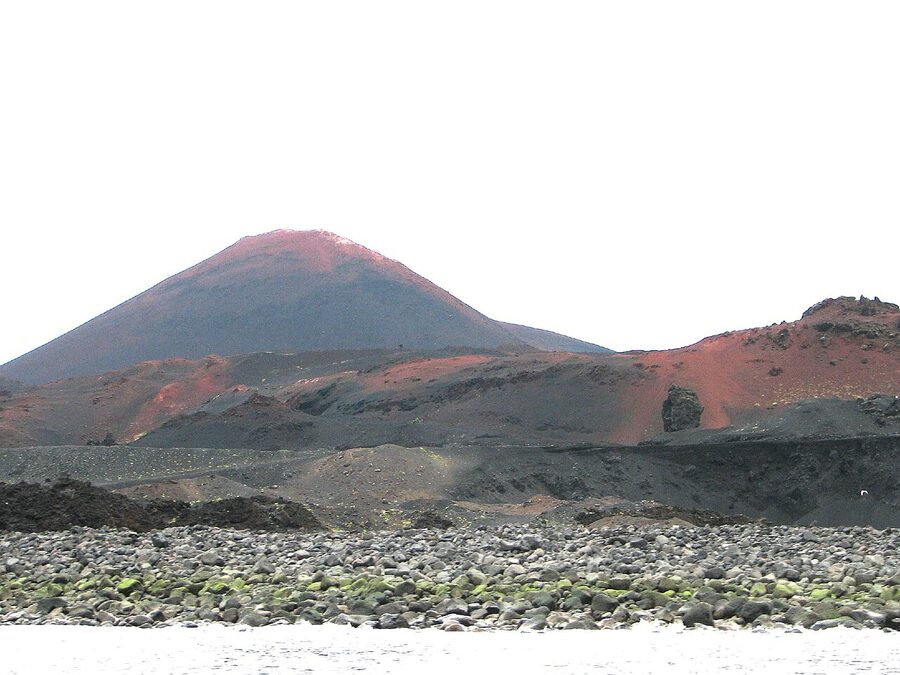
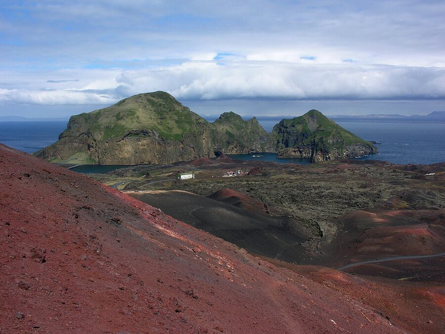
Surtsey and the youngest island
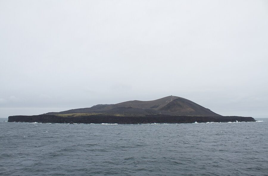
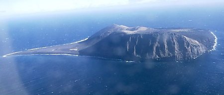
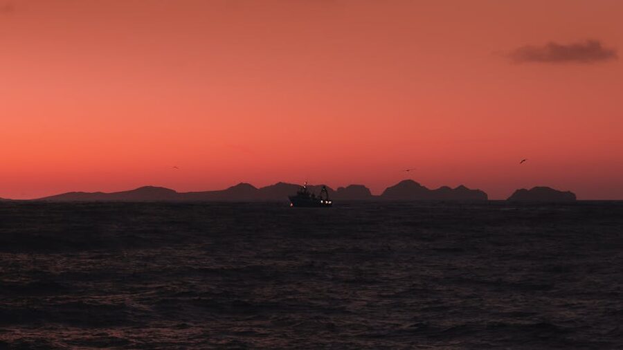
You can’t visit Surtsey, but you can see it. The youngest of the Westman Islands surfaced on the morning of 14 November 1963, when a seabed eruption broke through the ocean about thirty kilometres south of Heimaey. The eruption ran intermittently for almost four years and built an island of about 2.7 square kilometres, named after the fire-giant Surtr from Norse myth. Since 1965, when biologists realised they had a one-in-a-lifetime chance to watch life colonise a new piece of land from zero, the island has been a closed scientific reserve. Only a handful of permitted researchers ever set foot on it. UNESCO listed it as a World Heritage Site in 2008.
From Heimaey, on a clear day, you can see Surtsey on the southern horizon, a grey hump on the sea. The clearest viewpoints are from the top of Eldfell and from Stórhöfði. Boat tours from the harbour will take you closer; some loop around the island without landing, and on a calm day you can get a sense of the cliffs and the dark beach where puffins have begun nesting on their own. The island is slowly eroding, at current rates, it will likely be fully gone by 2100, so the chance to see a young volcanic island in mid-life is genuinely a now-or-never thing.
What I would actually do
The best version of a trip is two days, one night. Day-tripping is doable but tight. Three days is too long unless the weather is washing days out and you’re chasing windows. Here’s the version I’d plan if I had two days in July.
Day one, afternoon arrival
Catch a midday ferry from Landeyjahöfn so you arrive on Heimaey around 13:00. Walk into town from the ferry terminal, it’s about ten minutes, and have a late lunch at Tanginn, which is right on the harbour and serves a very good fish-of-the-day plate. After lunch, walk over to Eldheimar (about fifteen minutes from the harbour, all uphill but gentle) and spend two hours there. Come out at 17:00, drop your bag at the hotel, and if the weather is cooperating, walk straight up Eldfell. The light at the top in evening is the best you’ll get. Have dinner at Slippurinn, book ahead, and call it a night.
Day two, full day
Wake up early, breakfast at Gott (it has the best baked goods on the island and the place is small enough that you should arrive at 08:30, not 10:00). Pick up your rental car or e-bike and drive south to Stórhöfði. Spend an hour or so at the puffin hide. From Stórhöfði, work your way back north on the eastern side of the island via the lava walks, then loop around to Herjólfsdalur for a quiet picnic in the festival amphitheatre. Late afternoon, hike up Heimaklettur if your knees and the weather agree. Evening ferry back to the mainland, ideally the 19:30 or 22:00, and you’re back at your South Coast hotel by 21:30 or 23:30 respectively.
Day-trip version
If you only have a day, take the 08:15 ferry from Landeyjahöfn, plan to be back on the 17:00 or 19:30, and pick exactly two of: Eldheimar, Eldfell, Stórhöfði. Don’t try for all three plus Heimaklettur. You’ll get the highlights but not the rhythm of the place.
Where to stay
Heimaey has limited rooms and they sell out faster than people expect, especially in July, August, and the festival weekend. Book months ahead in summer.
Hotel Vestmannaeyjar
The biggest and most established option in town, a short walk from the harbour, with a good restaurant attached. Rooms are clean, the staff are helpful, breakfast is included on most rates. It’s not stylish, exactly, it’s a working Icelandic small-town hotel, but it’s well run and a fine place to come back to after a day on the cliffs. Check rates on Booking.com.
Guesthouse Hamar and Lava Guesthouse
Two of the better mid-range guesthouse options in town. Both are small, family-run, and walking distance from the harbour and Eldheimar. Lava Guesthouse, as the name suggests, sits at the edge of the lava field. Guesthouse Hamar on Booking.com · Lava Guesthouse on Booking.com.
Bjarmaland and Guesthouse Árný
Apartment-style options if you’d rather self-cater. Both are well placed, simple, and reliable. Apartment Bjarmaland in particular is good for two-night stays where you want a kitchen. Bjarmaland on Booking.com · Guesthouse Árný on Booking.com.
Puffin Nest Capsule Hostel
Budget option, sleeping pods rather than rooms, perfectly fine for one or two nights if you don’t need a private bathroom. Closer to the harbour than most other options. Puffin Nest Capsule Hostel on Booking.com.
Camping
The official campsite is at Herjólfsdalur, the same spot Þjóðhátíð uses, but most of the year it’s a quiet, sheltered grass bowl at the foot of the cliffs. It’s around 1,700 ISK per person per night, with showers, a communal kitchen, and bathroom blocks. It’s cleaner than most Icelandic campsites I’ve used. Closed during the festival itself unless you’re there for the festival.
Where to eat
For a town of 4,400, Heimaey eats well. The fishing fleet is right there, and what comes off the boats in the morning is on plates by lunch.
Slippurinn
The reason food critics know about the islands. Slippurinn is in a converted machine shop on the harbour, a Nordic fine-ish-dining restaurant with a tasting menu that uses what’s been landed and foraged that day. It’s not cheap, figure 12,000 to 18,000 ISK a head with wine, but for what you’re getting it’s reasonable, and on the islands it’s the best meal by a comfortable margin. Open in summer only, generally May to early September. Reservations are essential. They book out weeks ahead in July and August.
Tanginn
A bistro-pub right on the harbour. Good fish, decent burgers, well-poured beer, and the prices are about half of Slippurinn. The fish-of-the-day plate is usually the best thing on the menu. Walk-ins are usually fine outside of festival weekend.
Gott
A small café that does very good baked goods, sandwiches, and proper coffee. It’s where I’d go for breakfast and where I’d come back for cake at four in the afternoon. Limited seating; takeaway works fine.
Næs
Casual burger-and-beer place that the locals actually use. Nothing fancy. The burgers are decent. Open late.
The petrol station
The N1 petrol station near the harbour does cheap, decent fast food (hot dogs, soup of the day, sandwiches) at half the prices you’ll see anywhere else on the island. If your travel budget is tight, the soup of the day at the N1 is a perfectly respectable lunch. This is true across Iceland; islanders just take it more seriously than most.
Boat tours and seeing the islands from the water
You don’t really understand the geography of the Westman Islands until you’ve been around them on a boat. The cliffs that look impressive from the ferry are properly enormous from a small boat at the foot of them, and you can get into sea caves the ferry can’t approach. Wild Vestmannaeyjar runs the standard ninety-minute circuit on a small boat, about 10,000 ISK a head, and a faster RIB option that gets you out further for closer to 13,000 ISK. You’ll see puffins at sea level (different perspective than the cliff hide), fulmars and gannets and razorbills, the basalt formation called the Organ that looks exactly like organ pipes carved out of black rock, the natural arch, and the sea cave called Klettshellir where the boat will go inside on a calm day and the captain will play a few notes on a cornet for the acoustics. It’s exactly as ridiculous and as good as it sounds.
Orca sightings are common in spring (March to June, peak in late spring) when the killer whales follow the herring through these waters. Summer sightings happen but are rarer. The boat tours don’t promise orcas, but they will detour to them if a captain spots them. Minke whales and white-beaked dolphins are seen regularly through summer.
Booked tours from Reykjavík
If you’d rather not handle ferry logistics, several Reykjavík operators run a full-day Westman Islands trip: pickup from your hotel, the drive to Landeyjahöfn, the ferry over, four to six hours on Heimaey with a guided minibus, the ferry back, and the drive home. Around 25,000 to 35,000 ISK depending on operator. GetYourGuide and Viator both list Westman Islands day trips, and the larger Iceland operators like Nordic Visitor include them in some south-coast itineraries. It’s a long day on a coach, but if you don’t want to drive in Iceland, it removes every logistical question from the equation. For the slow tour around the islands once you’re there, do it as a guided minibus with someone like Eyja Tours: they’ll get you to the puffin hide, Eldfell, the lava field, and the harbour viewpoint in about two and a half hours.
The 1627 raid
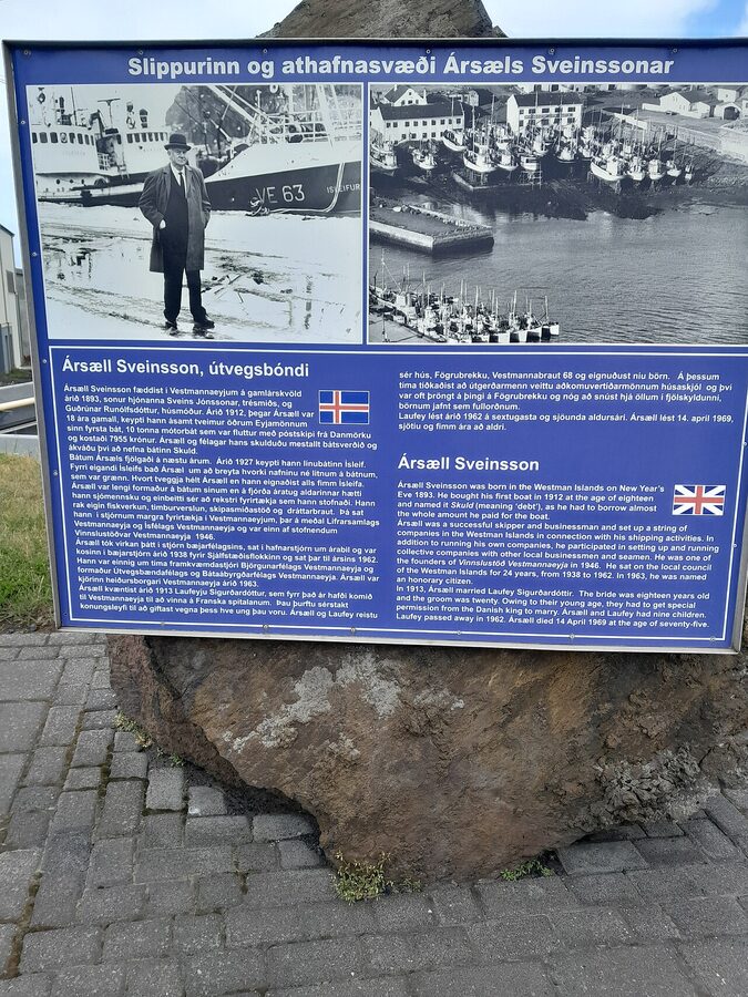
One historical detour that almost nobody mentions in puffin-and-volcano guides, and that you’ll see referenced on the islands themselves. In July 1627, three corsair ships from Algiers (really Salé and Algeria; the Icelandic word Tyrkjar, “Turks”, was used loosely for any North African Muslim) raided the Westman Islands. They came ashore on Heimaey, killed about thirty-six islanders, and took 242 prisoners as slaves. The captives were marched to the boats, sailed to North Africa, and sold in the slave markets at Algiers. A handful (most famously Guðríður Símonardóttir, who later married the Icelandic poet Hallgrímur Pétursson) were eventually ransomed back ten years later. Most never returned.
It is hard to overstate how much this event shapes the local imagination. The church bell on Heimaey carries the date of the raid. There are markers around the harbour pointing out where the corsairs landed and where the locals hid. The event is called the Tyrkjaránið (the Turkish Abduction), and there’s a substantial folk and literary tradition around it. If you walk the harbour at twilight and read the small plaques on the seawall, you’ll get a sense of how present it still is. The islanders are not the kind of people who let an event like this slide out of memory.
Practical bits
Weather and when to go
The Westman Islands are not exactly known for kindness on the weather front. Stórhöfði has been called the windiest weather station in Europe more than once. Average wind speed at the headland sits around 11 m/s, and gusts above 25 m/s aren’t rare even in summer. Fog rolls in fast. Rain comes in horizontal. Temperatures in July typically run 9 to 14 degrees, in January roughly 0 to 4. Best months are June, July, and August, long daylight, peak puffin, the festival is in there, and the ferry runs with maximum frequency. May and September are quieter and still good. October through April is harder; the ferry skips more days, the puffins are gone, and the daylight is short. I’d visit in winter only if you’re already on a longer Iceland trip and the forecast aligns.
Always check vedur.is the night before you go and the morning of. It will tell you if Landeyjahöfn is open or whether the ferry is running from Þorlákshöfn instead. Also check safetravel.is for general conditions and road.is if you’re driving south from Reykjavík.
Money, signal, walking
Cards work everywhere on Heimaey. Visa and Mastercard contactless are universal. Phone signal is good on the populated half of the island and patchy at Stórhöfði (you’ll get a bar at the road, not always at the cliff edge). Almost everything in town is walkable from the harbour: Eldheimar is fifteen minutes uphill on foot, the campsite at Herjólfsdalur is twenty minutes from the harbour, the football stadium is ten. Stórhöfði is the only thing you’d really want a car or bike for.
Bike and car rental on the island
There’s a small e-bike rental place near the harbour that does day rentals, the bike will get you to Stórhöfði and back without the road walk, and is a fine option in good weather. If you want a regular car, you’re better off bringing one over on the ferry or renting on the mainland and ferrying it; on-island car rental is limited.
The football stadium
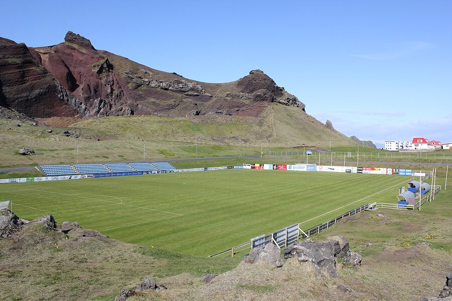
If you happen to be on the islands on a match day, ÍBV Vestmannaeyjar plays at Hásteinsvöllur, which sits between Helgafell and the harbour with one of the more theatrical settings of any football ground in Europe. ÍBV bounce between the top division and the second tier; check fixtures locally if you’re a fan. Tickets are inexpensive and the atmosphere is properly small-town. Wind frequently blows the ball back upfield, which is part of the charm.
What to skip
Every place has a few things that get over-marketed. Here are the ones I’d quietly de-prioritise.
Don’t try the islands as a four-hour visit. You’ll see the harbour, walk through town, eat lunch, and leave. That’s not a Westman Islands trip; that’s a ferry ride that cost you most of a day. Either commit to a proper day with the 08:15 ferry over and the 19:30 back, or stay overnight.
Don’t go puffin-hunting between September and April. The birds are not there. I have read travel pieces that suggest you can “still glimpse a few” in the off-season; you can’t. The colony is empty. If puffins are the reason for the trip, you must be on the islands in May, June, July, August, or the first half of September.
The elf garden is fine, not great. Gaujalundur is a small private rock garden with painted plaques marking “elf homes.” It’s a charming local-eccentric thing if you’re already walking past, but it’s not worth a special detour, and don’t expect anything more than a domestic garden with rocks.
The Stave Church is not original. Stafkirkjan in Skansinn is a black-tarred wooden replica gifted by Norway in 2000 to mark a thousand years of Christianity in Iceland. It’s pretty, photogenic, and very much a modern structure. Worth a look if you’re already in Skansinn (it’s near the harbour entrance), not worth a separate trip.
The Beluga whale sanctuary at Klettsvík is closed to direct visits. It used to house Keiko, the orca from Free Willy; Keiko died in 2003. The sanctuary’s permanent residents are belugas Little Grey and Little White, transferred from a Chinese aquarium in 2019. The bay is a working sanctuary and you can’t drop in on the belugas; you can see the bay from the cliffs above. There’s a small visitor centre in the town that does well-meaning, slightly-stretched programming around it. Worth thirty minutes if you’re curious, not a centrepiece.
What you walk away with
What I love about the Westman Islands isn’t any one thing on the list. It’s the density. You can stand on the deck of the ferry, see the whole inhabited island laid out in front of you, and understand within five minutes that this is a place where everyone has been pirated, evacuated, returned, dug their own house out of ash, fished from the same harbour for thirty generations, and sung the same festival song every August since the year their great-great-grandfather was a child. That’s not a vibe a place can be sold; it’s only earned. Heimaey has earned it twice.
Most Iceland trips are about wide spaces, the ring road, the highlands, the empty interior. Heimaey is the opposite. It’s a small spot of land where everything is close together and the layers stack: a thousand-year-old fishing town, a fifty-year-old volcano in its back garden, a million birds on the cliffs, the longest-running festival in the country, a UNESCO site you can’t visit but you can see, and a museum built around a single buried house on a single residential street. Two days, one night, in summer if at all possible. That’s all it asks for, and it pays the visit back many times over.
For wider trip planning, see our guide to day trips from Reykjavík, our bird watching pages for puffin alternatives elsewhere in the country, our animals of Iceland piece for orcas and whales, the car rental guide if you’re driving south, and the Ring Road piece for fitting Heimaey into a larger circuit. The full tour overview is here, and the destinations index lists every region piece on the site.
.jpg)