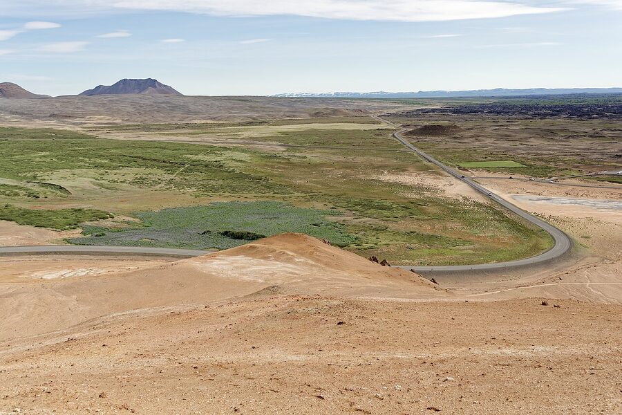
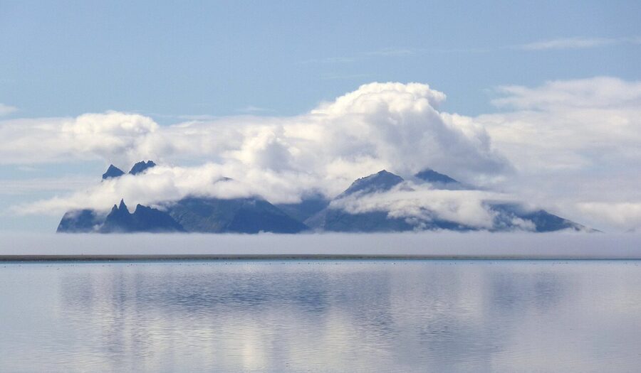
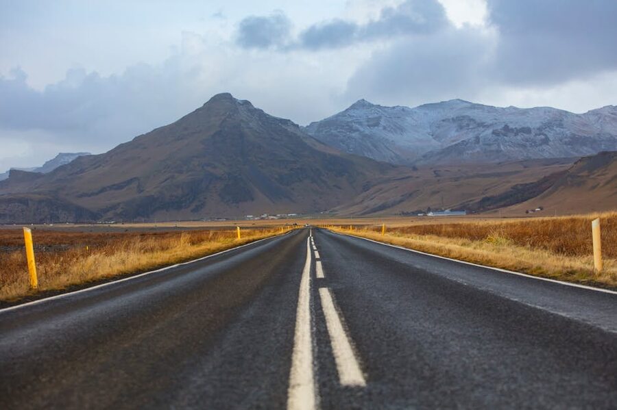
The Ring Road, Þjóðvegur 1 if you want the formal Icelandic name, is 1,332 kilometres of mostly two-lane tarmac that loops the entire country. They finished it in 1974, when the bridge across the sands of Skeiðarársandur was finally laid and the south coast was joined up with the rest of the island for the first time in geological memory. Until then, you couldn’t drive around Iceland. You drove until the road ended, then turned around. So this loop is younger than most of the people driving it, and that newness is part of why it works the way it does. There is one road. You stay on it. It takes you past most of what you came to see.
You can drive the whole thing in 24 hours. You’d be doing 90 km/h in the dark for a day, and you’d see nothing, but you can. Most people take seven to ten days. I’d argue ten if you have them, with a Snæfellsnes loop tacked on. Seven works if you accept up front that some stops stay on next year’s list. Five days is a punishment trip. Two weeks gives you Westfjords or Highlands as a bonus chapter.
What I want to do here is walk you through it the way I’d walk a friend through it. What the Ring Road actually is, how long you really need, which direction to drive, where to sleep at each major stop, what to skip and what’s worth lingering at. I’ll name the hotels by name. I’ll give you ISK numbers. I’ll flag the bits that catch people out and the section nobody warns you about until you’re trying to find a bed in Vík at 7pm in July with everything sold out. Þetta reddast, as we say. It’ll work out. You just need to know what you’re walking into.
In This Article
- What the Ring Road actually is
- How long do you actually need
- Clockwise, counter-clockwise, or does it matter
- The vehicle, and the insurance question
- The 7-day clockwise itinerary
- Day 1: Reykjavik to Vík (~190 km, 3 hours driving plus stops)
- Day 2: Vík to Höfn (~270 km, 4 hours driving plus stops)
- Day 3: Höfn to Egilsstaðir (~250 km, 4 hours plus the East Fjords)
- Day 4: Egilsstaðir to Mývatn (~170 km, 3 hours plus Dettifoss)
- Day 5: Mývatn to Akureyri, with a Húsavík detour (~140 km direct, 250 km with Húsavík)
- Day 6: Akureyri to Borgarnes via Tröllaskagi (~430 km, 5 to 6 hours driving)
- Day 7: Borgarnes to Reykjavik via Reykholt (~140 km, 2 hours plus stops)
- The things you will skip on a Ring Road, and that’s fine
- Costs in plain numbers
- Weather, daylight, and when to go
- Five things that catch people out
- Single-lane bridges, tunnels, and one-way etiquette
- If you have nine or ten days, this is what I’d do
- What I’d do, if it was me
What the Ring Road actually is
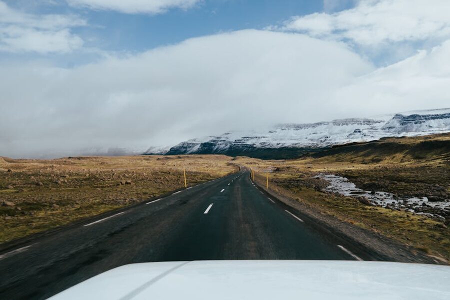
Þjóðvegur 1, also called Hringvegurinn (literally “the ring road”), is the country’s main highway. It is 1,332 kilometres long, mostly two lanes, paved end to end, with 32 single-lane bridges and a handful of one-way tunnels. It connects every region except the Westfjords and the Highlands, and it brushes past or close to almost every famous sight in Iceland. Waterfalls, glaciers, geothermal areas, fishing villages, the lot. If you stay on the 1, you cannot really get lost, which is a kind of road trip mercy that anyone who has tried navigating rural France will appreciate.
The road as a complete loop only opened in 1974. The hold-up was the south coast, where the Skeiðarársandur outwash plain in front of Vatnajökull glacier kept washing every previous bridge attempt away in jökulhlaup floods. They finally engineered something the floods couldn’t take, ran a national party for it, and the country could be driven around for the first time. The ribbon-cutting still holds the record for the largest gathering Icelanders have ever shown up to in one place. You’ll cross those Skeiðarársandur bridges on Day 2 of a clockwise loop, and they’re still rebuilt every few decades when a serious flood comes through.
The speed limit on Route 1 is 90 km/h on the open paved stretches, 70 on gravel, 50 in towns. There are speed cameras at every petrol-station town worth mentioning, and the fines are the kind that ruin a holiday. Don’t speed. The road wasn’t built for it, and the police aren’t gentle.
How long do you actually need
Five days will get you around the loop, technically. You will spend most of it in the car, you will skip Höfn for langoustine, you will drive past Goðafoss in the rain because you’re behind schedule, and you’ll arrive in Reykjavik on Day 5 wondering why you bothered. I would not do this. If you have five days, do the South Coast and Golden Circle properly and save the loop for a return trip.
Seven days is the standard and it works. You’ll have one or two punchy driving days, especially the Höfn-to-Egilsstaðir East Fjords run, but you’ll see all the headline sights. Most operator-packaged Ring Road trips, like the ones Nordic Visitor sells, are built around this seven-day rhythm.
Nine to ten days is what I’d actually recommend if your time is flexible. You get a buffer day for weather, and you can either slow the East Fjords down to a sensible pace or slot in a Snæfellsnes loop at the end. Snæfellsnes is technically a detour from the Ring Road, but it’s one of the most rewarding side trips Iceland has and it adds about a day and a half if you’re moving.
Twelve to fourteen days lets you add the Westfjords or a guided Highland super-jeep trip. The Westfjords are a different country in feel: emptier, steeper, with one of the great cliff bird colonies at Látrabjarg. Few people who do them regret it. The Highlands need their own gear and their own caveats and I’d treat them as a separate trip on a return visit.
The tempting plan is “we’ll do Ring Road and Westfjords in seven days.” You can’t. The Westfjords alone need three days at a sane pace. Picking one is much better than half-doing both.
Clockwise, counter-clockwise, or does it matter
It is a slightly tribal question and I will give you the actual answer. There is no wrong direction, but there is a small case for each.
Clockwise (north out of Reykjavik first, south coast last) saves the busiest, most touristed section for the end. You do the quietest country, the East Fjords and the north, when you’re fresh and curious. The south coast is always the part where you collide with day-trip tour buses out of Reykjavik, and arriving there at the end means the contrast lands differently. You also drive south in the afternoons of the last days, which puts the famous waterfalls (Skógafoss, Seljalandsfoss) with the sun behind you for photography. This is what most photographers prefer. It’s what I’d pick most years.
Counter-clockwise (south coast first, working back through the north) is the more popular direction with first-timers because you front-load the famous stuff. You see Seljalandsfoss on Day 1 or 2, you’re at Jökulsárlón by Day 3, and the East Fjords are a quieter middle act before Akureyri and the run home. The advantage is that if weather forces a day off, you’ve already banked the headline sights. The disadvantage is the tour-bus stretch is right at the start of your trip when you’re least prepared for it.
I write this itinerary clockwise because I prefer the rhythm. If you’d rather go the other way, just read it from the back. The places don’t move.
The vehicle, and the insurance question
The Ring Road is paved end to end, so in the technical sense you do not need a 4WD. A 2WD economy car (Toyota Yaris, Hyundai i10, VW Polo) will do the entire loop in summer at around 8,000 to 12,000 ISK a day. A compact AWD (Suzuki Vitara, Dacia Duster, Toyota Yaris Cross) sits at 14,000 to 20,000 ISK and is what I’d send most week-long visitors to, because the small extra ground clearance means you can take the gravel side road to a viewpoint without panicking. In winter, you want a proper 4WD with studded tyres, full stop. Budget 22,000 to 35,000 ISK a day.
Compare prices on northbound.is, which is the local comparison engine, then book direct with one of the local operators. The two I’d happily put a friend in are Blue Car Rental and Lava Car Rental, both based at Keflavík. We’ve gone deeper into all of this in the Iceland car rental guide, including the insurance breakdown that will save you a lot of money at the desk. Short version: you want SCDW (Super Collision Damage Waiver) and GP (Gravel Protection), and in spring or autumn add SADW (Sand and Ash) too. Skip the WiFi hotspot upsell.
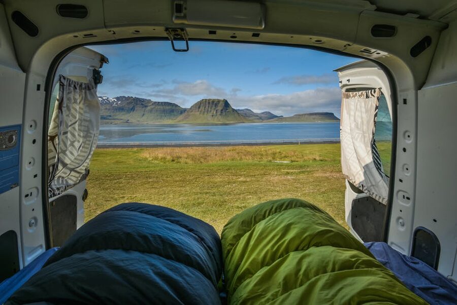
If you want to consolidate the rental and the bed into one cost, a campervan is a credible option for the Ring Road. Happy Campers and Kúkú Campers are the two reputable local outfits. You sleep in designated campsites (around 2,000 ISK per person per night), wake up where you stopped, and don’t have to commit to hotel bookings months in advance. Wild camping outside designated sites is not legal in Iceland, even from a van. The rule was tightened years ago after too many tourists left too much mess in too many lay-bys. The official guidance lives at umhverfisstofnun.is, the Environment Agency.
Self-drive versus a guided multi-day tour: self-drive wins on cost and flexibility every time. A guided tour wins if you’re nervous about winter driving in a country you’ve never been to. Operators like Nordic Visitor, Hidden Iceland, and our own customised Iceland trips can put together a package where someone else does the logistics, hotels, and weather calls. That is genuinely worth the price markup if a December Ring Road in your own rental car would be the kind of holiday that has you staring at a blizzard at 4pm wondering whether to push on or stay put. There’s no honour in white-knuckling Route 1 in the dark.
The 7-day clockwise itinerary
This is the seven-day version, clockwise from Reykjavik. Each day has a sensible amount of driving and one or two main stops. If you have eight days, add a buffer day at Skaftafell on Day 2. If you have nine, add a Snæfellsnes loop after Day 7 (it’s a separate post: see the Snæfellsnes peninsula guide).
Day 1: Reykjavik to Vík (~190 km, 3 hours driving plus stops)
Pick the car up at Keflavík, fuel up at the N1, and drive east on Route 41 then Route 1 through Selfoss. Selfoss is the agricultural service town for the south, useful for a Bónus supermarket stop to load up on bread, cheese, fruit, and skyr. It will save you about 5,000 ISK over the next three days versus eating every meal at a roadside cafe.
Past Selfoss, the south coast hits properly. Seljalandsfoss first, parked off Route 1 on the right. Parking is now 1,000 ISK via the Parka.is app. Pay it the moment you stop. Enforcement is aggressive and the fines are not small. The walk behind the falls is wet and you will be soaked. Wear waterproofs. The path around back is closed in heavy frost in winter.
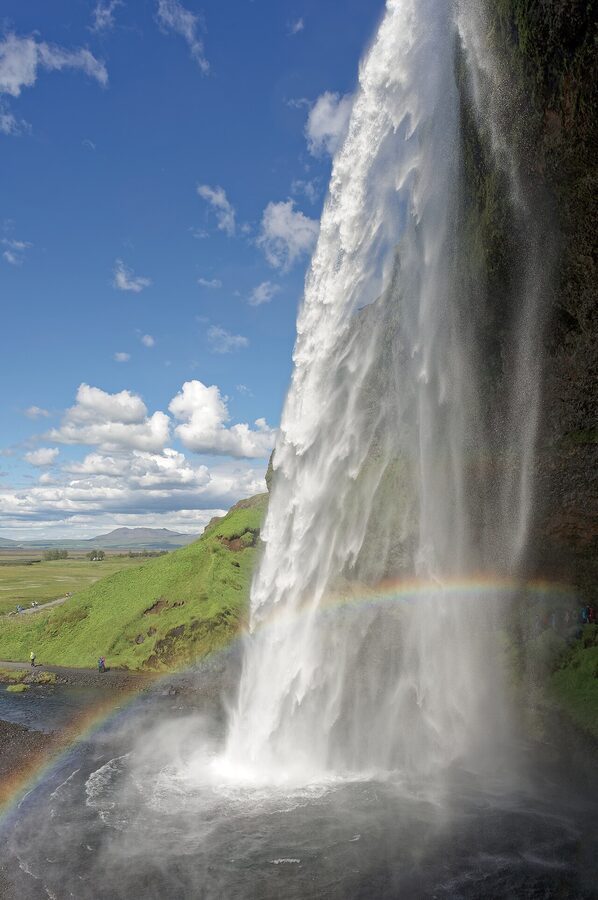
Twenty minutes further east is Skógafoss, 62 metres of vertical drop, parking still free. The stairs on the right go up to the head of the falls. The view from the top, looking out across the south coast plain, is the better one. The walk to Sólheimajökull glacier (turning off at the next junction) is worth doing if you have an hour and a half spare and want a glacier hike, which can be booked in advance with mountainguides.is.
Then Vík. The town itself is tiny, a population of about 800 people clustered around the petrol station, the supermarket, and the church on the hill. Sleep here.
Where to stay in Vík
Black Beach Suites sit on the cliff above Reynisfjara, a ten-minute drive west of Vík, and the suites have black-sand-beach views from the bed. They are not cheap (60,000 to 90,000 ISK in summer) but the location is unbeatable. Hotel Vík í Mýrdal is the safe bet in town itself, around 35,000 to 50,000 ISK in summer, walking distance to the supermarket and the church viewpoint. Volcano Hotel sits a few kilometres east of town with a slightly more hostel-ish feel and lower rates.
Eat at Suður-Vík restaurant in the town centre or the Black Crust pizzeria. Both are decent. Don’t expect Reykjavik prices.
Day 2: Vík to Höfn (~270 km, 4 hours driving plus stops)
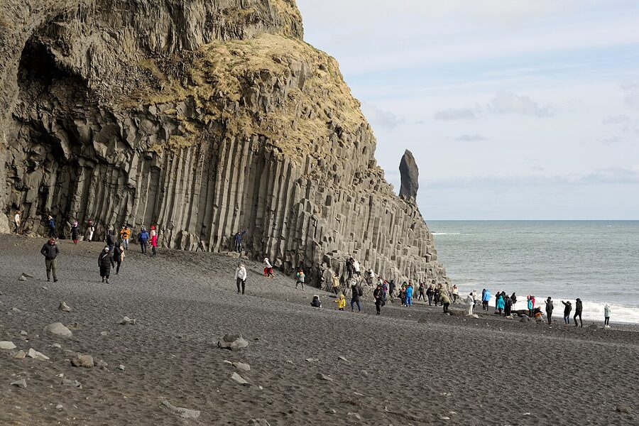
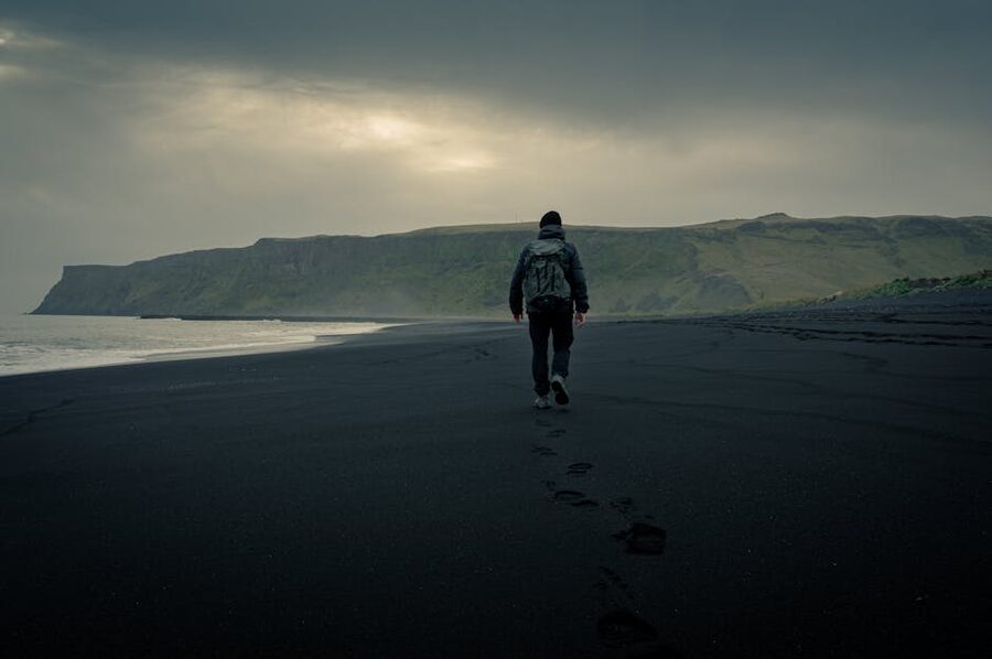
Start with Reynisfjara, the famous black-sand beach with the basalt columns at one end. Read this twice: the waves at Reynisfjara have killed six people since 2013, the most recent a nine-year-old child in August 2025. They look small until they’re not. The “sneaker waves” surge up the sand far past the normal waterline without warning, and they pull people out. The rule is non-negotiable. Stay well back from the water. Never turn your back on the ocean. Pay attention to the colour-coded flag system at the entrance (Yellow, Orange, Red). On Red days the Hálsanefshellir cave is closed and lower beach access is restricted. Treat it the way you’d treat any actual hazard.
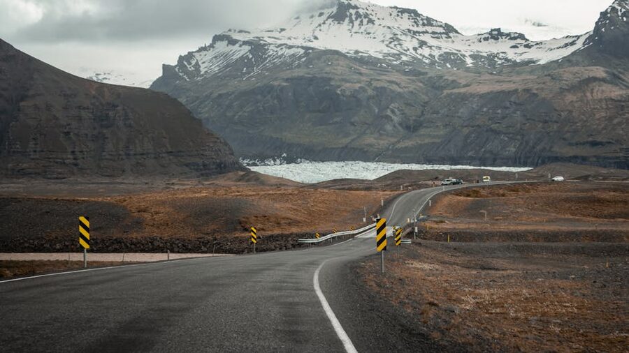
From Vík, Route 1 turns inland and then east across the Mýrdalssandur plain, a vast lava-and-sand expanse where you’ll do an hour without seeing much except the road. Then comes the south coast’s geological climax. Skaftafell, the southwest entrance to Vatnajökull National Park, is signposted off the 1. If you have a full day to give, this is where I’d give it. Glacier hikes onto Falljökull leave hourly in summer with glacieradventure.is. Ice cave tours run November to March only, sometimes from the ranger station, sometimes from Jökulsárlón, and they always need to be booked in advance.
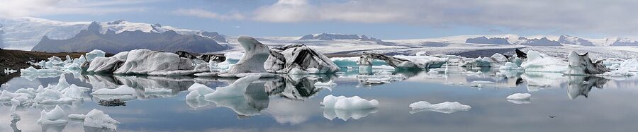
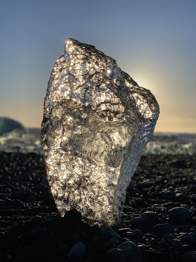
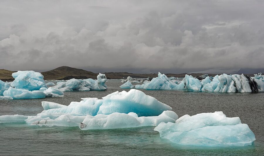
An hour further east is Jökulsárlón, the glacier lagoon. This is on most people’s Iceland top three for a reason. Icebergs the size of cars float across a milky-blue lake, calving off Breiðamerkurjökull at the back, drifting through the channel under the Ring Road bridge, and washing up on the black-sand beach on the seaward side. That beach is Diamond Beach, named for the way the wave-polished ice catches the sun. It is a 60-second walk from the lagoon car park. Boat tours run on the lagoon May to October from around 12,000 ISK. Worth it on a calm day.
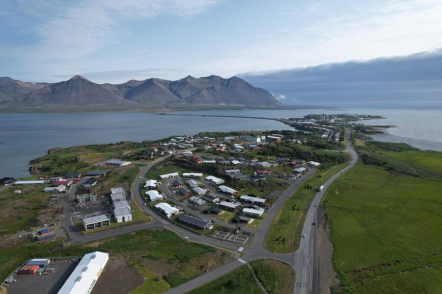
An hour past Jökulsárlón you reach Höfn, the unofficial langoustine capital of Iceland. Population around 1,700. Pull in for the night.
Where to stay in Höfn
Fosshotel Glacier Lagoon is actually about 20 minutes back west of town, near Hali, and it has the closest hotel beds to Jökulsárlón itself. Rates 40,000 to 65,000 ISK in summer. Good restaurant, decent breakfast. In Höfn town proper, the local Hotel Höfn is the long-running mid-range option. For dinner, Pakkhús and Humarhöfnin both do the langoustine the town is famous for. They’re not cheap (a humar main runs around 7,500 to 9,000 ISK), but if you’re going to eat one expensive meal on this trip, this is the one. Tail-only langoustine at Pakkhús with a glass of white is one of the small joys of doing the Ring Road properly.
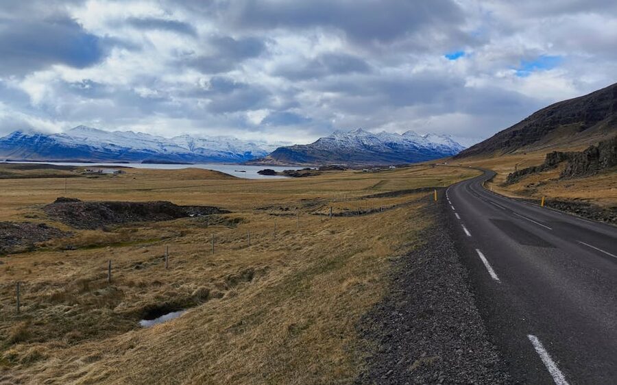
Day 3: Höfn to Egilsstaðir (~250 km, 4 hours plus the East Fjords)
This is the quietest day of the loop, and the one where the Ring Road feels longest. Out of Höfn, the road climbs onto the eastern coast and starts the East Fjords sequence: a series of long, narrow fjords that the road dutifully tracks around. You’ll spend the day driving up one side of a fjord, looking across at the road on the other side ten minutes by air and forty by tarmac, then back down the other.
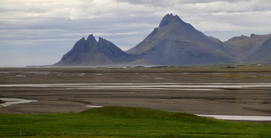
Before you commit to the eastern fjord-tracking, take the 15-minute detour to Stokksnes and Vestrahorn. This is the “fang mountain” peninsula that ends up on every photographer’s Iceland reel. Access is 900 ISK paid at the Viking Café at the gate. Worth it on a clear day for the reflection shots from the black sand. On a rainy or foggy day, save the money and drive on.
The first proper fjord village is Djúpivogur, a charming fishing town with the Eggin í Gleðivík sculpture installation along the harbour, which is 34 oversized eggs each representing a local bird species. Free, take twenty minutes, very peaceful. Coffee at JFS Kjötbúd in town if you need it.
From Djúpivogur, you have hours of fjord-rounding ahead. It is genuinely beautiful and genuinely repetitive. One fjord is breathtaking. Six in a row become hypnotic. The trick is to pick one or two stops to break it up. The stretch around Stöðvarfjörður is worth a coffee and the Petra Stone Collection (a private mineral museum, 2,500 ISK, charmingly weird). Past Reyðarfjörður, the road climbs over the Fagridalur pass and drops down into the Lagarfljót valley where Egilsstaðir sits.
Egilsstaðir is a town of about 2,800, the regional capital of the east, with the only Bónus supermarket and proper petrol station for an hour in any direction. There is also Lake Lögurinn (or Lagarfljót if you want to be official), the long thin lake that supposedly hosts the Lagarfljótsormur, an Icelandic Loch-Ness-style creature first reported in 1345 and last reported on by a credible witness in 2012. Make of that what you will.
Where to stay in Egilsstaðir or Seyðisfjörður
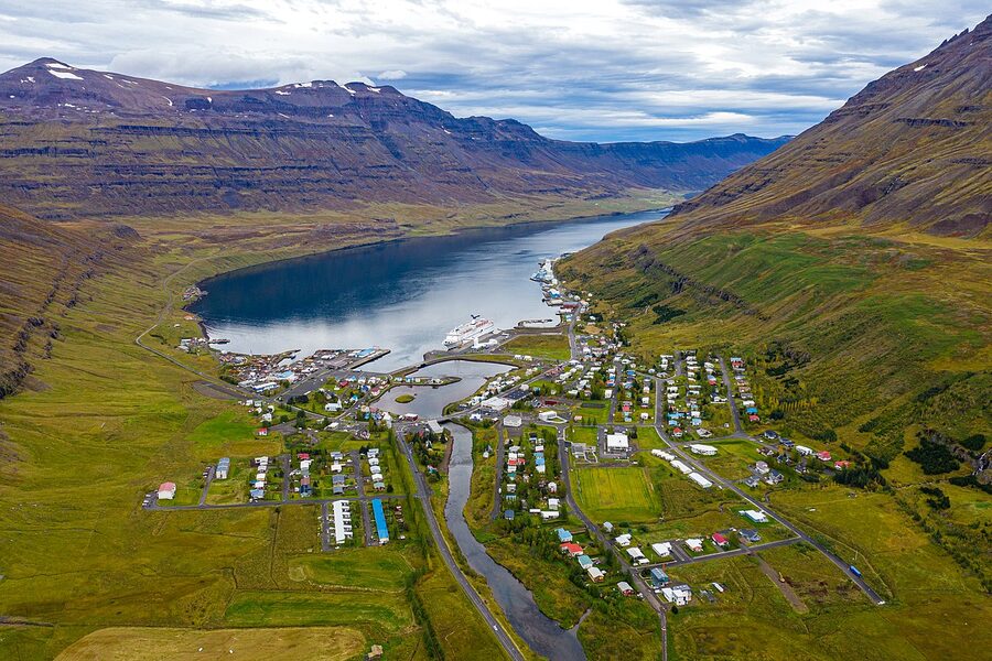
You have two good options. Stay in Egilsstaðir itself for convenience, or do the 27 km drive over the Fjarðarheiði pass to Seyðisfjörður, the most photographed of the East Fjords villages, with its wooden houses and famous rainbow path leading to the blue church. Seyðisfjörður is also where the Norröna ferry from Denmark arrives twice a week.
For Egilsstaðir, Hotel Hallormsstaður sits on the lake about 25 km south of town and is the more atmospheric choice (around 30,000 to 45,000 ISK in summer). For Seyðisfjörður, Fosshotel Eastfjords at Fáskrúðsfjörður (technically a different fjord, an hour south) is the well-reviewed mid-range option. The previous Fosshotel Hérað in Egilsstaðir town has changed hands a few times in the last few years and the reviews are a bit mixed. If you’re not committed, look at independent guesthouses on the lake.
Eating in Egilsstaðir is functional rather than exciting: Skálinn diner does a serviceable burger, Salt Bistro is the more ambitious option. Seyðisfjörður has Norð Austur, an excellent Japanese-Nordic fusion sushi place that is a genuinely surprising find for an east-coast village of 700 people.
Day 4: Egilsstaðir to Mývatn (~170 km, 3 hours plus Dettifoss)
The drive from Egilsstaðir north-west towards Mývatn is the loneliest stretch of the entire loop. You climb out of the Lagarfljót basin, cross the Möðrudalsöræfi highland steppe, and for about an hour you’re in moonscape with no buildings in sight. Petrol up before you leave Egilsstaðir. The next station is Möðrudalur which has irregular hours.
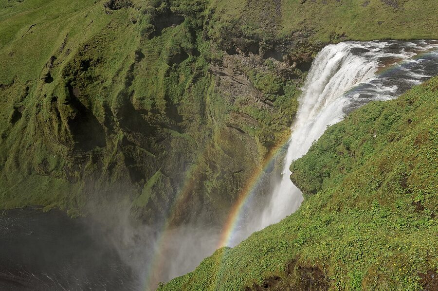
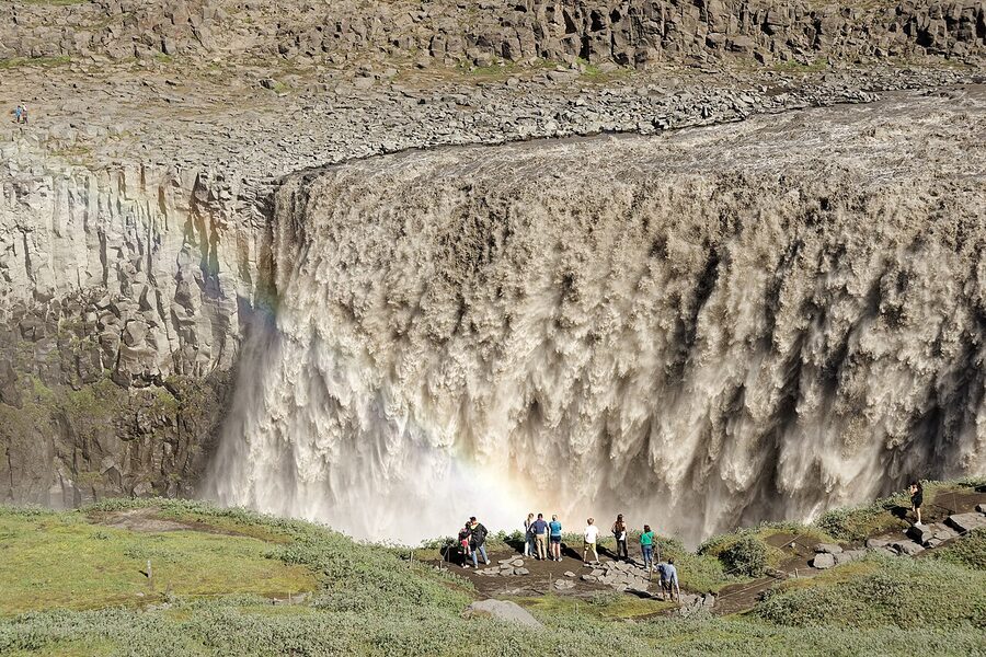
About two thirds of the way there, take the signed turning for Dettifoss, the most powerful waterfall in Europe by volume. 500 cubic metres of water per second drops 45 metres into a basalt canyon and throws a permanent rainbow if there’s any sun at all. Two routes get you there: Route 862 from the west (paved, easy, the side most coach tours use) and Route 864 from the east (gravel, rougher, smaller crowds). The west side has been improved with a proper viewing platform. Allow 90 minutes for the detour.
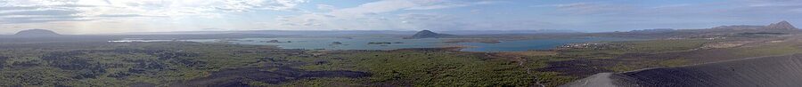
Just upstream of Dettifoss is Selfoss (the waterfall, not the south-coast town), a wider but lower set of falls 20 minutes’ walk further. Easy to combine. Downstream from Dettifoss, the Jökulsárgljúfur canyon stretches north all the way to Ásbyrgi, a horseshoe-shaped cliff bowl that Norse legend says is the hoofprint of Odin’s eight-legged horse Sleipnir. It’s a 45-minute drive from Dettifoss, properly out of the way, but if you’re a Norse mythology nerd or just like a quiet hike, it’s worth the diversion.
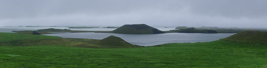
Push on to the Mývatn area. This is one of the densest concentrations of geological weirdness in the country: a shallow lake ringed with pseudo-craters, a black-castled lava field at Dimmuborgir, the steaming sulphur mud pots of Hverir, the geothermal area at Krafla with a still-active caldera, and the Mývatn Nature Baths, which are essentially the north’s quieter, half-priced answer to the Blue Lagoon. Entry is around 6,500 ISK. The view across the lava field as the sun sits low at 10pm in summer is worth the entry on its own.
You’ll want at least a half day at Mývatn. Some people give it two. If you can spare an extra night here, do.
Where to stay at Mývatn
Sel-Hotel Mývatn sits at Skútustaðir, on the south side of the lake, near the pseudo-craters. Solid, family-run, around 30,000 to 45,000 ISK in summer. Fosshotel Mývatn is the larger, modern option at Reykjahlíð on the north shore, 35,000 to 55,000 ISK. Icelandair Hotel Mývatn is also at Reykjahlíð and has a slight edge on the views from some rooms. Reykjahlíð has the only Vínbúðin (state liquor store) and the Mývatn Café for a cheap-ish dinner.
Day 5: Mývatn to Akureyri, with a Húsavík detour (~140 km direct, 250 km with Húsavík)
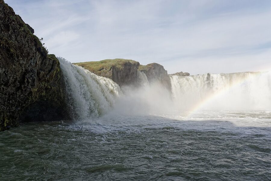
Out of Mývatn, the road climbs up over the Vaðlaheiði tunnel (one-way toll, 1,800 ISK each way, paid online via vegagerdin.is) and drops down into the Eyjafjörður valley. About halfway there is Goðafoss, the “Waterfall of the Gods”. Twelve metres high, thirty metres wide, a perfect horseshoe shape. The legend is the kind of thing Iceland is good at: in the year 1000, the lawspeaker of the Althing, Þorgeir Ljósvetningagoði, was tasked with deciding whether the country should officially convert to Christianity. He spent a day under a fur cloak thinking about it, declared in favour, and then on his way back north threw his old pagan idols into these falls to make the point. The car park is a hundred metres from the lip and parking is free. Both banks have viewpoints. The east bank gives you the wider angle.
If you have an extra half day and the weather is settled, take the 45-minute detour from Mývatn north to Húsavík, Iceland’s whale-watching capital. The harbour has the country’s most consistent humpback sightings, and the smaller, faster RIB tours leave from the same dock as the traditional oak schooners. Operators worth booking are North Sailing (the original, traditional boats) and Gentle Giants (slightly faster RIBs). A 3-hour tour runs about 13,500 ISK. The Húsavík Whale Museum in town is genuinely good, around 2,500 ISK entry. We’ve covered the country’s whale-watching options properly in the Iceland wildlife guide.
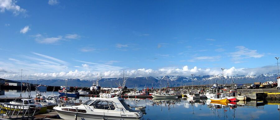
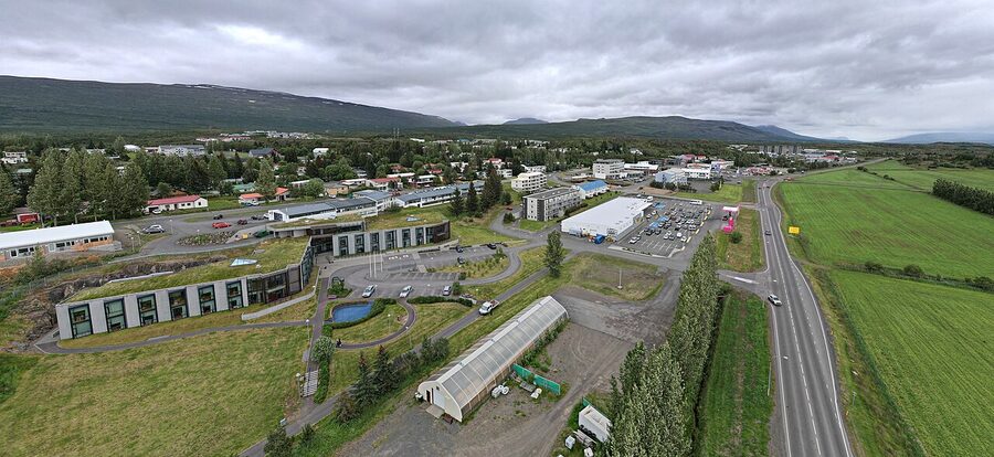
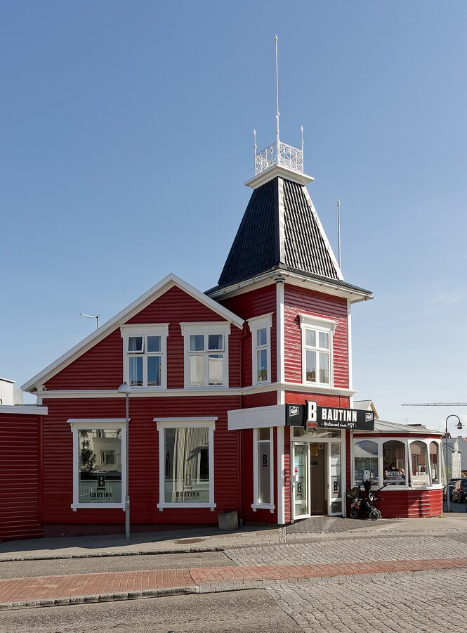
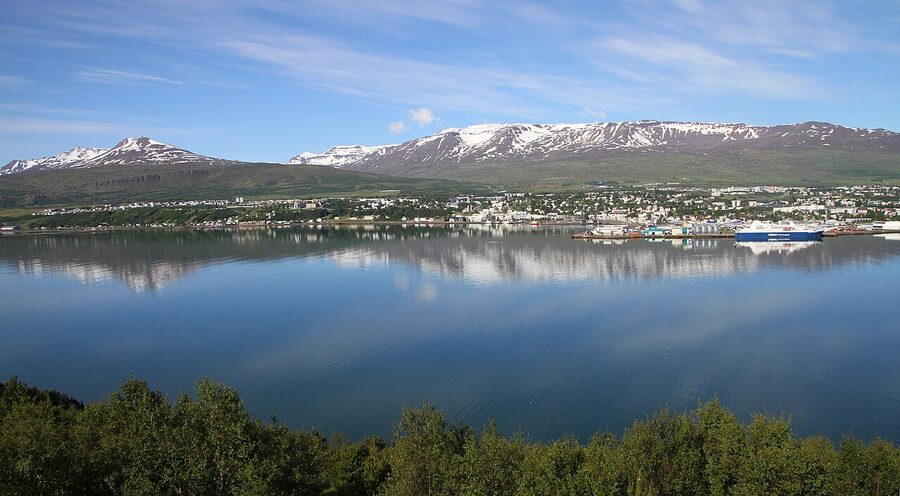
From Goðafoss it’s another 50 km to Akureyri, Iceland’s “second city” with a population of about 18,000. By Icelandic standards this is a metropolis. There’s a proper grid of streets, real cafes, the only botanical garden north of the Arctic Circle, and the town swimming pool is one of the best in the country. Park anywhere central, walk the main shopping street Hafnarstræti, eat at Strikið or Rub23, and have a swim at the open-air pool (around 1,400 ISK).
Where to stay in Akureyri
Hotel Kea is the long-running town-centre choice, opposite Akureyri’s church. It is not flashy but it’s well-located, around 28,000 to 45,000 ISK in summer. Icelandair Hotel Akureyri sits a few blocks south on Þingvallastræti, has more reliable rooms, around 30,000 to 50,000 ISK. For something more boutique, Hotel Apótek occupies a converted pharmacy on Hafnarstræti and has the best dinners.
Day 6: Akureyri to Borgarnes via Tröllaskagi (~430 km, 5 to 6 hours driving)
This is the longest driving day of the loop. Out of Akureyri, the Ring Road heads west around the base of Tröllaskagi, the Troll Peninsula. The fast option is to stay on the 1 and skirt the bottom. The much better option, if you have the time and you’ve not packed too much else into the day, is to take Route 76 over the top via Dalvík, Ólafsfjörður, and Siglufjörður. This adds about two hours and a few one-way tunnels, and it gives you one of the country’s prettiest small-town stretches.
Siglufjörður was once the herring capital of the world. The town’s Herring Era Museum (open June to August, 2,800 ISK) is unexpectedly excellent and has been short-listed for European Museum of the Year more than once. The harbour is photogenic, the main square has a couple of decent cafes, and the surrounding mountains feel close enough to touch. Hofsós, the other Tröllaskagi stop, has a famous infinity-edge thermal pool overlooking Skagafjörður. Entry around 1,200 ISK. The view across the fjord while you’re chest-deep in geothermal water is one of those quintessentially Icelandic experiences nobody talks about because the queue isn’t long.
Past Tröllaskagi, the road runs west across the broad grasslands of north-west Iceland. Hvammstangi, on the Vatnsnes peninsula, is worth pulling off for if you have any interest in seals. The Icelandic Seal Centre in town does a free overview and points you to the nearby beaches at Illugastaðir and Hvítserkur where you can usually see harbour seals hauled out on the rocks. We’ve written about Iceland’s wildlife in more depth in the animals of Iceland piece.
Then it’s another two hours south to Borgarnes, the western service town facing the Borgarfjörður estuary. Population about 2,000. There’s a Bónus, an N1, and the Settlement Centre museum which tells the story of the original Norse settlers. Worth an hour if you have it. The town itself isn’t much of a destination, but it’s the natural overnight before the run back to Reykjavik.
Where to stay around Borgarnes
Borgarnes itself is fine but unexciting. The much better choice if your budget stretches is Hotel Húsafell, about 70 km inland up the Borgarfjörður valley, in the kind of countryside Halldór Laxness wrote his novels about. Hotel Húsafell is genuinely lovely and pricey to match (60,000 to 90,000 ISK). It is the upgrade you take if you’re treating yourself on the last full night of the trip. For a cheaper option in Borgarnes town, the Hotel Borgarnes is competent and walkable.
Day 7: Borgarnes to Reykjavik via Reykholt (~140 km, 2 hours plus stops)
The last day is the gentlest. Out of Borgarnes, take the inland route up through the Borgarfjörður valley to Reykholt, where Snorri Sturluson lived in the 13th century. Snorri wrote the Prose Edda, the major source for everything we know about Norse mythology, and was murdered in his cellar in 1241 by enemies of the Norwegian king. The cellar (Snorralaug) is still there, restored as a small geothermal bath he is said to have used. The Snorrastofa cultural centre next to the church is worth half an hour. We talk about Snorri and the other major figures in the Icelanders worth knowing about piece, and the broader settlement period in the history of Iceland.
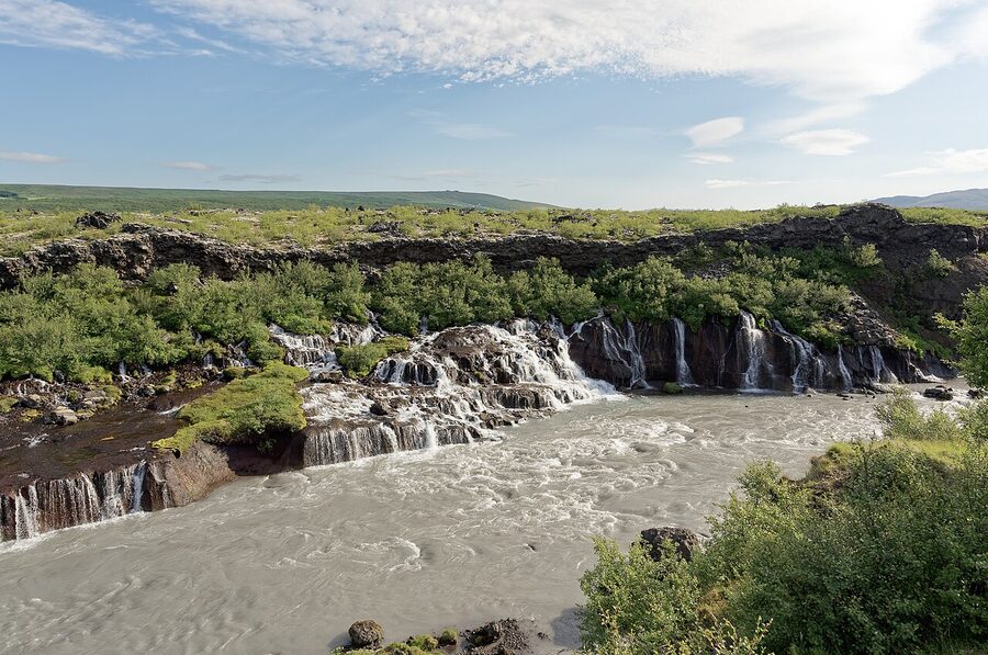
Twenty minutes further up the valley are Hraunfossar (“lava waterfalls”) and Barnafoss (“children’s falls”). Hraunfossar is the strange one: instead of a single waterfall, hundreds of small streams emerge from the front of a hardened lava flow and run a kilometre down into the Hvítá river. Barnafoss is right next to it, a single short, violent chute. Both share the same car park, free, and the walk between them is ten minutes.
Five minutes back south is Deildartunguhver, Europe’s most powerful hot spring, pumping out 180 litres a second of 97-degree water. Most of it is piped 40 km to heat homes in Borgarnes and Akranes. There’s a small viewing platform at the spring itself, and the very nice Krauma geothermal baths next door (open year-round, around 5,400 ISK).
From Reykholt, drop back down to Route 1 and head south. Borgarnes-Reykjavik is an hour. You’ll come back across the Hvalfjörður tunnel (free since 2018) and into the city in the late afternoon. Drop the car at Keflavík if you’re flying out the next morning, or at the city office if you have one more night in Reykjavik. The Reykjavik 2-to-5 day itinerary covers what to do with a final evening or two in the capital.
The things you will skip on a Ring Road, and that’s fine
The Ring Road is the country’s spine. It is not the country. Three regions are not on it, and depending on your interests, one or more of these is where you’d spend a return trip.
The Westfjords are the upper-left blob on the map, accessed by Route 60 north from Borgarnes. Allow three days minimum. They’re emptier, steeper, and more dramatically fjord-y than anywhere on the Ring Road. The bird cliffs at Látrabjarg are one of the great wildlife sites in the North Atlantic, the Hornstrandir nature reserve is a backpacker’s paradise, and the Dynjandi waterfall is a stair-step monster. Go in summer; many of the roads close from October.
The Highlands are the interior, accessed by F-roads (highland roads) that are legally restricted to 4WD vehicles with high ground clearance, often involving river crossings. They open mid-June to early September depending on the snow. Landmannalaugar, Þórsmörk, Askja, and Kerlingarfjöll are the headline destinations. Easiest with a guided super-jeep day from Reykjavik or Akureyri, or a multi-day camping trek.
The Snæfellsnes peninsula sticks out west from Borgarnes, often called Iceland in miniature because it has glaciers, lava fields, fishing villages, and one of the country’s most photographed mountains (Kirkjufell) all packed into a 90 km loop. It adds a comfortable day and a half to your trip and it’s the easiest add-on. We’ve covered it in the Snæfellsnes guide.
The Westman Islands are 30 minutes by ferry from Landeyjahöfn (1.5 hours west of Vík). Day-trippable, with one of the most active puffin colonies in the world from May to August. Add it to Day 1 if you’re starting clockwise.
Costs in plain numbers
Iceland is not a budget destination. Pretending otherwise leads to bad decisions at the rental desk and grumpy lunches at petrol stations. Here is a realistic seven-day Ring Road budget for two people in mid-2026 ISK. Convert to your own currency at today’s rate.
- Car rental, 4WD with full insurance bundle: 175,000 to 250,000 ISK for the week.
- Fuel and the per-kilometre road charge: 50,000 to 70,000 ISK over ~1,500 km. Note that since January 2026 Iceland replaced fuel duties with a per-kilometre road charge of about 6.95 ISK per km for a standard passenger car. Pump prices are lower than they were, but the rental company collects the road charge either as a flat daily rate or via the odometer at return. Net effect: similar overall cost.
- Accommodation, 6 nights mid-range: 90,000 to 180,000 ISK for two in a double room.
- Food, mix of self-catering and restaurants: 70,000 to 140,000 ISK for two over the week.
- Activities (glacier hike, whale watch at Húsavík, Mývatn Nature Baths, Stokksnes access, occasional museum): 50,000 to 150,000 ISK for two depending on choices.
Total for a comfortable mid-range trip for two: roughly 480,000 to 790,000 ISK, or about 3,400 to 5,600 EUR at current rates. You can shave 25 percent with hostels and serious self-catering. You can double it with luxury hotels and daily booked tours. Reykjavik is the most expensive base; the east and north are the cheapest.
The biggest budget surprise for most people is food. Eating dinner out in Iceland for two with drinks lands at 25,000 to 35,000 ISK most nights. Doing that every night for a week is real money. The mitigations are the ones you’d guess. Stay at guesthouses with kitchens. Hit Bónus or Krónan in the larger towns. Picnic at the waterfalls. Treat yourself once at Pakkhús in Höfn for langoustine and once at Strikið in Akureyri, and self-cater the rest.
Weather, daylight, and when to go
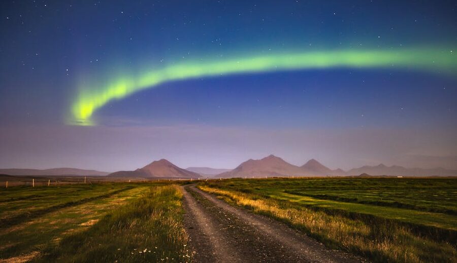
The sweet spot for a Ring Road trip is late June through mid-September. You get near-endless daylight, all roads open, the F-road detours into the Highlands available if you’ve added them on, and weather that is variable but rarely catastrophic. Mid-July is the absolute peak: book everything at least three months ahead, and budget for peak prices. The detail of what each month brings is in our when to visit Iceland piece and the broader Iceland climate guide.
Late September and early October are my own favourite shoulder. Crowds drop off sharply after the first week of September. The first frost dustings on the mountains arrive late September. The aurora season is starting. Prices ease. The catch is that the East Fjords stretch becomes weather-dependent earlier than the rest, and a serious storm can cost you a full day.
October to April is winter Ring Road country, and I’d be straight with you about the difficulty. Daylight in late December is around 11:30 to 15:30, four hours of usable light. Many days a storm will park itself across part of Route 1 and you’ll be sitting in a cafe in Vík watching the closure map at road.is. The East Fjords stretch between Breiddalsvík and Egilsstaðir is particularly prone to closure. If you really want a winter loop, allow at least ten days, rent a 4WD with studded tyres, and have a flexible plan. Otherwise, do the south coast properly in winter and save the full Ring Road for summer.
The Met Office at vedur.is issues colour-coded weather warnings (green, yellow, orange, red). Yellow is “be careful.” Orange is “stay off the roads if you can.” Red is “do not drive, the insurance won’t cover damage caused by ignoring this warning.” Take them seriously. Winter wind east of Vík has shoved cars sideways across both lanes. People die in those conditions every winter, and most of them are tourists who didn’t read the colour code that morning. The official safety site at safetravel.is lets you log your route so search and rescue knows where to look if you don’t check in.
Five things that catch people out
Accommodation scarcity in Vík, Höfn, Mývatn, and Egilsstaðir. These four towns have properly limited beds, and they fill up months ahead in summer. If you’re travelling in July or August, book the whole loop’s accommodation at least three months out. Booking just the first night when you arrive is one of the most common Ring Road mistakes I hear about. Wild camping is not legal, so “we’ll figure it out” doesn’t work.
The parking-app trap at south coast waterfalls. Seljalandsfoss, Skógafoss, Skaftafell, and most other major south-coast stops now charge for parking via the Parka.is app or EasyPark. Install the apps before you land. Pay the moment you park. Enforcement is aggressive and the fines are 10,000 to 15,000 ISK. People get ticketed on ten-minute photo stops because they thought “we’ll be back before anyone notices.” The parking officials always notice.
Reynisfjara sneaker waves. See Day 2 above. Six deaths since 2013, the most recent in 2025. Stay back. Do not turn your back on the ocean.
The F-road temptation. Somewhere around Day 3 you’ll be in a 2WD car and you’ll see a gravel side road heading off somewhere dramatic. F-roads (the ones with an F prefix) are legally restricted to 4WD vehicles. Your insurance will explicitly exclude damage from F-road driving. Damaged undercarriages are not covered, and a tow off an F-road can cost more than the car was worth. If you want F-roads, rent a proper 4WD from the start and confirm in writing that the insurance covers them. It often still doesn’t cover river crossings.
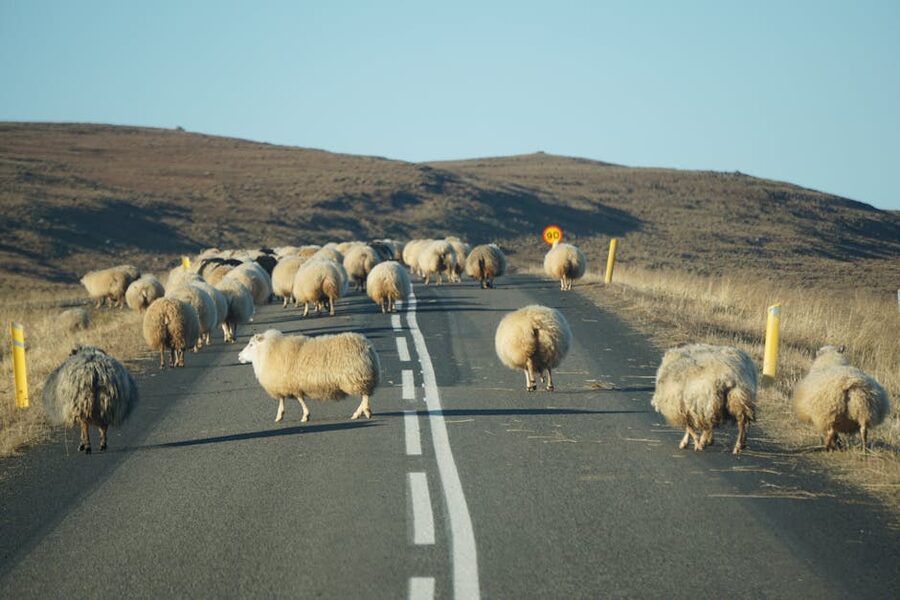
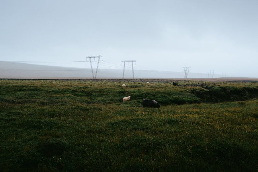
Sheep on the road. Not a joke. Icelandic sheep are free-range from May to September and they treat the road as additional pasture. Slow down for any animal you can see. Don’t honk; they panic in unpredictable directions. If you hit one, you legally owe the farmer the value of the animal. Keep the speed down on rural stretches especially in the morning and evening.
Single-lane bridges, tunnels, and one-way etiquette
Route 1 has 32 single-lane bridges, almost all of them in the south and east. The rule is the simplest in the world, and Icelanders treat it as a moral matter: whoever gets to the bridge first goes first. If you arrive together, the closer vehicle has priority. There are no signs and no signals; you read the situation and act. If you’re not sure, slow down well before the bridge and stop in a layby with your headlights on. The other driver will flash and wave you through.
Several of the longer Iceland tunnels are one-way with passing places. The Vaðlaheiði tunnel between Akureyri and Mývatn is two-way and tolled (1,800 ISK each way). Older tunnels you might encounter on the Tröllaskagi detour, like the Strákagöng outside Siglufjörður, are sometimes one-way with timed passing. You give way to oncoming traffic by pulling into the lit bays. It feels strange at first and is fine after the second one.
Right of way in Iceland defaults to the right at any unmarked junction. Roundabouts: inner lane has priority. Speed limits are firm and cameras are everywhere. The fines are not negotiable.
If you have nine or ten days, this is what I’d do
The 7-day version above works. The 9-day version is meaningfully better. Here’s where I’d add the days:
An extra day at Skaftafell or Höfn. Day 2 is the heaviest day of the loop, and Skaftafell deserves a full day on its own for a proper glacier hike on Falljökull, or a winter ice cave tour, or just for the hike up to Svartifoss and the sit on a rock with a sandwich watching the glacier. Sleep at Hotel Skaftafell or Fosshotel Glacier Lagoon to put yourself close.
An extra night at Mývatn. The geological density of the Mývatn area genuinely warrants two nights. Day 1 of two: lake loop, pseudo-craters, Dimmuborgir, Mývatn Nature Baths in the evening. Day 2: Krafla and Hverir in the morning, Húsavík for whales after lunch, Goðafoss late afternoon, sleep in Akureyri.
A Snæfellsnes loop on the way back. Adds a day and a half. Sleep at Hotel Búðir on the south side or Fosshotel Stykkishólmur on the north. The peninsula loop covers Kirkjufell, Arnarstapi, Djúpalónssandur, and Snæfellsjökull glacier, and is one of the most rewarding side trips in the country.
The 14-day version replaces or extends one of those with a Westfjords loop, which deserves its own piece and which you should treat as a separate trip rather than a tail to a Ring Road.
What I’d do, if it was me
Nine days, clockwise, late June or early September. 4WD even in summer because the spare ground clearance opens up the side roads. Sleep in Vík, Höfn, Egilsstaðir, Mývatn (two nights), Akureyri, Húsafell or Borgarnes. Glacier hike at Skaftafell. Whale watch at Húsavík. Mývatn Nature Baths instead of the Blue Lagoon. Langoustine at Pakkhús in Höfn. Snæfellsnes loop on the way back to Reykjavik for the final night before the flight. That trip costs about 600,000 ISK for two travelling mid-range, and it gives you the country properly without the panic of doing it in a week.
If you do nothing else from this guide, take three things with you. Book Vík, Höfn, Mývatn, and Egilsstaðir at least three months ahead. Pay the parking immediately at every south-coast stop. Stay back from the water at Reynisfjara. The trip largely manages itself once you’ve got those right.
Useful companions on the road: the daily road status at road.is, the weather forecast and aurora index at vedur.is, the safety site at safetravel.is, and the Vatnajökull National Park site at vatnajokulsthjodgardur.is for Skaftafell and the glacier-area rules. Have those four bookmarked, check them in the morning of any uncertain day, and the country tells you what it wants you to do.
Góða ferð. Drive safely, leave the sheep alone, and take more photographs than you think you need to.

.jpg)