You came back. Of course you did. The first trip checked the boxes that everyone tells you to check, Reykjavík for a couple of nights, the Golden Circle in a long minibus day, the South Coast as far as Vík with the obligatory stops at Seljalandsfoss and Skógafoss and Reynisfjara, and probably a Blue Lagoon dip somewhere in the middle. You drove past Eyjafjallajökull thinking about the 2010 ash cloud, you stood in the wind at Geysir waiting for Strokkur to spit, and at some point a tour guide said the word “þetta reddast” and you thought it sounded sensible. Then you went home and the country wouldn’t leave you alone.
That’s how it usually works. The first trip is Iceland greeting you at the door. The second is the country actually inviting you in. I get a steady trickle of emails from people who’ve done the loop once and want to know what to do the next time, and the answer is almost never “another circuit of the same sights.” It’s go where you didn’t last time. Go slower. Go in the opposite season. Pick one region and live in it for a week instead of clipping past in an afternoon.
This is the long version of that conversation. I’ll walk through the regions I’d push you towards, the activities that genuinely level up after the entry-tier versions you did last time, the seasons that change the whole feel of the country, and a couple of itineraries that put it all together. I’ll also tell you what’s still worth doing even though you’ve technically “done” it, and what isn’t.
In This Article
- The Baseline I’m Assuming You Already Did
- Westfjords as the Obvious Headline
- Dynjandi, Látrabjarg, and the Westfjords Big Three
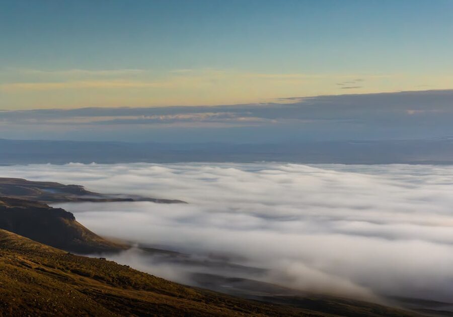
- Hornstrandir, the Empty Quarter
- East Fjords, the Slow Quarter
- Seyðisfjörður and the LungA Crowd
- Borgarfjörður Eystri and the Other Puffin Cliff
- Stokksnes and Vestrahorn at Sunrise
- North Iceland, Going Deeper Than Mývatn
- Akureyri as a Base
- Mývatn for Three Days, Not Three Hours
- Húsavík, Whale Capital
- Tröllaskagi, the Troll Peninsula
- Snæfellsnes in Winter, the Mini-Iceland
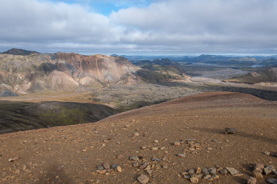
- The Highlands, 4×4 Only, Summer Only
- Landmannalaugar
- Þórsmörk
- Kerlingarfjöll
- Askja
- Westman Islands, the Day-or-Two Trip
- Reykjanes After the Eruptions
- Underrated South-East: Lón, Stafafell, Vestrahorn
- Slower Style and Where to Stay
- Activities, Levelled Up
- Best Repeat-Visit Seasons
- Don’t Skip Even on a Second Trip
- Three Itineraries
- 7 days, Westfjords loop
- 10 days, East and North
- 14 days, full-island slow
- Booking and Tour Operators
- Practical Plumbing for the Second Trip
- The Country Doesn’t Run Out
The Baseline I’m Assuming You Already Did
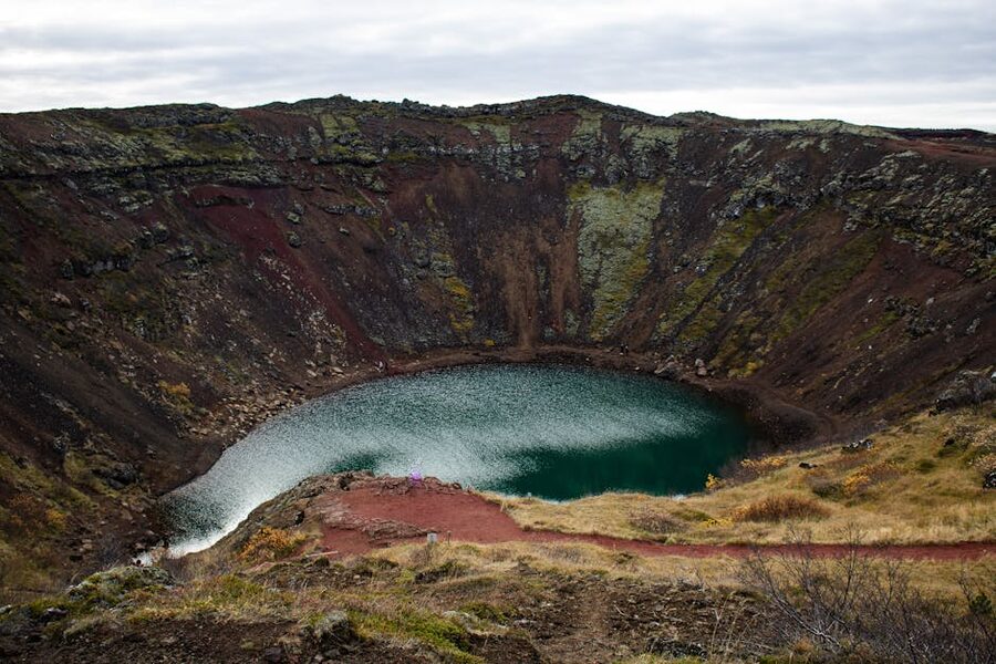
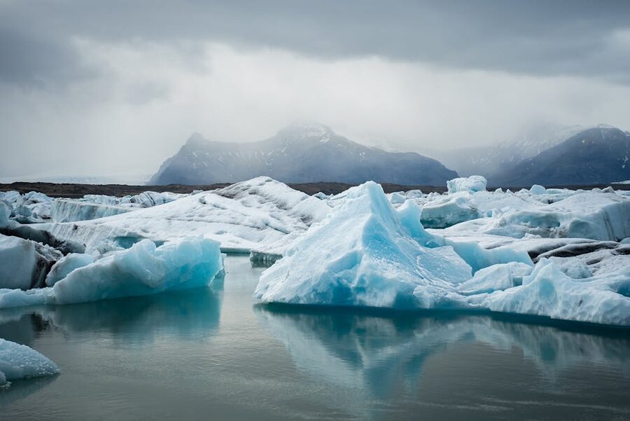
Before we go any further, let’s nail down the baseline. When I say “second trip,” I’m assuming you’ve ticked off the standard first-time loop: at least one full day in Reykjavík including a 101 walk and a Saturday at Laugardalslaug if you got lucky, the Golden Circle in some form (Þingvellir, Geysir, Gullfoss, often plus Kerið), the South Coast at least to Vík with the falls and the black-sand beach, and probably one dip at the Blue Lagoon or Sky Lagoon. Maybe you also did Jökulsárlón as a long day-trip from a base in Vík or Höfn. That’s the package that 80% of first-timers run, and it’s a fine package. It’s just not the country.
If you didn’t get to Jökulsárlón last time, that becomes the one piece of the standard loop I’d still push you to do on your second trip. Diamond Beach next to it, the kayaking among the icebergs in summer, the boat tour into the lagoon itself. It’s a 4–5 hour drive from Reykjavík one way, which is why a lot of people skip it on a short first visit. Don’t skip it twice.
Westfjords as the Obvious Headline

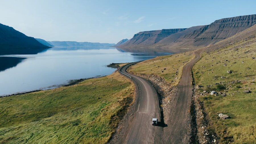
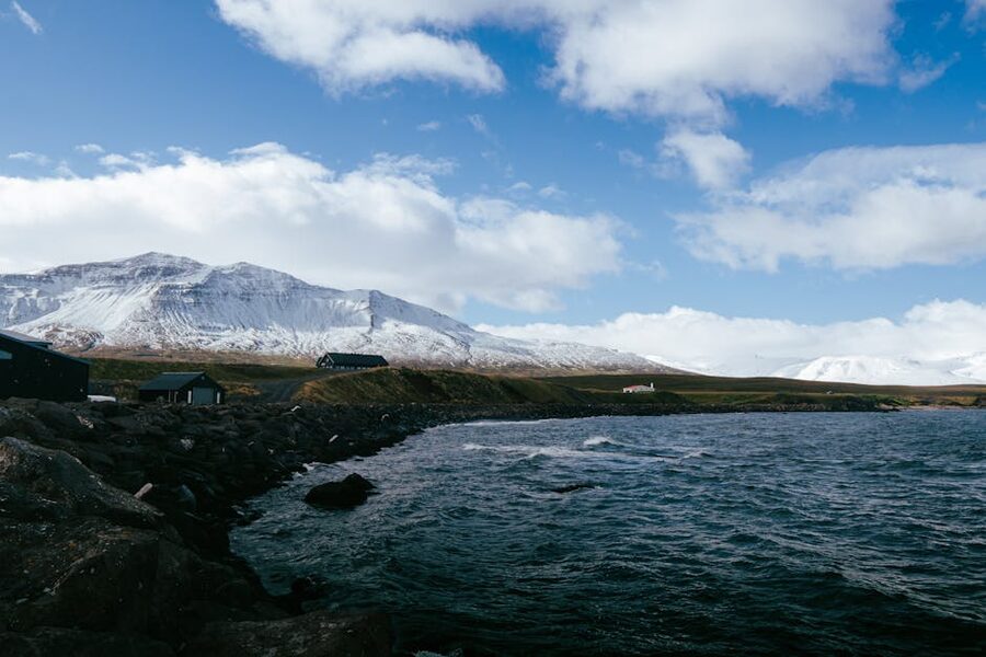
The Westfjords are where I’d send most second-time visitors, and there’s a structural reason for it: the region was bypassed by Route 1 in the 1970s, which means the same wave of mass tourism that hit the south never quite arrived here. Roads are slower. Petrol stations are further apart. The fjords are deeper and the cliffs higher than anywhere else on the island. And the population for the whole region is around 7,000 people, most of whom are in Ísafjörður.
The physical shape of it matters too. The Westfjords are a peninsula attached to the rest of Iceland by a narrow strip of land at the top of Breiðafjörður bay. From Reykjavík you’ve got two ways in: drive the long way around through Borgarnes and the Strandir coast, which takes a full day, or do what most locals do in summer and take the Baldur ferry from Stykkishólmur on the Snæfellsnes peninsula across to Brjánslækur in the southern Westfjords. The crossing is about 2.5 hours, runs twice daily in the summer season (1 June to 31 August), and once daily the rest of the year. Ferja.is and seatours.is publish the live timetable. Book ahead in July and August.
What I’d actually do for a week in the Westfjords:
- Day 1: Reykjavík to Stykkishólmur (around 2.5 hours), board the afternoon Baldur, arrive Brjánslækur, drive 1.5 hours to your base in Patreksfjörður or near Látrabjarg. Buy groceries at Bónus before you leave the south, the prices in Patreksfjörður are higher and selection thinner.
- Day 2: Látrabjarg cliffs at sunset for puffins. The cliffs face west, so the light is on the puffins from about 18:00 onwards in summer. Then back to Patreksfjörður for the night.
- Day 3: Drive north over the Dynjandisheiði heath to Dynjandi waterfall. Dynjandi is the second waterfall in the country I’d actually push you to climb up to, after Glymur. It’s a 15-minute walk up past six smaller falls before you reach the giant one at the top, shaped like a wedding cake. Continue to Þingeyri or Ísafjörður.
- Day 4: Day in Ísafjörður and surrounds. Walk the old harbour, eat at Tjöruhúsið, take the road around Súðavík to the Arctic Fox Centre.
- Day 5: Hornstrandir day trip from Ísafjörður (more on this in a second).
- Day 6: Drive east across the Strandir coast to Hólmavík. Stop at the Museum of Icelandic Sorcery and Witchcraft, which sounds like a tourist trap but is genuinely strange and worth the hour.
- Day 7: Down through Drangsnes and back to Reykjavík via Borgarnes. Long driving day, around 6 hours total.
Dynjandi, Látrabjarg, and the Westfjords Big Three
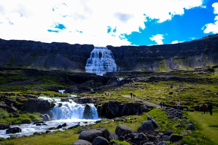
Dynjandi (the name means “the thunderer”) is the headline waterfall of the region and one of the few falls in Iceland I’d argue is worth a 90-minute detour from your driving line. It’s 100 metres tall and shaped like a fan, narrowing at the top and broadening into a 60-metre wide spread at the bottom. The walk up takes 15 minutes, passes five smaller named falls, and is rough but not difficult. Bring a windproof, the spray reaches the path on a strong day.
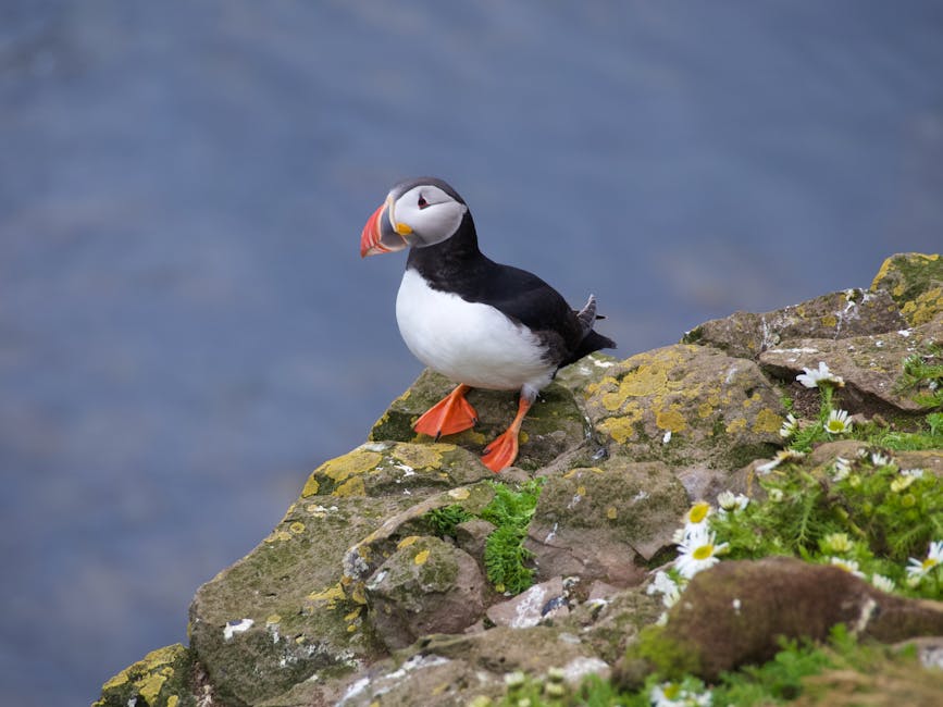
Látrabjarg is the bird cliff, 14 km long and up to 440 metres tall, the westernmost point of Europe if you don’t count the Azores. From mid-May to late August it’s stuffed with nesting puffins, razorbills, guillemots, and fulmars. The puffins here are unusually relaxed about people, which is why every Iceland nature documentary has its puffin shots from this exact cliff. Late evening, around 19:00 to 22:00, gives you the best light and the most birds back from feeding. The drive in from Patreksfjörður is gravel and slow, allow 90 minutes one way for what Google Maps will tell you is 50.
Ísafjörður is the third leg. The town sits on a sandbar inside its own fjord, surrounded by 800-metre-high mountains that close in tightly enough that the sun disappears behind them on November 13 and doesn’t come back over the rim until 25 January. There’s a decent café scene for a town of 2,600, the harbour is still working, and Tjöruhúsið down by the old timber buildings does a fish-of-the-day at lunch and a buffet of every fish landed that morning at dinner that’s the best meal in the region.
Hornstrandir, the Empty Quarter
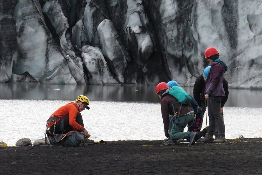
Hornstrandir is the abandoned northern tip of the Westfjords, a 580 km² nature reserve that hasn’t had permanent residents since 1952. The Iceland Environment Agency (ust.is) manages it, there are no roads, no shops, and no mobile signal across most of it. What you do is take a boat from Ísafjörður (operated by Sjóferðir, sold through West Tours) for a day trip or a multi-day camping trip, and walk.
The boat season is mid-June to early September. Outside that window, you cannot get to Hornstrandir; the boats don’t run, there are no scheduled flights, and the snow makes the trails impassable anyway. Even in season, the weather can pin you in for a day or two, so build slack into multi-day plans. The popular day option is the boat to Hesteyri (an abandoned village with one café in the old doctor’s house), a five-hour walk around the bay, and the boat back the same evening. The big multi-day classic is the four-day Hornvík loop, which involves real backcountry skill and a tent. If you’ve never camped wild in Iceland, do Hesteyri first.
The arctic fox is the only native land mammal here. There’s a research project at arcticfoxcentre.com in Súðavík; the Hornstrandir foxes are famously bolder than elsewhere because nobody hunts them, and you’ve got a real chance of seeing one walk past your tent at midnight in July. Bring binoculars regardless.
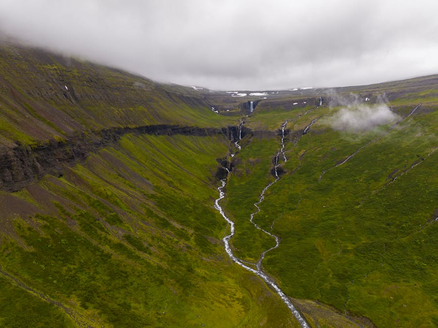
East Fjords, the Slow Quarter
The East Fjords are the section of the Ring Road that everyone driving counter-clockwise hits on day three and everyone clockwise hits on day eight, and almost nobody stops in. The locals call it “the slow quarter” and they’re right. Single-lane tunnels, fishing villages built around herring industry that left in the 1960s, the only ferry port in the country (Seyðisfjörður), and the only herd of wild reindeer.
For a second trip I’d give the east three days minimum. Most people give it a long lunch in Egilsstaðir and a photo stop in Djúpivogur. Worth more than that.
Seyðisfjörður and the LungA Crowd
Seyðisfjörður sits at the end of a 17-km fjord at the bottom of a 600-metre-deep valley, reached by Route 93 over a mountain pass that closes in winter. The town is around 700 people. It has the country’s most photographed wooden church (the powder-blue one at the end of the rainbow-painted street), a café and gallery scene that punches well above its size, and the only car ferry connection to mainland Europe, the Smyril Line’s Norröna, which docks once a week from Hirtshals in Denmark via the Faroes.
The annual LungA arts festival in mid-July is the country’s strongest small-town festival, a mix of music, gallery openings, and workshops. If you’re flexing your trip dates around something, that week is worth it. Hotel Aldan (on Booking) is the obvious place to stay; the Post Hostel (on Booking) is cheaper and run by the same people.
Borgarfjörður Eystri and the Other Puffin Cliff
Borgarfjörður Eystri is a 70-km detour off Route 1 north of Egilsstaðir, and it’s worth the hour each way for the Hafnarhólmi puffin colony. Unlike Látrabjarg, where you walk the cliff top, here a small wooden viewing platform is built into the rocks and the puffins nest right next to the railing. From late April to mid-August. The light’s better in the evening because the cliffs face west.
The village of Bakkagerði (population 90) has the second LungA-related fixture, the Álfaborg “elf rock” overlook with views back across the fjord, and a tiny art museum dedicated to Icelandic painter Jóhannes Kjarval, who grew up here. There’s one decent guesthouse (Álfheimar) and one café (Fjarðarborg). That’s the village. It’s enough.
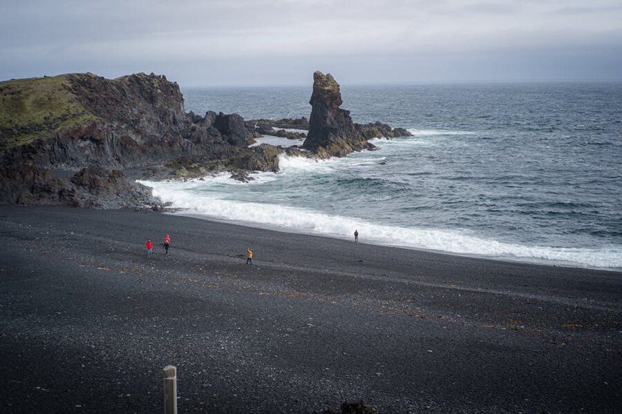
Stokksnes and Vestrahorn at Sunrise
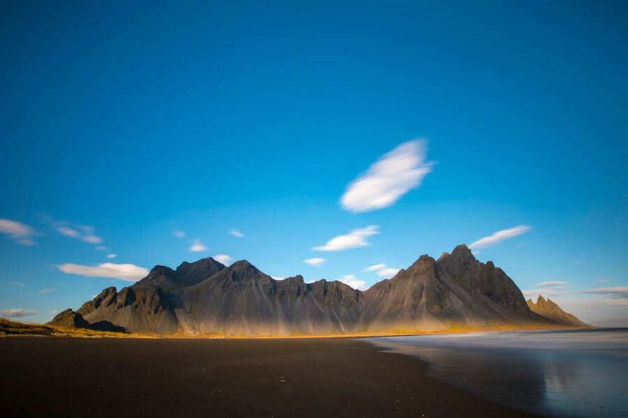
Stokksnes is the headland 10 km east of Höfn where the Vestrahorn mountain reflects in the wet black sand at low tide. It’s privately owned (the Viking Café charges a 1,000 ISK entry fee) and it’s the most photographed mountain in southeast Iceland, which means the bus tours roll in from about 11:00 onwards. Get there at sunrise. In summer that’s around 03:00 (technically a non-issue because the sun barely sets), in winter it’s around 11:00 and you have a 15-minute window. Either way, you’ll likely be alone with the mountain for the best of the light.
While you’re there, check the tide. The reflection only works at low to mid tide; high tide and the lagoon is gone. Vedur.is has the marine forecast.
North Iceland, Going Deeper Than Mývatn
If your first trip was a Ring Road sprint, you saw Mývatn from the highway, did Goðafoss in 20 minutes, and slept in Akureyri before pushing on. The north rewards a slower week. Akureyri alone is worth two nights, the Mývatn area genuinely needs three days, and the Tröllaskagi peninsula and the Diamond Circle each add another full day.
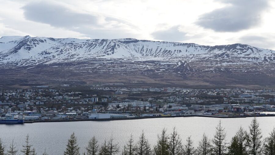
Akureyri as a Base
Akureyri is the second-largest urban area in Iceland, about 19,000 people, sitting at the head of Eyjafjörður on the north coast. It has its own airport with a 45-minute flight from Reykjavík (Icelandair operates several daily) and an entirely different microclimate from the south, drier in summer and snowier in winter. The town centre is walkable in an hour, the heated outdoor pool (Sundlaug Akureyrar) is one of the country’s better ones, and Bautinn the diner does a lamb stew that’s the right thing on a cold day.
For accommodation, Hotel Akureyri Resort (on Booking) is the most central option; the Akureyri Cottages (on Booking) above town are good if you’ve got a car. Skip the airport hotels, they’re 5 km out and the bus connection is poor.
Mývatn for Three Days, Not Three Hours

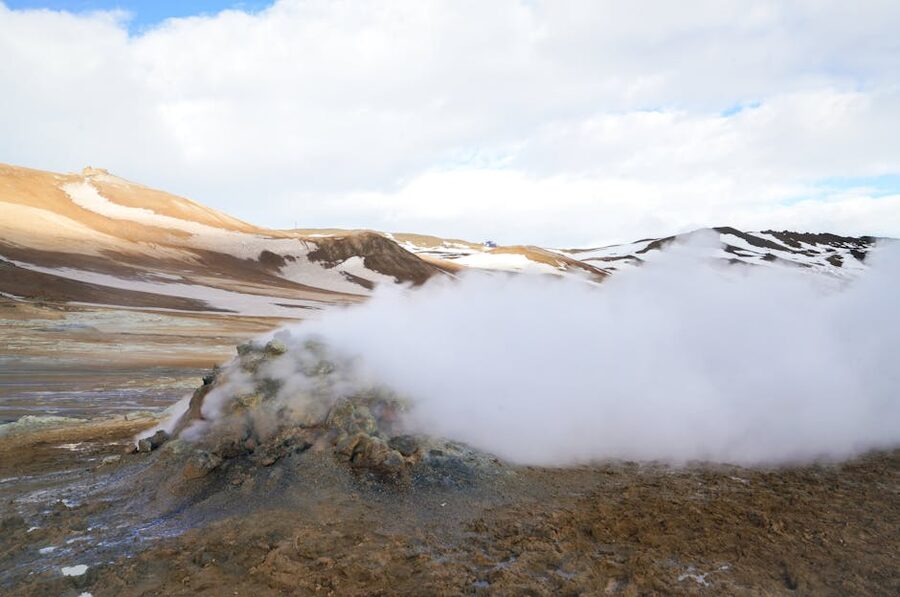
The Mývatn area is geothermal weirdness on a scale you won’t see anywhere else. Lava fields the size of small countries, pseudocraters that look like volcanoes but aren’t, the Krafla eruption fissures from 1975–84 still steaming, the Hverir mud pools, the Námafjall sulphur ridge, and Dimmuborgir’s lava castles. Three days here lets you do them at a walk-around pace.
Day one I’d give to the lake itself: the Skútustaðir pseudocraters, Höfði nature reserve, the boardwalks at Dimmuborgir. Day two to the Krafla side: the Hverir mud pools (smell of sulphur, no admission), Námafjall ridge, and the Mývatn Nature Baths in the late afternoon. Day three to the Diamond Circle: Dettifoss (Europe’s most powerful waterfall by volume, signed off Route 862 from the west, paved approach), Ásbyrgi canyon, and a stop at Húsavík for whales. My Mývatn deep-dive walks through it section by section.
For sleeping, Fosshotel Mývatn (on Booking) is the corporate-but-comfortable option; the Hlíð Cottages (on Booking) on the lakeshore are more characterful and cheaper.
Húsavík, Whale Capital
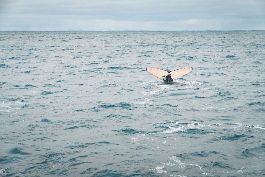
Húsavík is the country’s whale capital, in the way that Reykjavík is the capital of everything else. The bay (Skjálfandi) is a feeding ground for minke and humpback whales from April to October, and operators report 95–98% sighting rates over the summer. It’s a different experience from Reykjavík whale watching, both because the boats go out into a more enclosed bay and because North Sailing uses traditional oak schooners (Knörrinn, Náttfari, Hildur) instead of RIBs.
Three operators run from the harbour: North Sailing, Gentle Giants, and Salka. North Sailing’s silent electric-converted Opal is the boat to pick if you want to actually hear the whales breathe. Trips are around 3 hours, dressed in the supplied overalls (you’ll need them), and you’ll likely see at least one whale and several minke. If you don’t, every operator gives you a free second trip the next day. My Húsavík piece goes deep on the choice.
Tröllaskagi, the Troll Peninsula
The Tröllaskagi peninsula sits between Eyjafjörður and Skagafjörður and is the only part of north Iceland the Ring Road skips. Two-hour detour to drive the loop, with a tunnel at each end. Three things make it worth doing on a second trip: Siglufjörður’s Herring Era Museum (the best small-town museum in the country, three buildings, around 90 minutes), Hofsós’s infinity pool sticking out over Skagafjörður (open year-round, around 1,200 ISK), and the back-country ski scene out of Dalvík and Ólafsfjörður if you ski.
The skiing is the surprise. The peninsula has the country’s longest snow season (often into late May), reliable powder on the ridges, and fjord-level finish lines. Operators like Bergmenn Mountain Guides run heli-ski and ski-touring weeks here from March to early May. It’s the closest thing Iceland has to alpine skiing.
Snæfellsnes in Winter, the Mini-Iceland

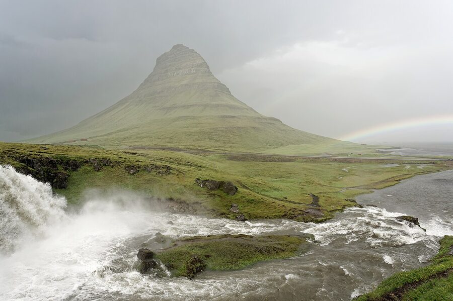
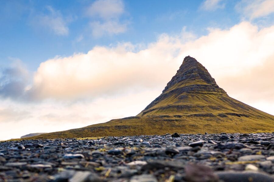
Snæfellsnes is sometimes called “Iceland in miniature” and the comparison is fair. A volcano (Snæfellsjökull, the one Jules Verne sent his characters down), black-sand beaches (Djúpalónssandur), basalt columns (Gerðuberg), a bird cliff (Arnarstapi), a glacier, hot springs, and the country’s most photographed mountain (Kirkjufell at Grundarfjörður) all in a 90-km peninsula north of Reykjavík. On a first trip you probably skipped it for the South Coast. On a second trip in winter, especially, it’s a stronger pick than the Reykjanes peninsula.
Why winter? Three reasons. The roads stay open year-round (unlike most of the highlands and parts of the Westfjords), the aurora forecast in February has Snæfellsnes on the edge of the cloud line that often forms over the south, and the small hotels in Stykkishólmur and Grundarfjörður drop to half their summer rate. My Snæfellsnes piece is the long version of this argument.
The base is Stykkishólmur on the north side, an old trading port with a Roni Horn art installation in the library that’s worth an hour. Hotel Stykkishólmur (on Booking) is the central option. The peninsula loop is an easy day from there: Bjarnarhöfn shark museum (you can taste hákarl, the fermented shark, and decide if it’s as bad as everyone says, it is), Kirkjufell, Arnarstapi to Hellnar coastal walk, the Lóndrangar basalt towers, Djúpalónssandur, the Snæfellsjökull glacier viewpoints. Run the loop counter-clockwise to keep the sun behind you for the photos.
The Stykkishólmur boat trips with Seatours across Breiðafjörður’s island scatter (Viking Sushi tour, with bivalves pulled live from the seabed) is the surprise highlight if you go in summer. In winter it doesn’t run.
The Highlands, 4×4 Only, Summer Only
The interior of the country is closed for nine months of the year. From late June to early September, depending on snow, the F-roads (mountain roads) open and the highlands become accessible. They are, in my opinion, the strongest argument for a second trip in summer if your first was anywhere else in the calendar. If you came in winter and saw mostly snow and grey skies, the highlands in July are a different country.
Open dates from road.is and the Icelandic Road Administration:
- F35 Kjölur: easiest F-road, sometimes opens early June.
- F208 north (Landmannalaugar from the north) and F225: typically mid to late June.
- F208 south (the harder Landmannalaugar approach via Eldgjá): late June.
- F26 Sprengisandur, F88 to Askja, F910: late June to early July.
- F249 to Þórsmörk: mid-June, with the Krossá river crossing being the most dangerous in the country.
F-roads are 4×4 only by Icelandic law. A 2WD on an F-road is illegal, voids the rental insurance, and earns a fine starting around 50,000 ISK. My driving piece goes into vehicle specs in detail; the short version is a Suzuki Jimny is the cheapest legal option, a Land Cruiser or modified super jeep is what you actually want on the harder roads, and “soft-roader” all-wheel-drive crossovers technically qualify on F-roads but get banned by most rental contracts on the river crossings.
Landmannalaugar
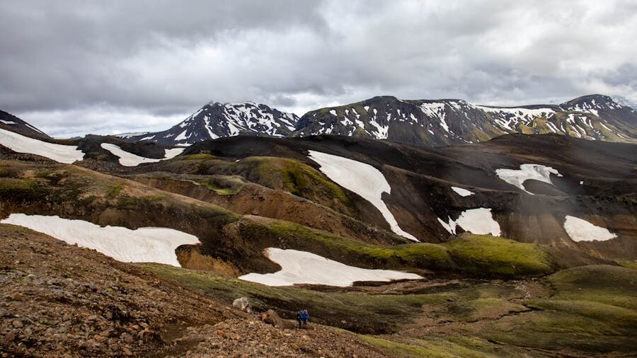
Landmannalaugar is the rhyolite-mountain valley at the edge of the Fjallabak nature reserve, with hot pools at the campsite, a network of day hikes, and the start of the four-day Laugavegur trek to Þórsmörk. For a day trip, drive in on F208 from Hella, walk the Bláhnúkur loop (about 4 km, three hours, 470 metres of climbing), soak in the hot pool, drive back. The walk gives you the rhyolite colours, the views down the valley, and a steaming hot stream you can sit in afterwards. Bring a swimsuit and a towel.
If you don’t want to drive in (and lots of people don’t, with the rivers), the bus from Reykjavík with Reykjavík Excursions takes about 4.5 hours each way and runs once a day in summer. Day-tripping it on the bus is brutal; if you’ve got the time, stay overnight at the FÍ hut or camp.
Þórsmörk
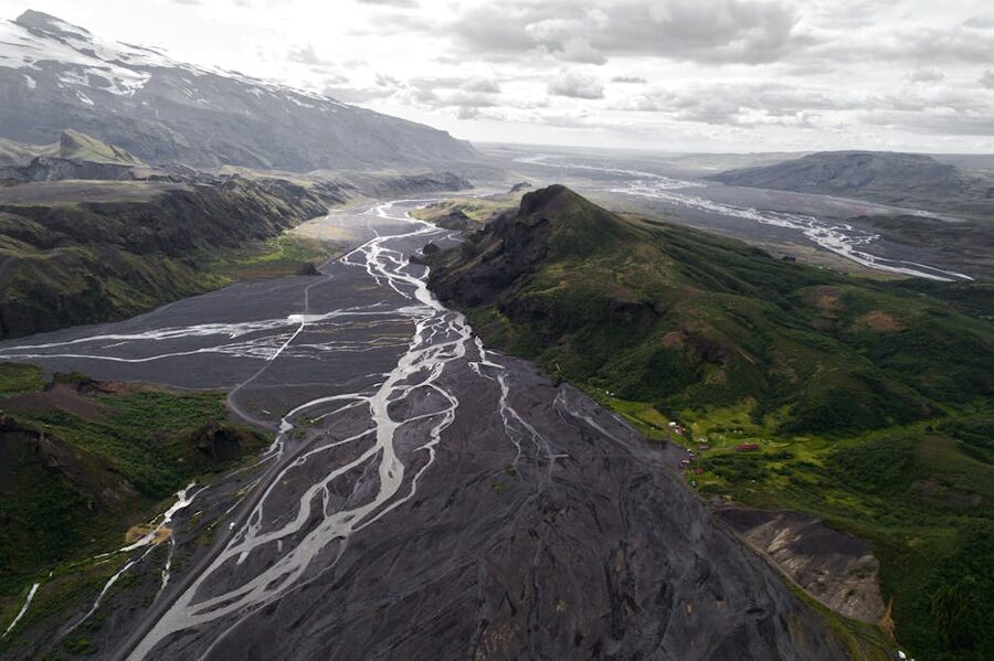
Þórsmörk (“the valley of Thor”) sits between three glaciers (Eyjafjallajökull, Mýrdalsjökull, and Tindfjallajökull) and is the green-and-mossy counter to Landmannalaugar’s bare rhyolite. The drive in on F249 has the most dangerous river crossing in the country, the Krossá, which changes course every season and has dropped many a rental Jeep on its side. The locals run modified super jeeps with 38-inch tyres for a reason. If you’re not in one, take the Reykjavík Excursions highland bus or the Trex service from Hvolsvöllur, both of which use jacked-up coaches and do the river crossing for you.
Once you’re in, the day hikes are the best in the country. Valahnúkur is an hour to the top with views over all three glaciers. Stakkholtsgjá canyon is a flat 90-minute walk into a slot with a hidden waterfall. The classic Fimmvörðuháls trail to Skógar (across the saddle between Eyjafjallajökull and Mýrdalsjökull) is a long full day.
Kerlingarfjöll
Kerlingarfjöll is the rhyolite-and-geothermal range off the F35 Kjölur road, less famous than Landmannalaugar but to my mind even more striking. The Hveradalir geothermal valley, accessed by a 90-minute walk from the Highland Base car park, is a cleft of steam vents and red and yellow earth that looks more like Mars than Iceland. There’s a new lodge (the Highland Base, opened in 2022) at the foot of the range with rooms, bunks, and a hot tub. The lodge changes the calculus on Kerlingarfjöll: it used to be only campers; now you can sleep in a real bed and still walk into the geothermal valley after dinner.
Askja
Askja is the central highlands volcano caldera, with a brilliant blue crater lake (Öskjuvatn) and a smaller pale-blue lake (Víti) you can swim in if you’re brave. NASA used the surrounding lunar landscape to train Apollo astronauts in the 1960s for a reason. Access is via F88 and F894 from the north (off Route 1 between Mývatn and Egilsstaðir), and the F88 includes the Lindaá river crossing, which rises after rain and has stranded plenty of less-than-prepared rental jeeps.
Most second-time visitors do Askja as a super jeep day tour from Mývatn (around 59,900 ISK with operators like Myvatn Tours), which solves the river-crossing problem and gives you a guide who knows the road. If you self-drive, do it in a real 4×4 with high clearance, check road.is the morning of, and don’t be the headline story by attempting it in a Dacia Duster. My highlands piece covers the whole area in more depth.
Westman Islands, the Day-or-Two Trip
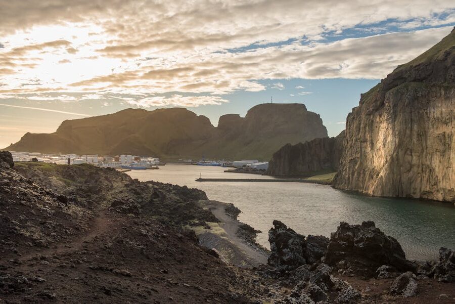
The Westman Islands (Vestmannaeyjar) are a 15-island archipelago off the south coast, one of which (Heimaey) is inhabited by around 4,400 people. The 1973 Eldfell eruption buried a third of the town in lava and ash, and the rebuilt half is now the most concentrated weird-and-charming small town in the country. Do it as a day trip if you must, an overnight is better.
The Herjólfur ferry runs from Landeyjahöfn (a 90-minute drive east of Reykjavík) and takes 35–40 minutes to cross. In peak summer (June to August) it runs hourly from around 07:00 to 23:00; the rest of the year it’s still frequent. Tickets are around 1,840 ISK each way for a foot passenger, more with a vehicle. Book ahead in summer. In rough weather (more common in winter), it sometimes diverts to the longer Þorlákshöfn route, which adds about an hour. There’s also a 25-minute flight from Reykjavík with Eagle Air if you really want to skip the road; pricier but spectacular on a clear day.
What to do once you’re there: walk up Eldfell volcano (1973’s debutante, an hour up and back from town, ground still warm in places), the Eldheimar museum (built around an excavated buried house, around 90 minutes), the boat tour around the cliffs of Heimaey to see the puffin colonies and the Elephant Rock formation, the new Beluga Whale Sanctuary (two captive belugas relocated from China in 2019, 4,000 ISK, mixed reviews but the scenery is the draw). The annual Þjóðhátíð festival in early August is the country’s biggest cultural blowout, 16,000 visitors crammed into a valley for three days; book accommodation a year out.
For sleeping, the Hótel Vestmannaeyjar (on Booking) is the central option; the Westman Luxury Villas (on Booking) are the splurge.
Reykjanes After the Eruptions
The Reykjanes peninsula is the southwest finger between Keflavík airport and Reykjavík, and it’s been the site of seven eruptions since 2021. The 2021 Fagradalsfjall eruption was the friendly one, a slow-flowing fissure you could walk to; the 2023–24 Sundhnúkur cycle has been less friendly, with magma pushing under the town of Grindavík and forcing a long evacuation. As of early 2026, there’s no active eruption, but the volcanic system is still active and the Icelandic Met Office (vedur.is) keeps Reykjanes-Svartsengi at “Heightened Unrest” level.
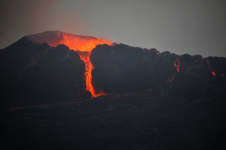
What this means for a second trip: don’t plan around seeing an active eruption; you can’t predict them and the safe-distance perimeter is enforced. Do plan around the now-cooled lava fields, which you can walk on. The Fagradalsfjall area, off Route 427 from Grindavík, has marked trails over and around the 2021 to 2023 flows. The newest cracks bleed heat into the air and you can feel it through your boots in places. Surreal, free, and almost always uncrowded since the buses don’t run when there’s no eruption.
Grindavík itself is a different question. Most of the town has reopened as of late 2025, but a section near the Sundhnúkur fissures remains evacuated, and the Blue Lagoon (which sits in the same volcanic system) has had to close several times during eruption phases. Book any Blue Lagoon visit close to your travel dates and check bluelagoon.com for the latest. Visit Reykjanes (visitreykjanes.is) keeps the most current “what’s open” page.
The rest of Reykjanes is fine and worth a half-day. The Bridge Between Continents (a footbridge across the Mid-Atlantic Ridge, free), Gunnuhver mud pots, the Reykjanesviti lighthouse, the Gunnuhver geothermal area, and the Krýsuvík geothermal field are all unaffected by the eruptions. Don’t underrate it just because it’s the airport region.
Underrated South-East: Lón, Stafafell, Vestrahorn
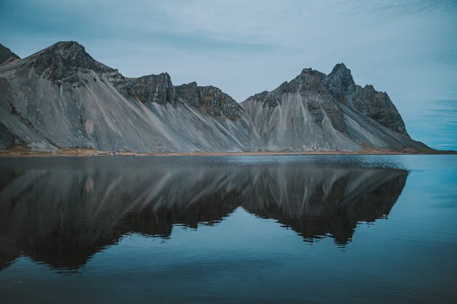
The 60-km stretch of Route 1 east of Höfn (between Höfn and Djúpivogur) gets driven straight through by almost everyone. Most return-trippers fly into Höfn, do Jökulsárlón, and head back west. They miss Lón.
Lón is a quiet inlet east of Höfn with the Stafafell hiking area at its head. The 12-km Hvannagil canyon walk goes up a slot with red rhyolite walls and a stream you ford twice; allow four hours, properly equipped. The Stafafell guesthouse is the only sleep, simple but functional. The bird life is excellent (whooper swans, eider ducks, the occasional sea eagle), the road is empty, and the light at the head of the inlet is some of the best in the southeast on a clear evening. If you’ve got an extra day on a Ring Road plan, this is where to spend it. Ten cars a day, often less.
The Almannaskarð pass between Höfn and Lón gives you the first proper view of Vestrahorn on a clear day; pull off at the Hraundrangar viewpoint for the photo.
Slower Style and Where to Stay
The biggest mistake first-trippers make isn’t where they go; it’s that they go everywhere. Six nights, eight bases, a different town every evening, dinner at 21:30 because that was the soonest restaurant booking. By night four they’re tired, by night six they’re catching colds, and they remember the country as a series of car parks. The fix is to stay longer in fewer places.
For a second trip I’d push you towards smaller guesthouses, farm stays, and hot-pot cabins over hotels. Hey Iceland aggregates farm stays across the country and is the easiest way to find one with a hot tub, a stable, and a host who’ll cook breakfast. Book ahead for July and August; a lot of the better farms are sold out by January.
Hot-pot cabins (small wooden cabins with a private outdoor hot tub) have multiplied in the last five years, especially in the north and east. Go look for them in remote areas if you want a slow week. They’re priced like a mid-range hotel but feel like a small luxury, especially in winter when the steam rises off the tub against the snow. Klausturhof in the south, Frost & Fire in Hveragerði, and many of the smaller listings around Egilsstaðir and Akureyri are good starting points.
Cost-wise, expect around 28,000 to 45,000 ISK a night for a guesthouse double in summer, around 18,000 to 28,000 ISK off-season. My budget piece has the full breakdown.
Activities, Levelled Up
If you did the standard tourist activities last time, the second trip is when you upgrade them. Each of these is a real step up, both in difficulty and in what you’ll see.
Glacier walk to glacier hike. The 90-minute Sólheimajökull walk is the entry version; you’ve done it. The upgrade is a 4–6 hour glacier hike on Vatnajökull from Skaftafell with Icelandic Mountain Guides (around 17,500–28,000 ISK), which gets you onto the upper ice fields, into proper crevasse country, and to ice formations the day-trippers never see. Ice climbing (full day, 19,500 ISK and up) is the next step; you don’t need experience for the beginner trip but you’ll work harder than you expect.
Snowmobile to ice climbing. The Langjökull snowmobile tour is a fun two hours but it’s a tourist activity in the strict sense; you sit on the machine and follow the guide. The upgrade is ice climbing on Falljökull or Sólheimajökull (full day with crampons and axes, around 28,000 ISK) or the Into the Glacier ice tunnel (intotheglacier.is) which goes 500 metres horizontally into Langjökull’s ice. My snowmobile piece has the comparison.
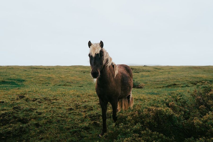
Horse riding to multi-day pack trips. The 90-minute beginner ride past Þingvellir is the introduction; the upgrade is a 3 or 5-day horse trek with Íshestar or Eldhestar, where you ride 4–6 hours a day, change horses every two hours from a herd that runs alongside, and sleep in farmhouses. It’s the most Icelandic activity I can think of and the most underrated. Around 200,000 ISK per person all-in.
Standard whale watching to research-grade. The Reykjavík tour with Elding is a fine entry-level experience. The upgrade is Húsavík with North Sailing on the silent electric Opal, where you can hear the breath, or a Húsavík overnight that includes an Eyjafjörður trip and tours of the small whale museum.
Standard photo tour to focused workshop. The day photo tours from Reykjavík are mostly transport. Iceland Photo Tours and Arctic Shots run multi-day workshops that put you in the right place at the right hour for the right month. My photo tour piece has the breakdown.
Best Repeat-Visit Seasons
If your first trip was in summer, do the second in winter; if your first was winter, come back for the long days. The country is genuinely different in different months. A few specific season windows worth chasing on a second trip:
- Late June (Lupin season). The pink-and-purple Alaskan lupin (introduced in 1945, naturalised, beloved and slightly controversial) blankets the south coast in June. The drive between Hvolsvöllur and Vík is unrecognisable.
- Early to mid-September. The locals’ quiet favourite. Autumn colours are short but vivid, the tourist crush has eased, and the aurora season is back. My September piece goes deeper.
- Mid-November to March. Natural ice cave season. Crystal Cave under Vatnajökull is open mid-October to March; the Skaftafell seasonal caves form each winter and change every year. Operators rebuild them every November.
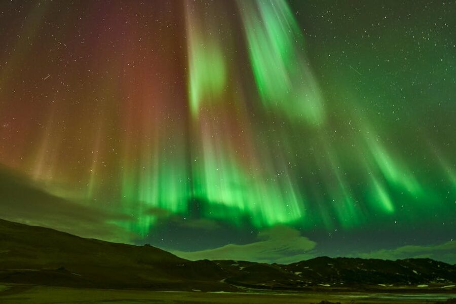
- Late February. The light starts to come back, the aurora is still strong, and the prices haven’t spiked yet for spring break. The middle two weeks of February are my pick for a winter second trip.
- Late August. Highlands still open, midges down, prices easing into shoulder. Best of summer with fewer crowds.
My aurora-forecast guide walks through how to actually plan a winter trip around the lights, and my summer piece handles the high-season trade-offs.
Don’t Skip Even on a Second Trip
A few sights are still worth doing the second time, third time, and fourth time. They change enough year to year, or they reward repeat visits in ways the standard tour doesn’t.
Jökulsárlón. The glacier lagoon. The icebergs you saw last time aren’t there anymore; they’ve calved, melted, drifted out to Diamond Beach. Go again, take the Zodiac boat tour this time (40 minutes, around 11,500 ISK), or try the kayaking option in summer. Or just sit on the south bank with a coffee and watch the seals.
Þingvellir in winter. If you only saw the rift in summer, the snowy version is a different place. Bring spikes for the boardwalks, the ice gets brutal.
Reykjavík’s local pools. Laugardalslaug on a Saturday morning, Vesturbæjarlaug on a winter weeknight, Sundhöllin in the early morning. The pool culture is the most Icelandic thing in the country and probably the most underrated single experience for foreign visitors. My Reykjavík piece goes through the pool list.
Skógafoss, but climbed. Last time you stood at the bottom; this time go up the 527 steps to the top and continue along the river upstream towards Fimmvörðuháls. The first 30 minutes give you a series of falls behind the famous one that almost nobody walks to.
Three Itineraries
To put it together, here are three itineraries I’d actually run on a second trip, depending on what time you have.
7 days, Westfjords loop
- Day 1: Land Keflavík, drive to Stykkishólmur (2.5 hours via Borgarnes). Sleep Stykkishólmur.
- Day 2: Morning Snæfellsnes peninsula loop (Kirkjufell, Arnarstapi, Djúpalónssandur). Afternoon Baldur ferry across to Brjánslækur, drive to Patreksfjörður. Sleep there.
- Day 3: Látrabjarg morning, Rauðasandur beach afternoon. Sleep Patreksfjörður.
- Day 4: Drive north to Dynjandi (90 minutes), continue to Ísafjörður (another 2 hours). Sleep Ísafjörður.
- Day 5: Hornstrandir day trip (Hesteyri loop). Sleep Ísafjörður.
- Day 6: Drive south through Strandir to Hólmavík. Museum of Sorcery. Sleep Hólmavík or push to Borgarnes.
- Day 7: Down to Reykjavík (3 hours from Borgarnes). Half-day in town, fly home.
10 days, East and North
- Day 1: Reykjavík to Höfn (510 km, 6 hours; break at Vík). Sleep Höfn.
- Day 2: Jökulsárlón, Diamond Beach, Stokksnes at sunset. Sleep Höfn.
- Day 3: Höfn to Egilsstaðir via the East Fjords (270 km, slow day). Sleep Egilsstaðir.
- Day 4: Borgarfjörður Eystri puffin trip. Sleep Egilsstaðir or Bakkagerði.
- Day 5: Egilsstaðir to Seyðisfjörður via Route 93 (40 minutes); afternoon in town. Sleep Seyðisfjörður.
- Day 6: Drive to Mývatn (250 km via Möðrudalur, around 4 hours). Sleep Reykjahlíð.
- Day 7: Mývatn area: Hverir, Námafjall, Mývatn Nature Baths. Sleep Reykjahlíð.
- Day 8: Diamond Circle: Dettifoss, Ásbyrgi, Húsavík whale tour. Sleep Húsavík.
- Day 9: Drive to Akureyri (1 hour), afternoon free. Sleep Akureyri.
- Day 10: 45-minute flight back to Reykjavík, or 5-hour drive via Borgarnes.
14 days, full-island slow
This is the trip I’d run for someone who can take the time. Counter-clockwise, with proper rest days.
- Days 1–2: Reykjavík (you’ve done it, but add Laugardalslaug, the Settlement Museum, a half-day to Reykjanes lava fields).
- Days 3–4: Snæfellsnes peninsula, sleeping Stykkishólmur.
- Days 5–7: Westfjords (Patreksfjörður, Ísafjörður).
- Days 8–9: Down through Strandir to Akureyri.
- Days 10–11: Mývatn area and Diamond Circle.
- Day 12: Drive to Egilsstaðir, then East Fjords.
- Day 13: Höfn area, Stokksnes, Jökulsárlón.
- Day 14: Drive back to Reykjavík via the south coast, fly out.
If you want this customised, my customized tours page walks through how I’d build it for two people, four people, or a family with teens (teen version here). Honeymooners can read the honeymoon piece for the romantic-pacing version, which is closer to the 10-day East and North itinerary above with extra hot pots.
Booking and Tour Operators
For independent self-drive, the multi-day tour operators put together itineraries with cars, hotels, and guides; useful if you don’t want to do it yourself. Nordic Visitor is the longstanding pick for the Westfjords and Ring Road combos, with their own ground team in Reykjavík. Hidden Iceland runs smaller-group photo and aurora trips. Hey Iceland is the farm-stay aggregator I mentioned above.
For day tours and individual activities, GetYourGuide, Viator, and Klook all aggregate the same operators with broadly similar pricing; I check all three before booking anything because the discount codes vary.
For accommodation, Booking.com remains the path of least resistance for guesthouses and hotels in Iceland. Confirmed places I’ve recommended above:
- The Ísafjörður Inn (Westfjords)
- Hotel Stykkishólmur (Snæfellsnes)
- Hotel Akureyri Resort (north)
- Fosshotel Mývatn
- Hengifoss Lodge tiny houses (near Egilsstaðir)
- Post Hostel Seyðisfjörður
- Hótel Vestmannaeyjar
- Hotel Höfn
- West (Patreksfjörður)
Practical Plumbing for the Second Trip
A few things that are worth re-checking even though you’ve been before:
Driving. The big-car-rental rules haven’t changed (4×4 for highlands, winter tyres mandatory November to mid-April), but the gravel roads in the Westfjords and the East have shifted. Some have been paved, some have been re-routed. Always check road.is the morning of and pair it with the vedur.is wind forecast. Anything over 20 metres per second and you should be inside drinking coffee.
Safety. The Icelandic Travel and Tourist Board’s safetravel.is is where you log a travel plan if you’re going off-piste in the highlands or to Hornstrandir. They check on you if you don’t sign back in. Free.
Money. Cards work everywhere now, including the petrol pumps. PIN is essential (most pumps don’t take signature). I haven’t used cash for anything in two years.
Petrol. N1 has the densest network. Olís and Orkan are slightly cheaper. Keep the tank above quarter on the Westfjords and East Fjords routes; gaps of 80 km without a station are normal.
Food. Bónus and Krónan supermarkets are 30–40% cheaper than gas-station snacks. A loaf of bread at Bónus is 350 ISK; at an N1 it’s 750 ISK. Stock up before remote stretches.
Connectivity. Icelandic mobile coverage is excellent on Route 1 and around the populated areas, patchy in the highlands and Westfjords. Buy a Vodafone or Síminn data SIM at the airport on arrival; about 2,500 ISK gives you 10 GB.
The Country Doesn’t Run Out
I’ve been doing this for years and I still have lists. Mýrarvatn for an overnight at the lodge instead of just driving past. Þingeyri’s free hot-pot above the village. The 60-km cycle out of Vík to Þakgil (gravel and a tunnel under a glacier toe). The whole Strandir coast in October when the road is empty and the colours are the best they get.
If your first trip was the highlights, the second is the chance to put yourself somewhere quieter, longer, slower. Pick one region. Stay a week. Eat dinner at the same café three nights in a row. Get to know the dog at the guesthouse. The country always does the same thing on a second trip; it stops being a list of waterfalls and starts being a place. Þetta reddast.